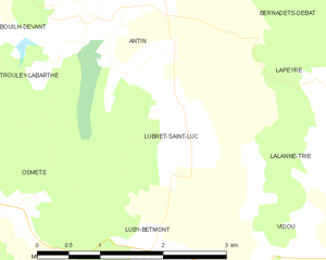
Antin (Antin)

- commune in Hautes-Pyrénées, France
- Country:

- Postal Code: 65220
- Coordinates: 43° 20' 1" N, 0° 17' 14" E


- GPS tracks (wikiloc): [Link]
- Area: 7.46 sq km
- Population: 116
- Wikipedia en: wiki(en)
- Wikipedia: wiki(fr)
- Wikidata storage: Wikidata: Q1327528
- Wikipedia Commons Category: [Link]
- Freebase ID: [/m/03nv2cx]
- Freebase ID: [/m/03nv2cx]
- GeoNames ID: Alt: [6450434]
- GeoNames ID: Alt: [6450434]
- SIREN number: [216500157]
- SIREN number: [216500157]
- BnF ID: [15270397p]
- BnF ID: [15270397p]
- INSEE municipality code: 65015
- INSEE municipality code: 65015
Shares border with regions:


Mazerolles
- commune in Hautes-Pyrénées, France
- Country:
- Postal Code: 65220
- Coordinates: 43° 21' 16" N, 0° 17' 8" E
- GPS tracks (wikiloc): [Link]
- Area: 6.33 sq km
- Population: 109
Osmets
- commune in Hautes-Pyrénées, France
- Country:
- Postal Code: 65350
- Coordinates: 43° 18' 19" N, 0° 15' 56" E
- GPS tracks (wikiloc): [Link]
- Area: 4.88 sq km
- Population: 81


Bernadets-Debat
- commune in Hautes-Pyrénées, France
- Country:
- Postal Code: 65220
- Coordinates: 43° 21' 13" N, 0° 19' 2" E
- GPS tracks (wikiloc): [Link]
- AboveSeaLevel: 308.5 м m
- Area: 8.77 sq km
- Population: 106
Bouilh-Devant
- commune in Hautes-Pyrénées, France
- Country:
- Postal Code: 65140
- Coordinates: 43° 19' 50" N, 0° 15' 35" E
- GPS tracks (wikiloc): [Link]
- Area: 2.99 sq km
- Population: 22
Trouley-Labarthe
- commune in Hautes-Pyrénées, France
- Country:
- Postal Code: 65140
- Coordinates: 43° 18' 58" N, 0° 14' 28" E
- GPS tracks (wikiloc): [Link]
- Area: 4.39 sq km
- Population: 98

Lubret-Saint-Luc
- commune in Hautes-Pyrénées, France
- Country:
- Postal Code: 65220
- Coordinates: 43° 18' 56" N, 0° 18' 7" E
- GPS tracks (wikiloc): [Link]
- Area: 5.61 sq km
- Population: 61


Lapeyre
- commune in Hautes-Pyrénées, France
- Country:
- Postal Code: 65220
- Coordinates: 43° 19' 23" N, 0° 20' 20" E
- GPS tracks (wikiloc): [Link]
- Area: 3.57 sq km
- Population: 93