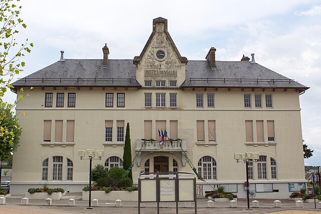
Apprieu (Apprieu)
- commune in Isère, France
Apprieu is a charming commune located in the Isère department in the Auvergne-Rhône-Alpes region of southeastern France. This area offers various hiking opportunities, leveraging its picturesque landscapes and proximity to the foothills of the French Alps. Here are some key points for hiking in and around Apprieu:
Scenic Trails
-
Local Trails: There are several local paths and trails that wind through the forests and fields surrounding Apprieu. These trails often provide beautiful views of the surrounding countryside and the Alps.
-
Mont de l'Herbasse: This nearby mountain offers a hiking route that can be explored, providing a moderate challenge and rewarding views from the summit.
-
Belledonne Range: A bit further afield, but accessible from Apprieu, the Belledonne mountains offer more challenging hikes for those looking for an adventure. Trails range from moderate to difficult, catering to experienced hikers.
Hiking Tips
- Weather: Always check the weather forecast before setting out, as conditions can change rapidly in mountainous areas.
- Gear: Wear appropriate footwear, dress in layers, and carry essentials like water, snacks, and a first-aid kit.
- Maps and Navigation: Bring a map or GPS device, as some trails may not be well marked, especially in more remote areas.
Safety Considerations
- Hike with a companion if possible, especially in more isolated areas.
- Inform someone about your hiking plan and expected return time.
- Be mindful of your own fitness level and choose trails that suit your ability.
Local Attractions
Aside from hiking, Apprieu has local restaurants and shops where you can enjoy regional cuisine and products. After a day of hiking, it's nice to relax and enjoy the local culture.
Whether you're a beginner looking for gentle walks or an experienced hiker seeking challenging terrain, Apprieu and the nearby areas can provide a fulfilling hiking experience in the heart of the French countryside.
- Country:

- Postal Code: 38140
- Coordinates: 45° 24' 1" N, 5° 29' 28" E


- GPS tracks (wikiloc): [Link]
- Area: 15.09 sq km
- Population: 3269
- Web site: http://www.apprieu.fr
- Wikipedia en: wiki(en)
- Wikipedia: wiki(fr)
- Wikidata storage: Wikidata: Q1008890
- Wikipedia Commons Category: [Link]
- Freebase ID: [/m/03g_7m2]
- GeoNames ID: Alt: [6448711]
- SIREN number: [213800139]
- BnF ID: [152578422]
- INSEE municipality code: 38013
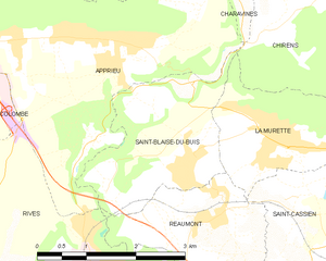
Shares border with regions:


Rives
- commune in Isère, France
Rives, located in the Isère department of the Auvergne-Rhône-Alpes region in southeastern France, offers a range of outdoor activities, including hiking. The area is characterized by its picturesque landscapes, mountainous terrain, and proximity to the French Alps, making it a great starting point for various hiking adventures....
- Country:

- Postal Code: 38140
- Coordinates: 45° 21' 3" N, 5° 30' 8" E


- GPS tracks (wikiloc): [Link]
- Area: 10.93 sq km
- Population: 6242
- Web site: [Link]


Charavines
- commune in Isère, France
Charavines is a picturesque village located in the Isère department of the Auvergne-Rhône-Alpes region in southeastern France. Nestled near the shores of Lake Paladru, it offers a variety of hiking opportunities suitable for all levels of outdoor enthusiasts. Here are some highlights of hiking in and around Charavines:...
- Country:

- Postal Code: 38850
- Coordinates: 45° 25' 50" N, 5° 30' 48" E


- GPS tracks (wikiloc): [Link]
- Area: 7.52 sq km
- Population: 1907
- Web site: [Link]


Saint-Blaise-du-Buis
- commune in Isère, France
 Hiking in Saint-Blaise-du-Buis
Saint-Blaise-du-Buis, located in the Isère department in southeastern France, is a great destination for hiking enthusiasts who appreciate nature and stunning landscapes. This area is characterized by its beautiful scenery, rolling hills, and a mix of forested areas and open fields, making it a picturesque spot for outdoor activities....
- Country:

- Postal Code: 38140
- Coordinates: 45° 22' 37" N, 5° 31' 6" E


- GPS tracks (wikiloc): [Link]
- Area: 5.44 sq km
- Population: 1028
- Web site: [Link]


Oyeu
- commune in Isère, France
Oyeu is a charming municipality located in the Auvergne-Rhône-Alpes region of France, known for its picturesque landscapes and outdoor activities, including hiking. Although Oyeu might not be as famous as some larger hiking destinations, it offers a range of trails that cater to various skill levels and preferences....
- Country:

- Postal Code: 38690
- Coordinates: 45° 25' 19" N, 5° 28' 28" E


- GPS tracks (wikiloc): [Link]
- Area: 13.69 sq km
- Population: 956
- Web site: [Link]


Chirens
- commune in Isère, France
Chirens is a charming village located in the Isère department in the Auvergne-Rhône-Alpes region of southeastern France. It’s surrounded by beautiful natural landscapes, making it a great destination for hiking enthusiasts. Here are some highlights for hiking in and around Chirens:...
- Country:

- Postal Code: 38850
- Coordinates: 45° 24' 50" N, 5° 33' 21" E


- GPS tracks (wikiloc): [Link]
- AboveSeaLevel: 876 м m
- Area: 17.53 sq km
- Population: 2342
- Web site: [Link]


Colombe
- commune in Isère, France
Colombe is a region that typically offers a variety of hiking opportunities depending on its geographical features and local trails. Since I don’t have specific details about Colombe, I can offer some general advice for hiking in areas that might be similar:...
- Country:

- Postal Code: 38690
- Coordinates: 45° 23' 56" N, 5° 26' 58" E


- GPS tracks (wikiloc): [Link]
- Area: 13.23 sq km
- Population: 1506
- Web site: [Link]
