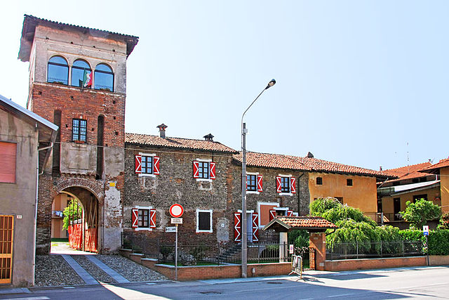
Arborio (Arborio)
- Italian comune
 Hiking in Arborio
Arborio, located in the Piedmont region of Italy, is best known for its rice cultivation, particularly for the high-quality Arborio rice used in risottos. While it may not be a widely recognized hiking destination, the surrounding area offers beautiful landscapes and opportunities for outdoor activities.
Hiking Opportunities in and Around Arborio:
-
Rice Fields and Countryside: The flat, expansive rice fields provide a unique hiking experience. Walking through these fields during different seasons offers stunning views of lush green paddies or golden fields ready for harvest.
-
Natural Reserves: The nearby Parco Nazionale del Gran Paradiso is not too far away. This national park has a variety of trails, ranging from easy walks to more challenging hikes, with beautiful alpine scenery, wildlife, and waterfalls.
-
Wine Trails: The area around Arborio is also part of the wine-producing regions of Piedmont, such as the Vercellese and Novarese. Many trails exist that connect vineyards and offer a chance to explore the rolling hills and taste local wines.
-
Hiking Trails: Specific trails may vary, but it is advisable to explore paths that link nearby towns and cultural sites, like Vercelli or the hills around Novara. Many trails are marked and cater to various skill levels.
-
Cultural Sites: Combine your hike with visits to nearby cultural landmarks, such as ancient churches, castles, and historical sites that are often found in the Piedmont region.
Tips for Hiking in Arborio:
-
Best Time to Visit: Late spring to early autumn (May to October) is ideal for hiking. The weather is generally mild, and you can enjoy the lush landscapes.
-
Preparation: Even if the hikes are not challenging, wear comfortable shoes and bring enough water, sunscreen, and snacks. Always check the weather forecast before heading out.
-
Local Guidance: Consider checking with local tourist offices for maps, trail recommendations, and guided hiking tours, which can enhance your experience.
Though Arborio itself may not be a recognized hiking hotspot, its rich agricultural landscapes and proximity to natural parks can offer memorable outdoor experiences for those willing to explore.
- Country:

- Postal Code: 13031
- Local Dialing Code: 0161
- Licence Plate Code: VC
- Coordinates: 45° 30' 0" N, 8° 23' 0" E


- GPS tracks (wikiloc): [Link]
- AboveSeaLevel: 185 м m
- Area: 23.31 sq km
- Population: 870
- Web site: http://www.comune.arborio.vc.it
- Wikipedia en: wiki(en)
- Wikipedia: wiki(it)
- Wikidata storage: Wikidata: Q24854
- Wikipedia Commons Category: [Link]
- Freebase ID: [/m/0g8p0j]
- GeoNames ID: Alt: [6538098]
- VIAF ID: Alt: [239240258]
- OSM relation ID: [45084]
- UN/LOCODE: [ITZCR]
- ISTAT ID: 002006
- Italian cadastre code: A358
Shares border with regions:
Landiona
- Italian comune
Hiking in Landiona
Landiona is a picturesque area that offers a variety of hiking opportunities, characterized by its stunning landscapes, diverse ecosystems, and unique cultural heritage. While specific trails or locations might not be widely recognized, here’s a general overview of what hikers can expect when exploring a region like Landiona:...
- Country:
- Postal Code: 28060
- Local Dialing Code: 0321
- Licence Plate Code: NO
- Coordinates: 45° 30' 0" N, 8° 25' 0" E
- GPS tracks (wikiloc): [Link]
- AboveSeaLevel: 184 м m
- Area: 7.28 sq km
- Population: 567
- Web site: [Link]

Recetto
- Italian comune
Hiking in Recetto
Recetto is a small municipality located in the province of Novara in the Piedmont region of Italy. While it may not be as widely recognized as tourist destinations for hiking, the surrounding areas offer opportunities for outdoor activities and exploration....
- Country:
- Postal Code: 28060
- Local Dialing Code: 0321
- Licence Plate Code: NO
- Coordinates: 45° 28' 0" N, 8° 26' 0" E
- GPS tracks (wikiloc): [Link]
- AboveSeaLevel: 162 м m
- Area: 8.85 sq km
- Population: 948
- Web site: [Link]

Sillavengo
- Italian comune
Hiking in Sillavengo
Sillavengo is a small town in the Province of Novara in the Piedmont region of northern Italy. While it may not be widely recognized as a hiking destination, the surrounding area offers opportunities for outdoor activities, including hiking. Here are some things to consider for a hiking experience near Sillavengo:...
- Country:
- Postal Code: 28060
- Local Dialing Code: 0321
- Licence Plate Code: NO
- Coordinates: 45° 31' 0" N, 8° 26' 0" E
- GPS tracks (wikiloc): [Link]
- AboveSeaLevel: 192 м m
- Area: 9.54 sq km
- Population: 560
- Web site: [Link]

Vicolungo
- Italian comune
Hiking in Vicolungo
Vicolungo is a small town located in the Piedmont region of Italy, near Novara. While it may not be as renowned for hiking as other areas in the region, it is in proximity to various natural attractions that offer beautiful hiking opportunities....
- Country:
- Postal Code: 28060
- Local Dialing Code: 0321
- Licence Plate Code: NO
- Coordinates: 45° 29' 0" N, 8° 28' 0" E
- GPS tracks (wikiloc): [Link]
- AboveSeaLevel: 170 м m
- Area: 13.29 sq km
- Population: 887
- Web site: [Link]
Ghislarengo
- Italian comune
Hiking in Ghislarengo
Ghislarengo is a small village located in the Piedmont region of Italy, nestled in the picturesque Sesia Valley. The area is characterized by its stunning landscapes, rich biodiversity, and traditional architecture, making it an excellent destination for hiking enthusiasts....
- Country:
- Postal Code: 13030
- Local Dialing Code: 0161
- Licence Plate Code: VC
- Coordinates: 45° 30' 0" N, 8° 23' 0" E
- GPS tracks (wikiloc): [Link]
- AboveSeaLevel: 206 м m
- Area: 12.5 sq km
- Population: 870
- Web site: [Link]
Greggio
- Italian comune
Hiking in Greggio
It seems there might be a mix-up with the name "Greggio," as it doesn't correspond to a widely recognized hiking destination or national park based on my knowledge up to October 2023. However, if you’re referring to a specific region, municipality, or trail, please provide more details so I can give you the best possible information....
- Country:
- Postal Code: 13030
- Local Dialing Code: 0161
- Licence Plate Code: VC
- Coordinates: 45° 27' 0" N, 8° 23' 0" E
- GPS tracks (wikiloc): [Link]
- AboveSeaLevel: 161 м m
- Area: 11.88 sq km
- Population: 357
- Web site: [Link]

Rovasenda
- Italian comune
Hiking in Rovasenda
Rovasenda is a small village located in the Piedmont region of northern Italy. While the area is not widely recognized as a major hiking destination, it does offer some beautiful landscapes and opportunities for outdoor activities....
- Country:
- Postal Code: 13040
- Local Dialing Code: 0161
- Licence Plate Code: VC
- Coordinates: 45° 32' 0" N, 8° 19' 0" E
- GPS tracks (wikiloc): [Link]
- AboveSeaLevel: 221 м m
- Area: 29.27 sq km
- Population: 959
- Web site: [Link]
San Giacomo Vercellese
- Italian comune
Hiking in San Giacomo Vercellese
San Giacomo Vercellese is a small town located in the Piedmont region of Italy, not far from the city of Vercelli. While it may not be as famous for hiking as some other areas in Italy, there are still opportunities for outdoor activities and exploring nature nearby. Here are a few points to consider if you're interested in hiking in this area:...
- Country:
- Postal Code: 13030
- Local Dialing Code: 0161
- Licence Plate Code: VC
- Coordinates: 45° 30' 0" N, 8° 20' 0" E
- GPS tracks (wikiloc): [Link]
- AboveSeaLevel: 197 м m
- Area: 9.6 sq km
- Population: 319
- Web site: [Link]

Villarboit
- Italian comune
Hiking in Villarboit
Villarboit is a small village located in the province of Vercelli in the Piedmont region of northern Italy. While it may not be as widely known as other hiking destinations, the surrounding landscape offers a charming mix of natural beauty and rural tranquility, making it suitable for hiking enthusiasts who prefer quieter and more off-the-beaten-path experiences....
- Country:
- Postal Code: 13030
- Local Dialing Code: 0161
- Licence Plate Code: VC
- Coordinates: 45° 26' 0" N, 8° 20' 0" E
- GPS tracks (wikiloc): [Link]
- AboveSeaLevel: 162 м m
- Area: 25.51 sq km
- Population: 438
- Web site: [Link]