Ardez (Ardez)
- former municipality of Switzerland
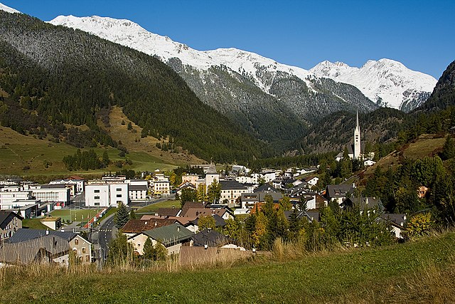
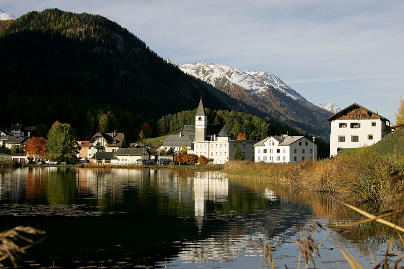
Ardez is a picturesque village located in the Swiss Alps, specifically in the Lower Engadine region of Switzerland. Surrounded by stunning mountain landscapes, Ardez is an excellent destination for hiking enthusiasts. Here are some things to consider for hiking in and around Ardez:
Trails and Routes:
-
Local Hiking Trails: There are numerous marked hiking trails that cater to various skill levels, from easy strolls to challenging mountain hikes. Popular trails include routes through the beautiful scenery of the Engadine valley.
-
The Swiss National Park: Located a bit further from Ardez, the Swiss National Park offers more extensive hiking opportunities. It has well-marked trails that allow you to explore its diverse flora and fauna.
-
Panoramic Trails: Some trails provide breathtaking panoramic views of the surrounding mountains and valleys. The hike to the top of Piz Arpiglia, for example, can be rewarding for those seeking excellent vistas.
Best Time to Hike:
- Summer (June to September): This is the ideal time for hiking in Ardez since the weather is generally warm and most trails are accessible.
- Autumn (October): Early October can also be good, with the fall colors adding extra beauty to the landscape, though trails may start to become less accessible as the weather changes.
Preparation Tips:
- Navigation: Make sure to carry a map or use a GPS device, as some trails can be less marked.
- Safety: Be aware of weather conditions, as mountain weather can change abruptly. Inform someone about your hiking plans.
- Gear: Wear proper hiking shoes, dress in layers, and carry enough water and snacks.
Accessibility:
Ardez is accessible via train and bus services from larger cities in Switzerland, making it convenient for a hiking getaway. There are also numerous accommodations in the area, from hotels to guesthouses, which can serve as a base for your hiking adventures.
Local Culture:
Don't miss the chance to explore Ardez itself—a charming village with traditional Engadine architecture. It's also a great opportunity to experience local Swiss culture, cuisine, and hospitality.
Whether you’re looking for a strenuous hike or a leisurely nature walk, Ardez and its surroundings offer a fantastic hiking experience in one of the most beautiful regions of the Swiss Alps.
- Country:

- Postal Code: 7546
- Local Dialing Code: 081
- Licence Plate Code: GR
- Coordinates: 46° 46' 29" N, 10° 12' 3" E


- GPS tracks (wikiloc): [Link]
- AboveSeaLevel: 1362 м m
- Area: 61.39 sq km
- Web site: http://www.ardez.ch
- Wikipedia en: wiki(en)
- Wikipedia: wiki(de)
- Wikidata storage: Wikidata: Q64338
- Wikipedia Commons Category: [Link]
- Freebase ID: [/m/0bvvnx]
- GeoNames ID: Alt: [7285092]
- HDS ID: [1520]
- Swiss municipality code: [3741]
- Lexicon istoric retic ID: [145]
Shares border with regions:


Zernez
- municipality in Switzerland
Zernez is a beautiful village located in the Swiss National Park in the Engadin Valley, known for its stunning natural landscapes, diverse ecosystems, and a variety of hiking trails that cater to different skill levels. Here are some highlights and tips for hiking in Zernez:...
- Country:

- Postal Code: 7530
- Local Dialing Code: 081
- Licence Plate Code: GR
- Coordinates: 46° 41' 59" N, 10° 5' 59" E


- GPS tracks (wikiloc): [Link]
- AboveSeaLevel: 2216 м m
- Area: 344.04 sq km
- Population: 1532
- Web site: [Link]


Guarda
- municipality in Graubünden, Switzerland
Guarda, Switzerland, is a picturesque village located in the Lower Engadin region of the Swiss Alps. Renowned for its traditional Engadin architecture and stunning natural landscapes, Guarda is an excellent base for hiking enthusiasts. Here are some key highlights for hiking in this beautiful area:...
- Country:

- Postal Code: 7545
- Local Dialing Code: 081
- Coordinates: 46° 46' 31" N, 10° 9' 9" E


- GPS tracks (wikiloc): [Link]
- AboveSeaLevel: 1653 м m
- Area: 31.42 sq km
- Web site: [Link]


Ftan
- former municipality of Switzerland
Ftan is a picturesque village located in the Swiss Alps, specifically in the canton of Graubünden. It's renowned for its stunning landscapes and offers a variety of hiking trails suitable for different skill levels. Here's what you should know about hiking in Ftan:...
- Country:

- Postal Code: 7551
- Local Dialing Code: 081
- Licence Plate Code: GR
- Coordinates: 46° 49' 33" N, 10° 13' 41" E


- GPS tracks (wikiloc): [Link]
- AboveSeaLevel: 2751 м m
- Area: 43.08 sq km
- Web site: [Link]


Lavin
- former municipality of Switzerland
Lavin, a picturesque village in the Lower Engadine region of Switzerland, offers a stunning backdrop for hikers. Nestled in the Swiss Alps, it provides access to a variety of trails that cater to all skill levels. The region is known for its breathtaking landscapes, including lush valleys, scenic mountain views, and charming alpine architecture....
- Country:

- Postal Code: 7543
- Local Dialing Code: 081
- Licence Plate Code: GR
- Coordinates: 46° 46' 3" N, 10° 6' 38" E


- GPS tracks (wikiloc): [Link]
- AboveSeaLevel: 2140 м m
- Area: 46.26 sq km
- Web site: [Link]


Tarasp
- former municipality of Switzerland
Tarasp is a beautiful village in the Lower Engadine region of Switzerland, renowned for its stunning landscapes and rich cultural heritage. It’s an excellent destination for hiking enthusiasts, offering trails that cater to various skill levels, from easy walks to challenging hikes....
- Country:

- Postal Code: 7553
- Local Dialing Code: 081
- Licence Plate Code: GR
- Coordinates: 46° 46' 40" N, 10° 15' 37" E


- GPS tracks (wikiloc): [Link]
- AboveSeaLevel: 2658 м m
- Area: 46.99 sq km
- Web site: [Link]

