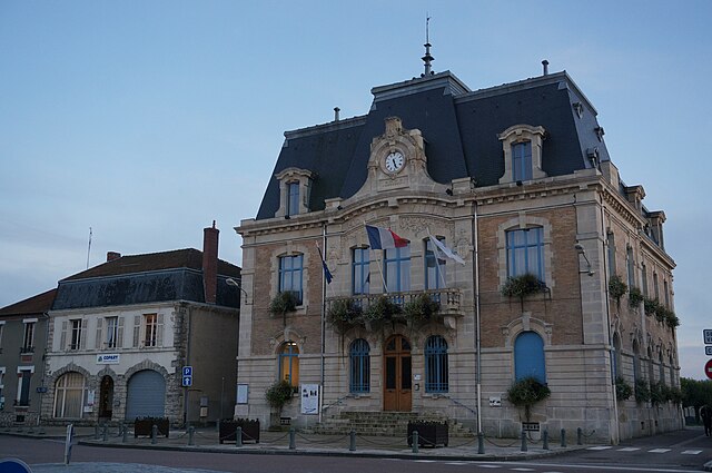
arrondissement of Bar-le-Duc (arrondissement de Bar-le-Duc)
- arrondissement of France
- Country:

- Capital: Bar-le-Duc
- Coordinates: 48° 45' 0" N, 5° 10' 0" E


- GPS tracks (wikiloc): [Link]
- Area: 1451 sq km
- Population: 60570
- Wikipedia en: wiki(en)
- Wikipedia: wiki(fr)
- Wikidata storage: Wikidata: Q616226
- Freebase ID: [/m/095692]
- GeoNames ID: Alt: [3034910]
- INSEE arrondissement code: [551]
- GNS Unique Feature ID: -1410406
Includes regions:


canton of Ligny-en-Barrois
- canton of France
- Country:

- Capital: Ligny-en-Barrois
- Coordinates: 48° 41' 22" N, 5° 18' 27" E


- GPS tracks (wikiloc): [Link]
- Population: 12495


canton of Revigny-sur-Ornain
- canton of France
- Country:

- Capital: Revigny-sur-Ornain
- Coordinates: 48° 48' 51" N, 4° 59' 48" E


- GPS tracks (wikiloc): [Link]
- Population: 11635


canton of Ancerville
- canton of France
- Country:

- Capital: Ancerville
- Coordinates: 48° 39' 57" N, 5° 5' 56" E


- GPS tracks (wikiloc): [Link]
- Population: 13284

canton of Bar-le-Duc-Nord
- canton of France
- Country:

- Capital: Bar-le-Duc
- Coordinates: 48° 46' 3" N, 5° 9' 53" E


- GPS tracks (wikiloc): [Link]

canton of Bar-le-Duc-Sud
- canton of France
- Country:

- Capital: Bar-le-Duc
- Coordinates: 48° 45' 17" N, 5° 6' 32" E


- GPS tracks (wikiloc): [Link]

canton of Vaubecourt
- canton of France
- Country:

- Capital: Vaubecourt
- Coordinates: 48° 54' 0" N, 5° 7' 13" E


- GPS tracks (wikiloc): [Link]

canton of Seuil-d'Argonne
- canton of France (until March 2015)
- Country:

- Capital: Seuil-d'Argonne
- Coordinates: 49° 0' 10" N, 5° 8' 30" E


- GPS tracks (wikiloc): [Link]

canton of Montiers-sur-Saulx
- canton of France (until March 2015)
- Country:

- Capital: Montiers-sur-Saulx
- Coordinates: 48° 34' 31" N, 5° 17' 3" E


- GPS tracks (wikiloc): [Link]

canton of Vavincourt
- canton of France (until March 2015)
- Country:

- Capital: Vavincourt
- Coordinates: 48° 49' 12" N, 5° 14' 15" E


- GPS tracks (wikiloc): [Link]
