arrondissement of Saint-Jean-de-Maurienne (arrondissement de Saint-Jean-de-Maurienne)
- arrondissement of France in the Savoie department
 Hiking in arrondissement of Saint-Jean-de-Maurienne
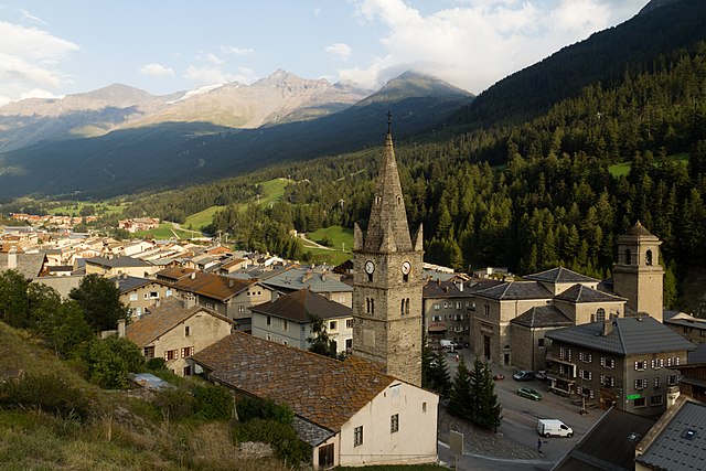
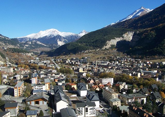
The Arrondissement of Saint-Jean-de-Maurienne, located in the Savoie region of the French Alps, is an excellent destination for hiking enthusiasts. This area is renowned for its stunning mountainous landscapes, diverse trails, and rich cultural heritage. Here are some highlights and tips for hiking in this beautiful region:
Trails and Hiking Areas
-
Vanoise National Park: This park is located a bit to the south but is easily accessible from the Saint-Jean-de-Maurienne area. It offers a range of trails from easy walks to challenging hikes, all featuring spectacular views of the surrounding peaks, glacial lakes, and unique wildlife.
-
Les Sybelles: This ski area transforms into a hiking paradise during the summer months. Numerous marked trails lead through alpine meadows, past mountain lakes, and along ridges with panoramic views.
-
Col du Glandon: The trails around this mountain pass provide some breathtaking views and a variety of routes for all skill levels. It’s a popular starting point for hikes into the surrounding mountains.
-
Lac de Grand'Mère: This beautiful alpine lake is accessible by a moderate hike, making it a popular destination for families. The trail offers lovely views and a chance to enjoy the serene lakeside atmosphere.
-
Mont Charvin: For seasoned hikers looking for a challenge, the ascent to Mont Charvin offers rewarding views of the surrounding peaks and valleys.
Tips for Hiking
-
Trail Information: Be sure to consult local maps and guides before setting out. Many trails are well-marked, but some can be more challenging, so it's essential to know your route and difficulty level.
-
Weather Conditions: The weather can change rapidly in the mountains, so check forecasts before you go and be prepared with the right gear, including waterproof clothing and sun protection.
-
Hydration and Nutrition: Bring plenty of water and snacks, as facilities may be scarce on some trails. High-altitude hiking can be demanding, and maintaining energy is key.
-
Safety: Always inform someone of your hiking plans, especially if you are heading into remote areas. A phone can be useful, but be aware that signal coverage may be limited.
-
Local Culture: Embrace the local culture by exploring villages and dining at mountain refuges (restaurants). You might enjoy traditional Savoyard cuisine, which is a rewarding way to cap off a day of hiking.
Wildlife and Flora
The Arrondissement of Saint-Jean-de-Maurienne is home to diverse flora and fauna. Keep an eye out for chamois, ibex, and golden eagles, as well as rich alpine vegetation. Respect the environment by sticking to marked paths and avoiding the picking of flowers.
In summary, the Arrondissement of Saint-Jean-de-Maurienne offers a wealth of hiking opportunities for all levels, with stunning landscapes and a variety of trails. Enjoy your adventures in this beautiful part of the French Alps!
- Country:

- Capital: Saint-Jean-de-Maurienne
- Coordinates: 45° 10' 0" N, 6° 35' 0" E


- GPS tracks (wikiloc): [Link]
- Area: 1976 sq km
- Population: 43240
- Wikipedia en: wiki(en)
- Wikipedia: wiki(fr)
- Wikidata storage: Wikidata: Q665242
- Wikipedia Commons Category: [Link]
- Freebase ID: [/m/095j1l]
- GeoNames ID: Alt: [2979302]
- INSEE arrondissement code: [733]
- GNS Unique Feature ID: -1466161
Includes regions:

canton of Lanslebourg-Mont-Cenis
- canton of France (until March 2015)
 Hiking in canton of Lanslebourg-Mont-Cenis
Canton de Lanslebourg-Mont-Cenis, located in the Savoie region of the French Alps, offers stunning landscapes and a variety of hiking opportunities. The area is renowned for its picturesque mountain scenery, charming alpine villages, and diverse flora and fauna....
- Country:

- Capital: Lanslebourg-Mont-Cenis
- Coordinates: 45° 14' 38" N, 6° 55' 35" E


- GPS tracks (wikiloc): [Link]

canton of Aiguebelle
- canton of France
 Hiking in canton of Aiguebelle
Canton d'Aiguebelle, located in the Auvergne-Rhône-Alpes region of France, is a fantastic destination for hiking enthusiasts. The area is known for its stunning natural landscapes, diverse flora and fauna, and historical sites....
- Country:

- Capital: Aiguebelle
- Coordinates: 45° 30' 33" N, 6° 17' 34" E


- GPS tracks (wikiloc): [Link]

canton of La Chambre
- canton of France
 Hiking in canton of La Chambre
Canton de La Chambre, located in the French Alps, is a beautiful area ideal for hiking enthusiasts. This region offers stunning landscapes, including mountains, valleys, and pristine natural environments that draw both novice and experienced hikers....
- Country:

- Capital: La Chambre
- Coordinates: 45° 21' 54" N, 6° 17' 46" E


- GPS tracks (wikiloc): [Link]


canton of Saint-Jean-de-Maurienne
- canton of France
 Hiking in canton of Saint-Jean-de-Maurienne
The Canton of Saint-Jean-de-Maurienne, located in the Savoie region of France, is renowned for its stunning Alpine landscapes and rich cultural heritage. Here are some insights for hiking in this picturesque area:...
- Country:

- Capital: Saint-Jean-de-Maurienne
- Coordinates: 45° 15' 47" N, 6° 19' 58" E


- GPS tracks (wikiloc): [Link]
- Population: 22191

canton of Saint-Michel-de-Maurienne
- canton of France (until March 2015)
 Hiking in canton of Saint-Michel-de-Maurienne
Canton de Saint-Michel-de-Maurienne is a beautiful region located in the Savoie department of the Auvergne-Rhône-Alpes region in France. It's characterized by its stunning mountain landscapes, rich flora and fauna, and charming villages, making it a great destination for hiking enthusiasts....
- Country:

- Capital: Saint-Michel-de-Maurienne
- Coordinates: 45° 12' 14" N, 6° 28' 25" E


- GPS tracks (wikiloc): [Link]


canton of Modane
- canton of France
The Canton of Modane, located in the Savoie region of France, offers stunning landscapes and diverse hiking opportunities, especially within the Vanoise National Park. Here’s an overview of what you can expect when hiking in this beautiful area:...
- Country:

- Capital: Modane
- Coordinates: 45° 12' 19" N, 6° 40' 40" E


- GPS tracks (wikiloc): [Link]
- Population: 14252
