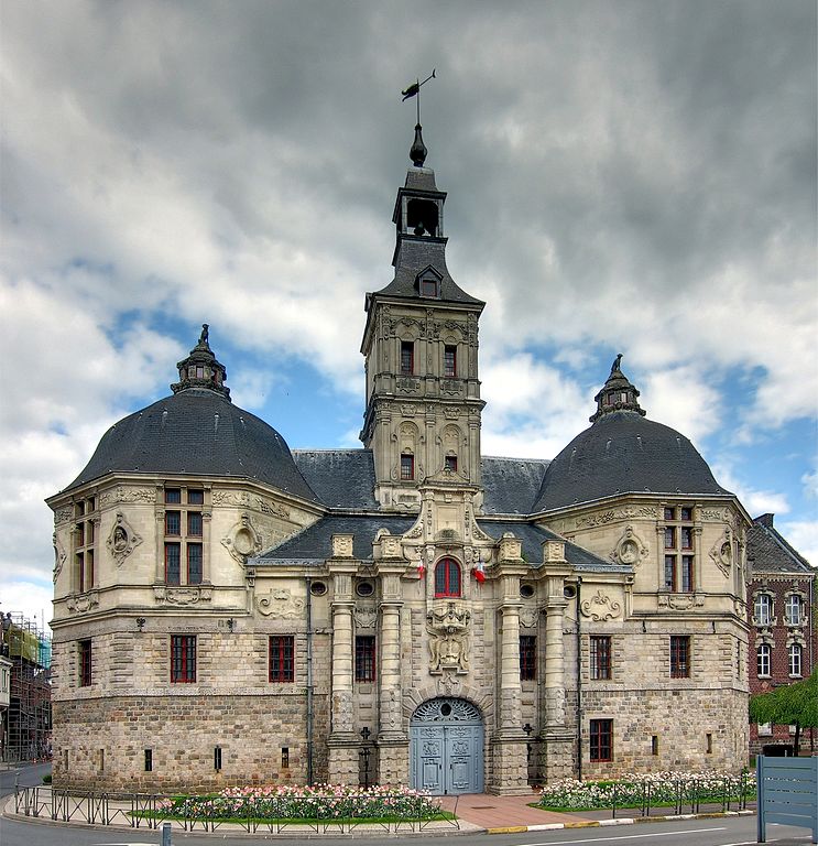
arrondissement of Valenciennes (arrondissement de Valenciennes)
- arrondissement of France
- Country:

- Capital: Valenciennes
- Coordinates: 50° 20' 0" N, 3° 25' 0" E


- GPS tracks (wikiloc): [Link]
- Area: 634.88 sq km
- Population: 351836
- Wikipedia en: wiki(en)
- Wikipedia: wiki(fr)
- Wikidata storage: Wikidata: Q702702
- Freebase ID: [/m/09562v]
- GeoNames ID: Alt: [2971040]
- Library of Congress authority ID: Alt: [n2018013482]
- INSEE arrondissement code: [596]
- GNS Unique Feature ID: -1474449
Includes regions:


canton of Denain
- canton of France
- Country:

- Capital: Denain
- Coordinates: 50° 20' 11" N, 3° 22' 24" E


- GPS tracks (wikiloc): [Link]
- Population: 70227

canton of Saint-Amand-les-Eaux-Rive droite
- canton of France
- Country:

- Capital: Saint-Amand-les-Eaux
- Coordinates: 50° 27' 42" N, 3° 27' 29" E


- GPS tracks (wikiloc): [Link]

canton of Saint-Amand-les-Eaux-Rive gauche
- canton of France
- Country:

- Capital: Saint-Amand-les-Eaux
- Coordinates: 50° 27' 47" N, 3° 24' 6" E


- GPS tracks (wikiloc): [Link]

canton of Valenciennes-Nord
- canton of France
- Country:

- Capital: Valenciennes
- Coordinates: 50° 22' 9" N, 3° 27' 22" E


- GPS tracks (wikiloc): [Link]

canton of Valenciennes-Est
- canton of France
- Country:

- Capital: Valenciennes
- Coordinates: 50° 21' 24" N, 3° 36' 1" E


- GPS tracks (wikiloc): [Link]

canton of Valenciennes-Sud
- canton of France
- Country:

- Capital: Valenciennes
- Coordinates: 50° 19' 12" N, 3° 28' 52" E


- GPS tracks (wikiloc): [Link]


canton of Aulnoy-lez-Valenciennes
- canton of France
- Country:

- Capital: Aulnoy-lez-Valenciennes
- Coordinates: 50° 19' 55" N, 3° 31' 51" E


- GPS tracks (wikiloc): [Link]
- Population: 53052


canton of Valenciennes
- canton of France
- Country:

- Capital: Valenciennes
- Coordinates: 50° 21' 29" N, 3° 31' 24" E


- GPS tracks (wikiloc): [Link]
- Area: 25.88 sq km
- Population: 55219


canton of Marly
- canton of France
- Country:

- Capital: Marly
- Coordinates: 50° 43' 30" N, 2° 32' 21" E


- GPS tracks (wikiloc): [Link]
- Population: 62373


canton of Saint-Amand-les-Eaux
- canton of France
- Country:

- Capital: Saint-Amand-les-Eaux
- Coordinates: 50° 26' 55" N, 3° 25' 41" E


- GPS tracks (wikiloc): [Link]
- Area: 196.04 sq km
- Population: 58519


canton of Anzin
- canton of France
- Country:

- Capital: Anzin
- Coordinates: 50° 22' 55" N, 3° 31' 36" E


- GPS tracks (wikiloc): [Link]
- Population: 52446

canton of Condé-sur-l'Escaut
- canton of France (until March 2015)
- Country:

- Capital: Condé-sur-l'Escaut
- Coordinates: 50° 26' 32" N, 3° 35' 31" E


- GPS tracks (wikiloc): [Link]
