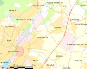
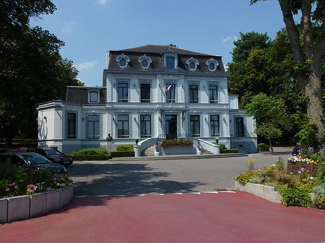
Marly (Marly)

- commune in Nord, France
- Country:

- Postal Code: 59770
- Coordinates: 50° 20' 56" N, 3° 32' 39" E


- GPS tracks (wikiloc): [Link]
- Area: 8.04 sq km
- Population: 11590
- Web site: http://www.marly.fr
- Wikipedia en: wiki(en)
- Wikipedia: wiki(fr)
- Wikidata storage: Wikidata: Q937793
- Wikipedia Commons Category: [Link]
- Freebase ID: [/m/03qfhct]
- Freebase ID: [/m/03qfhct]
- GeoNames ID: Alt: [6438351]
- GeoNames ID: Alt: [6438351]
- SIREN number: [215903832]
- SIREN number: [215903832]
- BnF ID: [15266955n]
- BnF ID: [15266955n]
- VIAF ID: Alt: [137321014]
- VIAF ID: Alt: [137321014]
- ISNI: Alt: [0000 0001 0724 2078]
- ISNI: Alt: [0000 0001 0724 2078]
- INSEE municipality code: 59383
- INSEE municipality code: 59383
- US National Archives Identifier: 10037875
- US National Archives Identifier: 10037875
Shares border with regions:


Aulnoy-lez-Valenciennes
- commune in Nord, France
- Country:
- Postal Code: 59300
- Coordinates: 50° 19' 53" N, 3° 31' 48" E
- GPS tracks (wikiloc): [Link]
- AboveSeaLevel: 37 м m
- Area: 6.12 sq km
- Population: 7339
- Web site: [Link]

Saint-Saulve
- commune in Nord, France
- Country:
- Postal Code: 59880
- Coordinates: 50° 22' 11" N, 3° 33' 17" E
- GPS tracks (wikiloc): [Link]
- Area: 12.06 sq km
- Population: 11176
- Web site: [Link]

Valenciennes
- commune in Nord, France
- Country:
- Postal Code: 59300
- Coordinates: 50° 21' 33" N, 3° 31' 30" E
- GPS tracks (wikiloc): [Link]
- AboveSeaLevel: 42 м m
- Area: 13.82 sq km
- Population: 44043
- Web site: [Link]


Estreux
- commune in Nord, France
- Country:
- Postal Code: 59990
- Coordinates: 50° 21' 3" N, 3° 35' 39" E
- GPS tracks (wikiloc): [Link]
- Area: 5.3 sq km
- Population: 954

Saultain
- commune in Nord, France
- Country:
- Postal Code: 59990
- Coordinates: 50° 20' 16" N, 3° 34' 34" E
- GPS tracks (wikiloc): [Link]
- Area: 6.45 sq km
- Population: 2281
- Web site: [Link]