Athée (Athée)

- commune in Mayenne, France
- Country:

- Postal Code: 53400
- Coordinates: 47° 53' 13" N, 0° 57' 1" E


- GPS tracks (wikiloc): [Link]
- Area: 17.23 sq km
- Population: 501
- Wikipedia en: wiki(en)
- Wikipedia: wiki(fr)
- Wikidata storage: Wikidata: Q1066376
- Wikipedia Commons Category: [Link]
- Freebase ID: [/m/03qdcck]
- Freebase ID: [/m/03qdcck]
- GeoNames ID: Alt: [6449631]
- GeoNames ID: Alt: [6449631]
- SIREN number: [215300120]
- SIREN number: [215300120]
- INSEE municipality code: 53012
- INSEE municipality code: 53012
Shares border with regions:


La Chapelle-Craonnaise
- commune in Mayenne, France
- Country:
- Postal Code: 53230
- Coordinates: 47° 53' 56" N, 0° 54' 56" E
- GPS tracks (wikiloc): [Link]
- Area: 10.32 sq km
- Population: 336
- Web site: [Link]


Denazé
- commune in Mayenne, France
- Country:
- Postal Code: 53400
- Coordinates: 47° 53' 6" N, 0° 53' 13" E
- GPS tracks (wikiloc): [Link]
- Area: 9.3 sq km
- Population: 154


Craon
- commune in Mayenne, France
- Country:
- Postal Code: 53400
- Coordinates: 47° 50' 53" N, 0° 56' 59" E
- GPS tracks (wikiloc): [Link]
- Area: 24.56 sq km
- Population: 4509
- Web site: [Link]

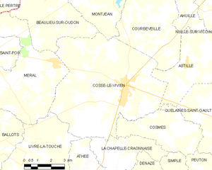
Cossé-le-Vivien
- commune in Mayenne, France
- Country:
- Postal Code: 53230
- Coordinates: 47° 56' 43" N, 0° 54' 42" E
- GPS tracks (wikiloc): [Link]
- Area: 44.41 sq km
- Population: 3057
- Web site: [Link]


Livré-la-Touche
- commune in Mayenne, France
- Country:
- Postal Code: 53400
- Coordinates: 47° 52' 52" N, 0° 58' 52" E
- GPS tracks (wikiloc): [Link]
- Area: 30.08 sq km
- Population: 756
- Web site: [Link]