Aubeville (Aubeville)

- former commune in Charente, France
- Country:

- Postal Code: 16250
- Coordinates: 45° 29' 55" N, 0° 0' 14" E


- GPS tracks (wikiloc): [Link]
- Area: 8.22 sq km
- Population: 140
- Wikipedia en: wiki(en)
- Wikipedia: wiki(fr)
- Wikidata storage: Wikidata: Q1349962
- Wikipedia Commons Category: [Link]
- Freebase ID: [/m/03mbc7q]
- GeoNames ID: Alt: [3036372]
- BnF ID: [15248460x]
- INSEE municipality code: 16021
Shares border with regions:


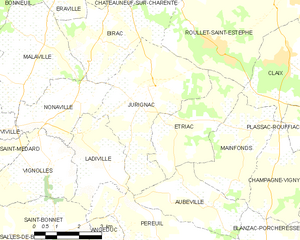
Étriac
- commune in Charente, France
- Country:
- Postal Code: 16250
- Coordinates: 45° 31' 42" N, 0° 1' 32" E
- GPS tracks (wikiloc): [Link]
- Area: 9.47 sq km
- Population: 204


Champagne-Vigny
- commune in Charente, France
- Country:
- Postal Code: 16250
- Coordinates: 45° 30' 27" N, 0° 2' 13" E
- GPS tracks (wikiloc): [Link]
- AboveSeaLevel: 103 м m
- Area: 8.31 sq km
- Population: 254

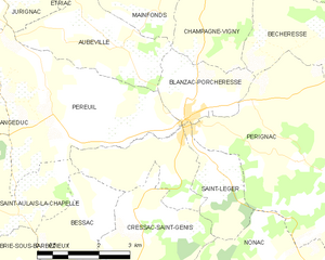
Blanzac-Porcheresse
- former commune in Charente, France
- Country:
- Postal Code: 16250
- Coordinates: 45° 29' 0" N, 0° 2' 0" E
- GPS tracks (wikiloc): [Link]
- AboveSeaLevel: 80 м m
- Area: 10.84 sq km
- Population: 773
- Web site: [Link]


Péreuil
- former commune in Charente, France
- Country:
- Postal Code: 16250
- Coordinates: 45° 28' 53" N, 0° 1' 21" E
- GPS tracks (wikiloc): [Link]
- Area: 17.18 sq km
- Population: 415

Jurignac
- former commune in Charente, France
- Country:
- Postal Code: 16250
- Coordinates: 45° 32' 1" N, 0° 2' 17" E
- GPS tracks (wikiloc): [Link]
- Area: 16 sq km
- Population: 617


Mainfonds
- former commune in Charente, France
- Country:
- Postal Code: 16250
- Coordinates: 45° 31' 5" N, 0° 1' 9" E
- GPS tracks (wikiloc): [Link]
- Area: 9.26 sq km
- Population: 232