Aubigny (Aubigny)

- commune in Deux-Sèvres, France
- Country:

- Postal Code: 79390
- Coordinates: 46° 44' 27" N, 0° 7' 11" E


- GPS tracks (wikiloc): [Link]
- Area: 11.98 sq km
- Population: 174
- Wikipedia en: wiki(en)
- Wikipedia: wiki(fr)
- Wikidata storage: Wikidata: Q1084361
- Wikipedia Commons Category: [Link]
- Freebase ID: [/m/03mg1h1]
- GeoNames ID: Alt: [6451227]
- SIREN number: [217900190]
- BnF ID: [15276155n]
- INSEE municipality code: 79019
Shares border with regions:


Gourgé
- commune in Deux-Sèvres, France
- Country:
- Postal Code: 79200
- Coordinates: 46° 43' 42" N, 0° 9' 57" E
- GPS tracks (wikiloc): [Link]
- Area: 50.43 sq km
- Population: 960
- Web site: [Link]


Thénezay
- commune in Deux-Sèvres, France
- Country:
- Postal Code: 79390
- Coordinates: 46° 43' 9" N, 0° 1' 37" E
- GPS tracks (wikiloc): [Link]
- Area: 48.49 sq km
- Population: 1396

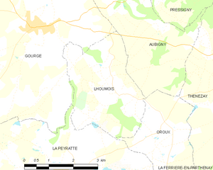
Lhoumois
- commune in Deux-Sèvres, France
- Country:
- Postal Code: 79390
- Coordinates: 46° 42' 20" N, 0° 7' 13" E
- GPS tracks (wikiloc): [Link]
- Area: 9.67 sq km
- Population: 159
Pressigny
- commune in Deux-Sèvres, France
- Country:
- Postal Code: 79390
- Coordinates: 46° 44' 52" N, 0° 5' 31" E
- GPS tracks (wikiloc): [Link]
- Area: 12.12 sq km
- Population: 182


Oroux
- commune in Deux-Sèvres, France
- Country:
- Postal Code: 79390
- Coordinates: 46° 41' 31" N, 0° 5' 22" E
- GPS tracks (wikiloc): [Link]
- Area: 6.56 sq km
- Population: 102


Saint-Loup-Lamairé
- commune in Deux-Sèvres, France
- Country:
- Postal Code: 79600
- Coordinates: 46° 47' 18" N, 0° 9' 55" E
- GPS tracks (wikiloc): [Link]
- AboveSeaLevel: 130 м m
- Area: 21.8 sq km
- Population: 970