canton of Thénezay (canton de Thénezay)
- canton of France (until March 2015)
- Country:

- Capital: Thénezay
- Coordinates: 46° 41' 58" N, 0° 5' 23" E


- GPS tracks (wikiloc): [Link]
- Wikidata storage: Wikidata: Q662610
- INSEE canton code: [7930]
Includes regions:
Aubigny
- commune in Deux-Sèvres, France
- Country:

- Postal Code: 79390
- Coordinates: 46° 44' 27" N, 0° 7' 11" E


- GPS tracks (wikiloc): [Link]
- Area: 11.98 sq km
- Population: 174


Thénezay
- commune in Deux-Sèvres, France
- Country:

- Postal Code: 79390
- Coordinates: 46° 43' 9" N, 0° 1' 37" E


- GPS tracks (wikiloc): [Link]
- Area: 48.49 sq km
- Population: 1396
Saurais
- commune in Deux-Sèvres, France
- Country:

- Postal Code: 79200
- Coordinates: 46° 37' 9" N, 0° 8' 43" E


- GPS tracks (wikiloc): [Link]
- Area: 11.3 sq km
- Population: 198


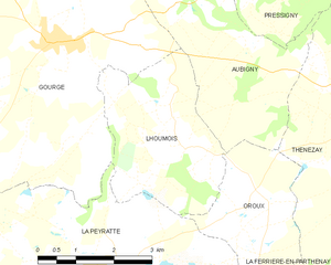
Lhoumois
- commune in Deux-Sèvres, France
- Country:

- Postal Code: 79390
- Coordinates: 46° 42' 20" N, 0° 7' 13" E


- GPS tracks (wikiloc): [Link]
- Area: 9.67 sq km
- Population: 159
Pressigny
- commune in Deux-Sèvres, France
- Country:

- Postal Code: 79390
- Coordinates: 46° 44' 52" N, 0° 5' 31" E


- GPS tracks (wikiloc): [Link]
- Area: 12.12 sq km
- Population: 182


La Ferrière-en-Parthenay
- commune in Deux-Sèvres, France
- Country:

- Postal Code: 79390
- Coordinates: 46° 39' 26" N, 0° 4' 33" E


- GPS tracks (wikiloc): [Link]
- Area: 29.12 sq km
- Population: 822


Oroux
- commune in Deux-Sèvres, France
- Country:

- Postal Code: 79390
- Coordinates: 46° 41' 31" N, 0° 5' 22" E


- GPS tracks (wikiloc): [Link]
- Area: 6.56 sq km
- Population: 102


Doux
- commune in Deux-Sèvres, France
- Country:

- Postal Code: 79390
- Coordinates: 46° 44' 18" N, 0° 0' 50" E


- GPS tracks (wikiloc): [Link]
- Area: 9.85 sq km
- Population: 223


La Peyratte
- commune in Deux-Sèvres, France
- Country:

- Postal Code: 79200
- Coordinates: 46° 40' 31" N, 0° 8' 52" E


- GPS tracks (wikiloc): [Link]
- Area: 46.86 sq km
- Population: 1163
- Web site: [Link]