Audincourt (Audincourt)

- commune in Doubs, France
 Hiking in Audincourt
Audincourt is a charming town located in the Bourgogne-Franche-Comté region of France, nestled near the city of Montbéliard. While it may not be as widely known for hiking as some other areas, there are opportunities for outdoor enthusiasts to explore the natural beauty of the surrounding region. Here are a few points to consider if you're planning to hike in and around Audincourt:
-
Local Trails: There are several walking and hiking trails around Audincourt that offer a range of difficulties. You may find local paths that take you through forests, along rivers, or into the rolling hills typical of the Franche-Comté region.
-
Nearby Nature Reserves: Consider visiting local nature reserves or parks. The nearby Vosges Mountains and Jura Mountains provide excellent hiking opportunities with trails that vary in difficulty and length.
-
Scenic Views: Hiking in the region can offer beautiful views of the countryside, with opportunities to see local wildlife, lush forests, and picturesque landscapes.
-
Planning Your Hike: Before heading out, check local resources or community boards for trail maps and conditions. It’s also a good idea to be aware of the weather forecast and to dress appropriately for the hike.
-
Cultural Sites: While hiking, you might also come across historical sites or points of interest that offer a glimpse into the region's culture and history.
-
Safety: Ensure you have the proper gear, carry enough water, and consider bringing a first aid kit. It's also wise to let someone know your hiking plans if you're going out alone.
For an enhanced hiking experience, you can also connect with local hiking groups or guides who may offer organized hikes or additional insights into the best trails in the area. Enjoy your hiking adventure in Audincourt!
- Country:

- Postal Code: 25400
- Coordinates: 47° 28' 58" N, 6° 50' 23" E


- GPS tracks (wikiloc): [Link]
- Area: 8.76 sq km
- Population: 14121
- Web site: http://www.audincourt.fr
- Wikipedia en: wiki(en)
- Wikipedia: wiki(fr)
- Wikidata storage: Wikidata: Q732475
- Wikipedia Commons Category: [Link]
- Freebase ID: [/m/03mgbts]
- Freebase ID: [/m/03mgbts]
- GeoNames ID: Alt: [3036240]
- GeoNames ID: Alt: [3036240]
- SIREN number: [212500318]
- SIREN number: [212500318]
- BnF ID: [152522577]
- BnF ID: [152522577]
- VIAF ID: Alt: [127635552]
- VIAF ID: Alt: [127635552]
- GND ID: Alt: [4697708-9]
- GND ID: Alt: [4697708-9]
- archINFORM location ID: [11059]
- archINFORM location ID: [11059]
- Library of Congress authority ID: Alt: [no2003040532]
- Library of Congress authority ID: Alt: [no2003040532]
- WOEID: [23689706]
- WOEID: [23689706]
- INSEE municipality code: 25031
- INSEE municipality code: 25031
Shares border with regions:


Valentigney
- commune in Doubs, France
Hiking in Valentigney
Valentigney, located in the Bourgogne-Franche-Comté region of France, offers some lovely opportunities for hiking enthusiasts. While it might not be as widely known for hiking as some other areas, its surrounding natural scenery and accessibility to nearby parks and trails can provide a delightful experience....
- Country:
- Postal Code: 25700
- Coordinates: 47° 27' 45" N, 6° 49' 56" E
- GPS tracks (wikiloc): [Link]
- Area: 9.74 sq km
- Population: 10196
- Web site: [Link]
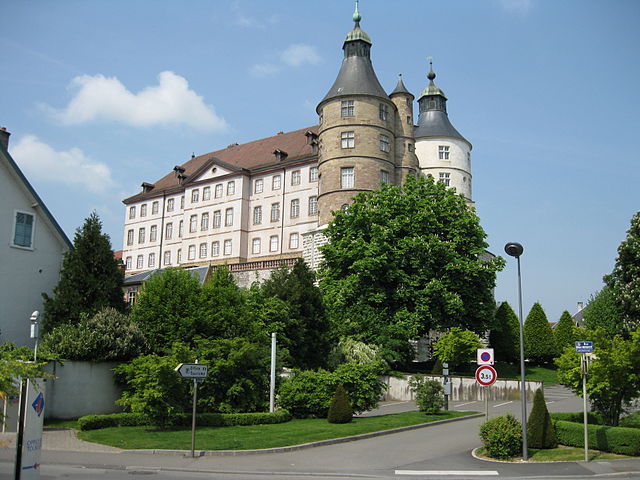

Montbéliard
- commune in Doubs, France
Hiking in Montbéliard
Montbéliard, a picturesque town located in the Bourgogne-Franche-Comté region of eastern France, offers various hiking opportunities that allow you to explore the beautiful landscapes and rich history of the area....
- Country:
- Postal Code: 25200
- Coordinates: 47° 30' 35" N, 6° 47' 54" E
- GPS tracks (wikiloc): [Link]
- AboveSeaLevel: 337 м m
- Area: 15.01 sq km
- Population: 25336
- Web site: [Link]


Taillecourt
- commune in Doubs, France
Hiking in Taillecourt
Taillecourt is a small commune located in the Doubs department in the Franche-Comté region of eastern France. While it may not be as well-known as some other hiking destinations, it offers some lovely natural landscapes and opportunities to explore the surrounding area....
- Country:
- Postal Code: 25400
- Coordinates: 47° 29' 48" N, 6° 50' 54" E
- GPS tracks (wikiloc): [Link]
- Area: 1.86 sq km
- Population: 1106


Voujeaucourt
- commune in Doubs, France
Hiking in Voujeaucourt
Voujeaucourt is a small commune located in the Doubs department in the Bourgogne-Franche-Comté region of eastern France. While it may not be as widely known as some larger hiking destinations, the surrounding areas offer opportunities for outdoor activities, including hiking....
- Country:
- Postal Code: 25420
- Coordinates: 47° 28' 32" N, 6° 46' 28" E
- GPS tracks (wikiloc): [Link]
- Area: 9.45 sq km
- Population: 3320
- Web site: [Link]