Audon (Audon)

- commune in Landes, France
- Country:

- Postal Code: 40400
- Coordinates: 43° 47' 51" N, 0° 49' 35" E


- GPS tracks (wikiloc): [Link]
- Area: 7.55 sq km
- Population: 368
- Web site: http://www.mairie-audon.fr
- Wikipedia en: wiki(en)
- Wikipedia: wiki(fr)
- Wikidata storage: Wikidata: Q2087105
- Wikipedia Commons Category: [Link]
- Freebase ID: [/m/03mhgr5]
- Freebase ID: [/m/03mhgr5]
- GeoNames ID: Alt: [6448828]
- GeoNames ID: Alt: [6448828]
- SIREN number: [214000184]
- SIREN number: [214000184]
- BnF ID: [15258961v]
- BnF ID: [15258961v]
- INSEE municipality code: 40018
- INSEE municipality code: 40018
Shares border with regions:


Bégaar
- commune in Landes, France
- Country:
- Postal Code: 40400
- Coordinates: 43° 49' 36" N, 0° 51' 1" E
- GPS tracks (wikiloc): [Link]
- AboveSeaLevel: 19 м m
- Area: 27.8 sq km
- Population: 1134
- Web site: [Link]


Gouts
- commune in Landes, France
- Country:
- Postal Code: 40400
- Coordinates: 43° 47' 3" N, 0° 47' 46" E
- GPS tracks (wikiloc): [Link]
- Area: 10.88 sq km
- Population: 281
- Web site: [Link]


Tartas
- commune in Landes, France
- Country:
- Postal Code: 40400
- Coordinates: 43° 49' 57" N, 0° 48' 31" E
- GPS tracks (wikiloc): [Link]
- AboveSeaLevel: 22 м m
- Area: 30.37 sq km
- Population: 3236
- Web site: [Link]

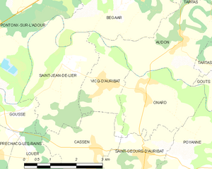
Vicq-d'Auribat
- commune in Landes, France
- Country:
- Postal Code: 40380
- Coordinates: 43° 47' 6" N, 0° 51' 35" E
- GPS tracks (wikiloc): [Link]
- AboveSeaLevel: 13 м m
- Area: 4.2 sq km
- Population: 265


Onard
- commune in Landes, France
- Country:
- Postal Code: 40380
- Coordinates: 43° 46' 48" N, 0° 50' 15" E
- GPS tracks (wikiloc): [Link]
- Area: 6.15 sq km
- Population: 375