Augignac (Augignac)

- commune in Dordogne, France
- Country:

- Postal Code: 24300
- Coordinates: 45° 35' 29" N, 0° 42' 6" E


- GPS tracks (wikiloc): [Link]
- Area: 22.64 sq km
- Population: 815
- Web site: http://www.augignac.fr
- Wikipedia en: wiki(en)
- Wikipedia: wiki(fr)
- Wikidata storage: Wikidata: Q471565
- Wikipedia Commons Category: [Link]
- Freebase ID: [/m/0276ggp]
- Freebase ID: [/m/0276ggp]
- GeoNames ID: Alt: [3036190]
- GeoNames ID: Alt: [3036190]
- SIREN number: [212400162]
- SIREN number: [212400162]
- BnF ID: [15251667d]
- BnF ID: [15251667d]
- VIAF ID: Alt: [235215111]
- VIAF ID: Alt: [235215111]
- INSEE municipality code: 24016
- INSEE municipality code: 24016
Shares border with regions:

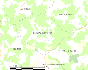
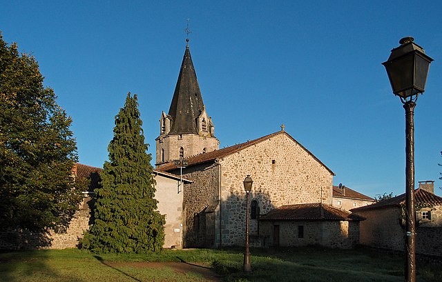
Savignac-de-Nontron
- commune in Dordogne, France
- Country:
- Postal Code: 24300
- Coordinates: 45° 32' 31" N, 0° 43' 23" E
- GPS tracks (wikiloc): [Link]
- Area: 9.69 sq km
- Population: 190

Abjat-sur-Bandiat
- commune in Dordogne, France
- Country:
- Postal Code: 24300
- Coordinates: 45° 35' 6" N, 0° 45' 29" E
- GPS tracks (wikiloc): [Link]
- Area: 27.62 sq km
- Population: 629
- Web site: [Link]

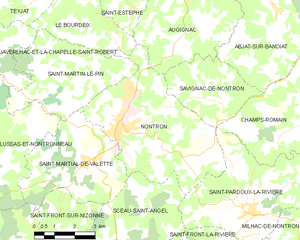
Nontron
- commune in Dordogne, France
- Country:
- Postal Code: 24300
- Coordinates: 45° 31' 46" N, 0° 39' 42" E
- GPS tracks (wikiloc): [Link]
- AboveSeaLevel: 200 м m
- Area: 24.67 sq km
- Population: 3121
- Web site: [Link]

Piégut-Pluviers
- commune in Dordogne, France
- Country:
- Postal Code: 24360
- Coordinates: 45° 37' 21" N, 0° 41' 22" E
- GPS tracks (wikiloc): [Link]
- Area: 18.11 sq km
- Population: 1182
- Web site: [Link]

Le Bourdeix
- commune in Dordogne, France
- Country:
- Postal Code: 24300
- Coordinates: 45° 35' 18" N, 0° 37' 55" E
- GPS tracks (wikiloc): [Link]
- Area: 11.69 sq km
- Population: 234