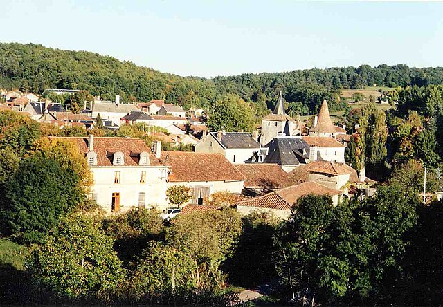
Le Bourdeix (Le Bourdeix)

- commune in Dordogne, France
- Country:

- Postal Code: 24300
- Coordinates: 45° 35' 18" N, 0° 37' 55" E


- GPS tracks (wikiloc): [Link]
- Area: 11.69 sq km
- Population: 234
- Wikipedia en: wiki(en)
- Wikipedia: wiki(fr)
- Wikidata storage: Wikidata: Q626915
- Wikipedia Commons Category: [Link]
- Freebase ID: [/m/0276gvd]
- Freebase ID: [/m/0276gvd]
- GeoNames ID: Alt: [3005098]
- GeoNames ID: Alt: [3005098]
- SIREN number: [212400568]
- SIREN number: [212400568]
- BnF ID: [15251707t]
- BnF ID: [15251707t]
- VIAF ID: Alt: [239194083]
- VIAF ID: Alt: [239194083]
- GND ID: Alt: [4553501-2]
- GND ID: Alt: [4553501-2]
- INSEE municipality code: 24056
- INSEE municipality code: 24056
Shares border with regions:

Étouars
- commune in Dordogne, France
- Country:
- Postal Code: 24360
- Coordinates: 45° 36' 6" N, 0° 37' 42" E
- GPS tracks (wikiloc): [Link]
- Area: 7.83 sq km
- Population: 151

Javerlhac-et-la-Chapelle-Saint-Robert
- commune in Dordogne, France
- Country:
- Postal Code: 24300
- Coordinates: 45° 34' 11" N, 0° 33' 38" E
- GPS tracks (wikiloc): [Link]
- AboveSeaLevel: 128 м m
- Area: 29.25 sq km
- Population: 858
- Web site: [Link]
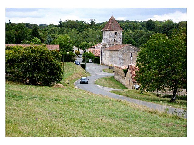
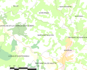
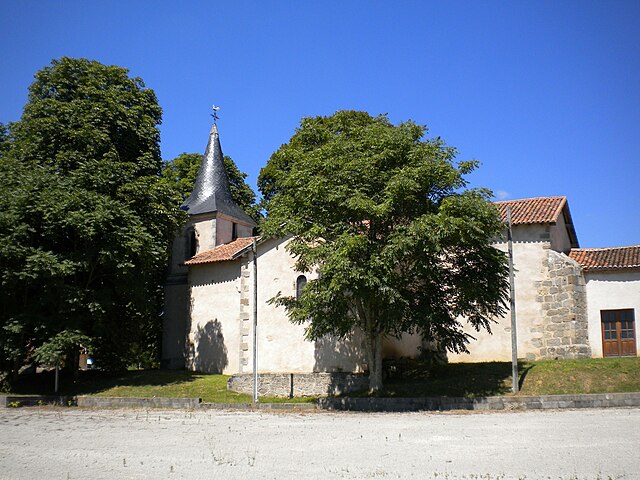
Saint-Martin-le-Pin
- commune in Dordogne, France
- Country:
- Postal Code: 24300
- Coordinates: 45° 33' 20" N, 0° 36' 41" E
- GPS tracks (wikiloc): [Link]
- Area: 15.54 sq km
- Population: 282

Nontron
- commune in Dordogne, France
- Country:
- Postal Code: 24300
- Coordinates: 45° 31' 46" N, 0° 39' 42" E
- GPS tracks (wikiloc): [Link]
- AboveSeaLevel: 200 м m
- Area: 24.67 sq km
- Population: 3121
- Web site: [Link]


Augignac
- commune in Dordogne, France
- Country:
- Postal Code: 24300
- Coordinates: 45° 35' 29" N, 0° 42' 6" E
- GPS tracks (wikiloc): [Link]
- Area: 22.64 sq km
- Population: 815
- Web site: [Link]