Avon (Avon)

- commune in Deux-Sèvres, France
- Country:

- Postal Code: 79800
- Coordinates: 46° 22' 36" N, 0° 1' 11" E


- GPS tracks (wikiloc): [Link]
- AboveSeaLevel: 141 м m
- Area: 12.54 sq km
- Population: 70
- Wikipedia en: wiki(en)
- Wikipedia: wiki(fr)
- Wikidata storage: Wikidata: Q1149065
- Wikipedia Commons Category: [Link]
- Freebase ID: [/m/03mg1j2]
- GeoNames ID: Alt: [6451229]
- SIREN number: [217900232]
- BnF ID: [152761591]
- INSEE municipality code: 79023
Shares border with regions:

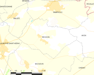
Bougon
- commune in Deux-Sèvres, France
- Country:
- Postal Code: 79800
- Coordinates: 46° 21' 52" N, 0° 3' 34" E
- GPS tracks (wikiloc): [Link]
- Area: 11.7 sq km
- Population: 180


Chenay
- commune in Deux-Sèvres, France
- Country:
- Postal Code: 79120
- Coordinates: 46° 19' 29" N, 0° 2' 2" E
- GPS tracks (wikiloc): [Link]
- Area: 21.7 sq km
- Population: 489


Exoudun
- commune in Deux-Sèvres, France
- Country:
- Postal Code: 79800
- Coordinates: 46° 20' 40" N, 0° 4' 55" E
- GPS tracks (wikiloc): [Link]
- Area: 25.95 sq km
- Population: 611

Rouillé
- commune in Vienne, France
- Country:
- Postal Code: 86480
- Coordinates: 46° 25' 14" N, 0° 2' 23" E
- GPS tracks (wikiloc): [Link]
- Area: 52.01 sq km
- Population: 2452


Saint-Sauvant
- commune in Vienne, France
- Country:
- Postal Code: 86600
- Coordinates: 46° 21' 34" N, 0° 3' 22" E
- GPS tracks (wikiloc): [Link]
- Area: 59.58 sq km
- Population: 1282


Pamproux
- commune in Deux-Sèvres, France
- Country:
- Postal Code: 79800
- Coordinates: 46° 23' 45" N, 0° 3' 20" E
- GPS tracks (wikiloc): [Link]
- Area: 36.3 sq km
- Population: 1707
- Web site: [Link]