canton of La Mothe-Saint-Héray (canton de La Mothe-Saint-Héray)
- canton of France
- Country:

- Capital: La Mothe-Saint-Héray
- Coordinates: 46° 22' 22" N, 0° 5' 12" E


- GPS tracks (wikiloc): [Link]
- Wikidata storage: Wikidata: Q1725637
- INSEE canton code: [7919]
Includes regions:

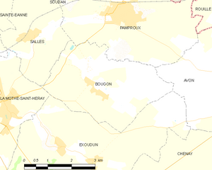
Bougon
- commune in Deux-Sèvres, France
- Country:
- Postal Code: 79800
- Coordinates: 46° 21' 52" N, 0° 3' 34" E
- GPS tracks (wikiloc): [Link]
- Area: 11.7 sq km
- Population: 180
Avon
- commune in Deux-Sèvres, France
- Country:
- Postal Code: 79800
- Coordinates: 46° 22' 36" N, 0° 1' 11" E
- GPS tracks (wikiloc): [Link]
- AboveSeaLevel: 141 м m
- Area: 12.54 sq km
- Population: 70


Exoudun
- commune in Deux-Sèvres, France
- Country:
- Postal Code: 79800
- Coordinates: 46° 20' 40" N, 0° 4' 55" E
- GPS tracks (wikiloc): [Link]
- Area: 25.95 sq km
- Population: 611
Soudan
- commune in Deux-Sèvres, France
- Country:
- Postal Code: 79800
- Coordinates: 46° 25' 22" N, 0° 6' 40" E
- GPS tracks (wikiloc): [Link]
- Area: 23.29 sq km
- Population: 439
Salles
- commune in Deux-Sèvres, France
- Country:
- Postal Code: 79800
- Coordinates: 46° 23' 7" N, 0° 5' 58" E
- GPS tracks (wikiloc): [Link]
- AboveSeaLevel: 100 м m
- Area: 7.77 sq km
- Population: 336
La Couarde
- commune in Deux-Sèvres, France
- Country:
- Postal Code: 79800
- Coordinates: 46° 19' 10" N, 0° 9' 33" E
- GPS tracks (wikiloc): [Link]
- Area: 16.36 sq km
- Population: 266
- Web site: [Link]


Pamproux
- commune in Deux-Sèvres, France
- Country:
- Postal Code: 79800
- Coordinates: 46° 23' 45" N, 0° 3' 20" E
- GPS tracks (wikiloc): [Link]
- Area: 36.3 sq km
- Population: 1707
- Web site: [Link]
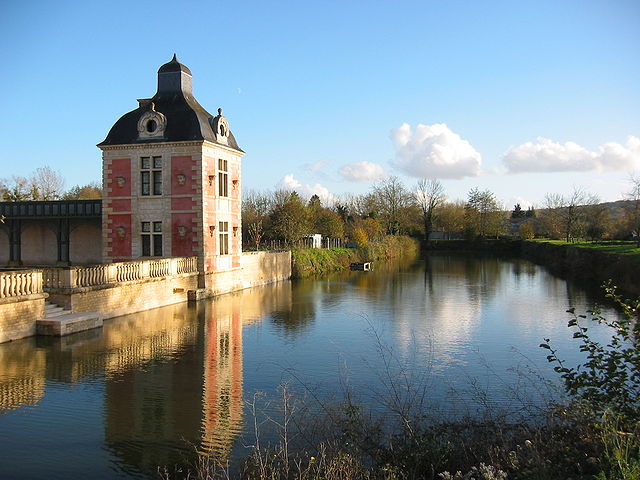

La Mothe-Saint-Héray
- commune in Deux-Sèvres, France
- Country:
- Postal Code: 79800
- Coordinates: 46° 21' 18" N, 0° 6' 36" E
- GPS tracks (wikiloc): [Link]
- Area: 14.92 sq km
- Population: 1702
- Web site: [Link]