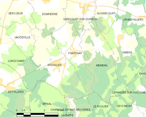
Aydoilles (Aydoilles)

- commune in Vosges, France
- Country:

- Postal Code: 88600
- Coordinates: 48° 12' 41" N, 6° 34' 19" E


- GPS tracks (wikiloc): [Link]
- Area: 10 sq km
- Population: 1060
- Web site: http://www.aydoilles-88.fr
- Wikipedia en: wiki(en)
- Wikipedia: wiki(fr)
- Wikidata storage: Wikidata: Q623985
- Wikipedia Commons Category: [Link]
- Freebase ID: [/m/03qgtz4]
- Freebase ID: [/m/03qgtz4]
- GeoNames ID: Alt: [6451762]
- GeoNames ID: Alt: [6451762]
- SIREN number: [218800266]
- SIREN number: [218800266]
- BnF ID: [15278955b]
- BnF ID: [15278955b]
- INSEE municipality code: 88026
- INSEE municipality code: 88026
Shares border with regions:


Vaudéville
- commune in Vosges, France
- Country:
- Postal Code: 88000
- Coordinates: 48° 13' 47" N, 6° 32' 32" E
- GPS tracks (wikiloc): [Link]
- Area: 3.22 sq km
- Population: 164

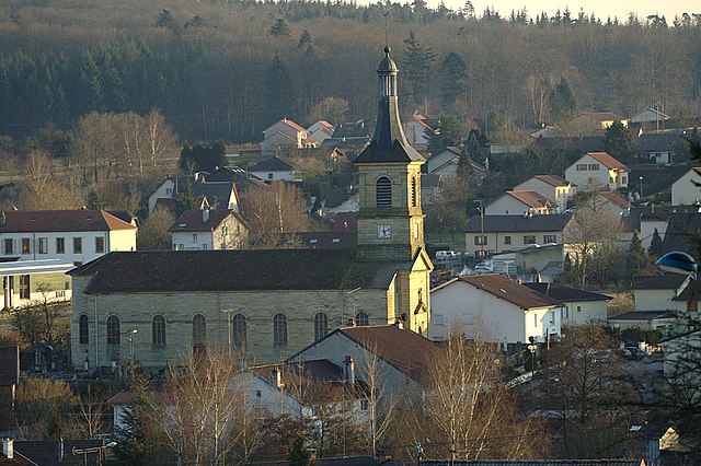
Fontenay
- commune in Vosges, France
- Country:
- Postal Code: 88600
- Coordinates: 48° 13' 6" N, 6° 35' 21" E
- GPS tracks (wikiloc): [Link]
- Area: 6.47 sq km
- Population: 492


Sercœur
- commune in Vosges, France
- Country:
- Postal Code: 88600
- Coordinates: 48° 15' 17" N, 6° 31' 57" E
- GPS tracks (wikiloc): [Link]
- Area: 9.18 sq km
- Population: 237
- Web site: [Link]


Épinal
- commune in Vosges, France
- Country:
- Postal Code: 88000
- Coordinates: 48° 10' 25" N, 6° 27' 6" E
- GPS tracks (wikiloc): [Link]
- Area: 59.24 sq km
- Population: 31938
- Web site: [Link]


Charmois-devant-Bruyères
- commune in Vosges, France
- Country:
- Postal Code: 88460
- Coordinates: 48° 10' 6" N, 6° 35' 35" E
- GPS tracks (wikiloc): [Link]
- Area: 6.61 sq km
- Population: 399


Dompierre
- commune in Vosges, France
- Country:
- Postal Code: 88600
- Coordinates: 48° 15' 10" N, 6° 33' 50" E
- GPS tracks (wikiloc): [Link]
- Area: 8.88 sq km
- Population: 270
- Web site: [Link]


Longchamp
- commune in Vosges, France
- Country:
- Postal Code: 88000
- Coordinates: 48° 13' 29" N, 6° 30' 48" E
- GPS tracks (wikiloc): [Link]
- Area: 10.26 sq km
- Population: 469


Le Roulier
- commune in Vosges, France
- Country:
- Postal Code: 88460
- Coordinates: 48° 10' 5" N, 6° 37' 12" E
- GPS tracks (wikiloc): [Link]
- Area: 5.67 sq km
- Population: 196

Deyvillers
- commune in Vosges, France
- Country:
- Postal Code: 88000
- Coordinates: 48° 12' 6" N, 6° 30' 48" E
- GPS tracks (wikiloc): [Link]
- Area: 8.77 sq km
- Population: 1447
- Web site: [Link]


La Baffe
- commune in Vosges, France
- Country:
- Postal Code: 88460
- Coordinates: 48° 9' 37" N, 6° 34' 19" E
- GPS tracks (wikiloc): [Link]
- Area: 9.01 sq km
- Population: 663