Béhéricourt (Béhéricourt)

- commune in Oise, France
- Country:

- Postal Code: 60400
- Coordinates: 49° 35' 46" N, 3° 3' 55" E


- GPS tracks (wikiloc): [Link]
- Area: 5.3 sq km
- Population: 211
- Wikipedia en: wiki(en)
- Wikipedia: wiki(fr)
- Wikidata storage: Wikidata: Q729843
- Wikipedia Commons Category: [Link]
- Freebase ID: [/m/03qfvg0]
- GeoNames ID: Alt: [6450129]
- SIREN number: [216000588]
- INSEE municipality code: 60059
Shares border with regions:
Crisolles
- commune in Oise, France
- Country:
- Postal Code: 60400
- Coordinates: 49° 37' 17" N, 3° 0' 58" E
- GPS tracks (wikiloc): [Link]
- Area: 10.54 sq km
- Population: 983

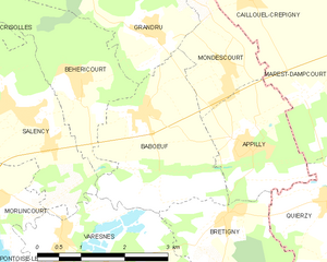
Babœuf
- commune in Oise, France
- Country:
- Postal Code: 60400
- Coordinates: 49° 35' 20" N, 3° 5' 4" E
- GPS tracks (wikiloc): [Link]
- Area: 7.18 sq km
- Population: 529
Salency
- commune in Oise, France
- Country:
- Postal Code: 60400
- Coordinates: 49° 35' 18" N, 3° 3' 1" E
- GPS tracks (wikiloc): [Link]
- Area: 7.79 sq km
- Population: 885
Grandrû
- commune in Oise, France
- Country:
- Postal Code: 60400
- Coordinates: 49° 36' 23" N, 3° 5' 13" E
- GPS tracks (wikiloc): [Link]
- Area: 7.35 sq km
- Population: 337