Bad Staffelstein (Bad Staffelstein)
- municipality of Germany
Bad Staffelstein, located in the Upper Franconia region of Bavaria, Germany, is a wonderful destination for hiking enthusiasts. The area is known for its scenic landscapes, rich history, and a variety of well-marked hiking trails that cater to different skill levels. Here are some highlights and tips for hiking in Bad Staffelstein:
Trails and Routes
- Bicycle and Hiking Trails: The region features several trails, including the well-known "Bergwanderwege" (mountain hiking paths) that showcase the beautiful Franconian landscape.
- Staffelberg: One of the most popular hiking destinations in Bad Staffelstein is the Staffelberg itself, a prominent mountain offering panoramic views of the surrounding area. The ascent is moderate and provides various paths to choose from.
- Basilique of Vierzehnheiligen: Hikers can enjoy a trail that leads to the Basilica of Vierzehnheiligen, a stunning example of baroque architecture, making for a great rest stop and cultural experience.
Scenic Views
- The trails around Bad Staffelstein offer breathtaking views of the surrounding hills, vineyards, and the river valley. Look out for viewpoints that are perfect for photography and relaxation.
Flora and Fauna
- The region's natural environment is rich in biodiversity. As you hike, keep an eye out for local wildlife and unique plant life typical of the Franconian landscape.
Hiking During Different Seasons
- Spring and Summer: These seasons are ideal for hiking due to the mild weather and abundant flora. The trails are usually bustling with activity during these times.
- Autumn: The fall foliage adds a stunning backdrop to your hikes, making it a picturesque time to explore.
- Winter: Depending on snow conditions, some trails may be suitable for winter hiking or snowshoeing, though caution is advised.
Preparation and Safety
- Trail Maps: Make sure to pick up a trail map from the local tourist information center or download an app. The trails are well marked, but having a map is always a good idea.
- Gear: Good hiking boots, weather-appropriate clothing, and enough water and snacks are essential for a comfortable hike.
- Stay Hydrated: Always carry sufficient water, especially during warmer months.
Local Amenities
- After a day of hiking, Bad Staffelstein offers several restaurants and cafes where you can enjoy regional cuisine and relax. Consider trying local specialties like Franconian wines or traditional Bavarian dishes.
Conclusion
Hiking in Bad Staffelstein is a rewarding experience that combines natural beauty with cultural significance. Whether you are looking for an easy walk or a more strenuous hike, this region provides options for everyone. Enjoy your outdoor adventure!
- Country:

- Postal Code: 96231
- Local Dialing Code: 09573
- Coordinates: 50° 6' 0" N, 10° 58' 0" E


- GPS tracks (wikiloc): [Link]
- AboveSeaLevel: 274 м m
- Area: 99.39 sq km
- Population: 10231
- Web site: https://www.bad-staffelstein.de/
- Wikipedia en: wiki(en)
- Wikipedia: wiki(de)
- Wikidata storage: Wikidata: Q504634
- Wikipedia Commons Gallery: [Link]
- Wikipedia Commons Category: [Link]
- Freebase ID: [/m/0cg2s5]
- GeoNames ID: Alt: [2829701]
- VIAF ID: Alt: [235479726]
- OSM relation ID: [1026857]
- GND ID: Alt: [4056831-3]
- archINFORM location ID: [208]
- MusicBrainz area ID: [cbd786cf-49b1-490d-9d16-c77e493126e1]
- Historical Gazetteer (GOV) ID: [BADEINJO50LC]
- Bavarikon ID: [ODB_A00002140]
- German municipality key: 09478165
Shares border with regions:


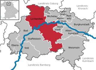
Lichtenfels
- county town of the district of Lichtenfels in the Bavarian administrative region Upper Franconia
Lichtenfels is a beautiful town located in Bavaria, Germany, and offers a variety of hiking opportunities that showcase the region's scenic landscapes, forests, and cultural landmarks. Here’s an overview of what you can expect when hiking in and around Lichtenfels:...
- Country:

- Postal Code: 96215
- Local Dialing Code: 09571
- Licence Plate Code: LIF
- Coordinates: 50° 8' 0" N, 11° 2' 0" E


- GPS tracks (wikiloc): [Link]
- AboveSeaLevel: 271 м m
- Area: 122.27 sq km
- Population: 20080
- Web site: [Link]


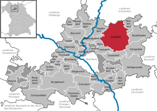
Scheßlitz
- municipality of Germany
Scheßlitz is a charming town located in Bavaria, Germany, surrounded by beautiful landscapes that offer excellent hiking opportunities. The region is characterized by its picturesque hills, forests, and scenic views, making it a great destination for outdoor enthusiasts....
- Country:

- Postal Code: 96110
- Local Dialing Code: 09542
- Licence Plate Code: BA
- Coordinates: 49° 58' 36" N, 11° 2' 2" E


- GPS tracks (wikiloc): [Link]
- AboveSeaLevel: 298 м m
- Area: 94.88 sq km
- Population: 7176
- Web site: [Link]


Großheirath
- municipality in Bavaria, Germany
Großheirath is a small town in Bavaria, Germany, located close to the city of Coburg. The surrounding area offers various opportunities for hiking enthusiasts, making it a great destination for enjoying nature, exploring scenic trails, and experiencing local wildlife....
- Country:

- Postal Code: 96269
- Local Dialing Code: 09565
- Licence Plate Code: CO
- Coordinates: 50° 10' 0" N, 10° 56' 0" E


- GPS tracks (wikiloc): [Link]
- AboveSeaLevel: 303 м m
- Area: 22.27 sq km
- Population: 1877
- Web site: [Link]


Ebensfeld
- municipality of Germany
Ebensfeld, located in Bavaria, Germany, provides a charming backdrop for hiking enthusiasts. The region is characterized by its picturesque landscapes, including rolling hills, forests, and a variety of trails suitable for different skill levels....
- Country:

- Postal Code: 96250
- Local Dialing Code: 09533; 09547; 09573
- Licence Plate Code: LIF
- Coordinates: 50° 4' 0" N, 10° 56' 59" E


- GPS tracks (wikiloc): [Link]
- AboveSeaLevel: 255 м m
- Area: 68.72 sq km
- Population: 5281
- Web site: [Link]


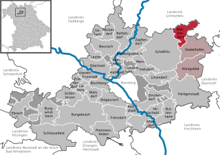
Wattendorf
- municipality of Germany
Wattendorf, located in Bavaria, Germany, offers a scenic backdrop for hiking enthusiasts. The region is characterized by its lush landscapes, rolling hills, and charming rural settings. Here are some key points about hiking in Wattendorf:...
- Country:

- Postal Code: 96196
- Local Dialing Code: 09504
- Licence Plate Code: BA
- Coordinates: 50° 2' 0" N, 11° 8' 0" E


- GPS tracks (wikiloc): [Link]
- AboveSeaLevel: 530 м m
- Area: 22.23 sq km
- Population: 662
- Web site: [Link]


Untersiemau
- municipality of Germany
Untersiemau is a quaint village located in Bavaria, Germany, and it's surrounded by beautiful landscapes that are perfect for hiking enthusiasts. Here are some highlights of hiking in and around Untersiemau:...
- Country:

- Postal Code: 96253
- Local Dialing Code: 09565
- Licence Plate Code: CO
- Coordinates: 50° 11' 39" N, 10° 58' 23" E


- GPS tracks (wikiloc): [Link]
- AboveSeaLevel: 299 м m
- Area: 20.49 sq km
- Population: 3802
- Web site: [Link]


Itzgrund
- municipality of Germany
Itzgrund is a beautiful area in Germany, located in the state of Bavaria, known for its stunning natural landscapes, which make it a great destination for hiking enthusiasts. While Itzgrund itself may not be a widely recognized hiking destination compared to larger parks or mountain ranges, the surrounding areas provide plenty of opportunities for outdoor activities. Here’s a general overview of what to expect when hiking in Itzgrund:...
- Country:

- Postal Code: 96274
- Local Dialing Code: 09573; 09533
- Licence Plate Code: CO
- Coordinates: 50° 7' 0" N, 10° 54' 0" E


- GPS tracks (wikiloc): [Link]
- AboveSeaLevel: 269 м m
- Area: 33.08 sq km
- Population: 1825
- Web site: [Link]

