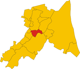
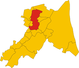
Bagnara di Romagna (Bagnara di Romagna)
- Italian comune
Bagnara di Romagna, located in the Emilia-Romagna region of Italy, is a small town that offers a variety of hiking opportunities for outdoor enthusiasts. While it's not as well-known for hiking as some other areas in Italy, its proximity to the Apennine Mountains provides access to beautiful trails and stunning landscapes.
Hiking Opportunities
-
Natural Surroundings: The region around Bagnara di Romagna is characterized by rolling hills, vineyards, and scenic countryside. You can explore rural paths that take you through picturesque landscapes, making it a great place for leisurely hikes.
-
Apennine Mountains: Just a short drive away, the Apennines offer more challenging hikes. Here, you'll find a variety of trails that cater to different skill levels. From beginner-friendly walks to more strenuous hikes, the mountains provide opportunities to experience breathtaking views and diverse ecosystems.
-
Local Trails: There are local paths that might not be well-marked but are worth exploring. You can potentially find routes connecting to nearby villages and attractions, allowing for a cultural as well as outdoor experience.
Recommendations
-
Gear Up: Ensure you have appropriate hiking gear, including sturdy footwear, a hat for sun protection, and water-repellent clothing if rain is in the forecast.
-
Stay Hydrated: Carry enough water, especially during the warmer months, and consider packing snacks to keep your energy up on longer hikes.
-
Maps and Guides: It might be helpful to have a detailed map or a hiking app to navigate the trails. Additionally, check for any guided tours that could enhance your experience.
-
Local Cuisine: After a day of hiking, indulge in the local cuisine. Emilia-Romagna is renowned for its excellent food, so don't miss out on exploring local trattorias.
-
Respect Nature: Be mindful of the natural environment by staying on marked trails, not disturbing wildlife, and carrying out any trash you bring along.
Conclusion
Bagnara di Romagna may not be a major hiking hub, but it offers the charm of rural Italy and can serve as a peaceful base for exploring nearby trails in the Apennines. Whether you're looking for a peaceful countryside walk or a more rigorous mountain trek, the area has something to offer for every type of hiker.
- Country:

- Postal Code: 48010
- Local Dialing Code: 0545
- Licence Plate Code: RA
- Coordinates: 44° 23' 0" N, 11° 50' 0" E


- GPS tracks (wikiloc): [Link]
- AboveSeaLevel: 22 м m
- Area: 9.96 sq km
- Population: 2439
- Web site: http://www.comune.bagnaradiromagna.ra.it
- Wikipedia en: wiki(en)
- Wikipedia: wiki(it)
- Wikidata storage: Wikidata: Q52959
- Wikipedia Commons Category: [Link]
- Freebase ID: [/m/0gkjlq]
- GeoNames ID: Alt: [6541042]
- VIAF ID: Alt: [136068812]
- OSM relation ID: [43115]
- GND ID: Alt: [4265890-1]
- TGN ID: [1043366]
- UN/LOCODE: [ITBDM]
- ISTAT ID: 039003
- Italian cadastre code: A551
Shares border with regions:


Imola
- town and comune in Italy
Hiking in Imola can be a delightful experience, especially for those who appreciate the beautiful landscapes and rich history of the Emilia-Romagna region in Italy. While Imola is primarily known for its motorsport scene, including the famous Autodromo Enzo e Dino Ferrari, the surrounding areas offer various hiking opportunities....
- Country:

- Postal Code: 40026
- Local Dialing Code: 0542
- Licence Plate Code: BO
- Coordinates: 44° 21' 12" N, 11° 42' 52" E


- GPS tracks (wikiloc): [Link]
- AboveSeaLevel: 47 м m
- Area: 205.02 sq km
- Population: 69951
- Web site: [Link]


Cotignola
- Italian comune
Cotignola is a small town in the region of Emilia-Romagna in Italy, located near the larger city of Ravenna. While it may not be a traditional hiking destination like the Dolomites or the Apennines, the area around Cotignola offers a network of trails and beautiful landscapes that can be appealing for outdoor enthusiasts....
- Country:

- Postal Code: 48010
- Local Dialing Code: 0545
- Licence Plate Code: RA
- Coordinates: 44° 23' 0" N, 11° 56' 0" E


- GPS tracks (wikiloc): [Link]
- AboveSeaLevel: 19 м m
- Area: 35.14 sq km
- Population: 7479
- Web site: [Link]


Lugo
- comune in Ravenna, Italy
Lugo, located in the Emilia-Romagna region of Italy, is known for its rich history and beautiful landscapes. While it's not a prominent hiking destination compared to some other areas in Emilia-Romagna, there are still some enjoyable hiking opportunities in and around Lugo....
- Country:

- Postal Code: 48022
- Local Dialing Code: 0545
- Licence Plate Code: RA
- Coordinates: 44° 25' 0" N, 11° 55' 0" E


- GPS tracks (wikiloc): [Link]
- AboveSeaLevel: 15 м m
- Area: 117.06 sq km
- Population: 32317
- Web site: [Link]
Solarolo
- Italian comune
Solarolo is a charming town located in the Emilia-Romagna region of Italy. While it may not be widely known for hiking, the surrounding countryside and landscapes provide some delightful opportunities for outdoor activities, including hiking....
- Country:

- Postal Code: 48027
- Local Dialing Code: 0546
- Licence Plate Code: RA
- Coordinates: 44° 22' 0" N, 11° 51' 0" E


- GPS tracks (wikiloc): [Link]
- AboveSeaLevel: 25 м m
- Area: 26.04 sq km
- Population: 4460
- Web site: [Link]
Mordano
- Italian comune
Mordano, located in the Emilia-Romagna region of Italy, is not typically known as a major hiking destination compared to more mountainous areas of Italy, but it does offer some pleasant trails and beautiful landscapes for outdoor enthusiasts....
- Country:

- Postal Code: 40027
- Local Dialing Code: 0542
- Licence Plate Code: BO
- Coordinates: 44° 24' 0" N, 11° 49' 0" E


- GPS tracks (wikiloc): [Link]
- AboveSeaLevel: 21 м m
- Area: 21.45 sq km
- Population: 4692
- Web site: [Link]

