Bagneaux-sur-Loing (Bagneaux-sur-Loing)

- commune in Seine-et-Marne, France
- Country:

- Postal Code: 77167
- Coordinates: 48° 13' 53" N, 2° 42' 18" E


- GPS tracks (wikiloc): [Link]
- Area: 5.26 sq km
- Population: 1688
- Web site: http://www.mairie-bagneauxsurloing.fr
- Wikipedia en: wiki(en)
- Wikipedia: wiki(fr)
- Wikidata storage: Wikidata: Q254519
- Wikipedia Commons Category: [Link]
- Freebase ID: [/m/02pkp2f]
- Freebase ID: [/m/02pkp2f]
- GeoNames ID: Alt: [3035419]
- GeoNames ID: Alt: [3035419]
- SIREN number: [217700160]
- SIREN number: [217700160]
- BnF ID: [15275357n]
- BnF ID: [15275357n]
- VIAF ID: Alt: [158608397]
- VIAF ID: Alt: [158608397]
- INSEE municipality code: 77016
- INSEE municipality code: 77016
Shares border with regions:


Faÿ-lès-Nemours
- commune in Seine-et-Marne, France
- Country:
- Postal Code: 77167
- Coordinates: 48° 13' 53" N, 2° 40' 26" E
- GPS tracks (wikiloc): [Link]
- Area: 7.78 sq km
- Population: 483
- Web site: [Link]

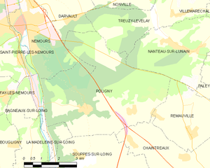
Poligny
- commune in Seine-et-Marne, France
- Country:
- Postal Code: 77167
- Coordinates: 48° 13' 28" N, 2° 44' 44" E
- GPS tracks (wikiloc): [Link]
- Area: 27.34 sq km
- Population: 816
- Web site: [Link]

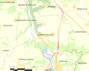
Souppes-sur-Loing
- commune in Seine-et-Marne, France
- Country:
- Postal Code: 77460
- Coordinates: 48° 10' 59" N, 2° 44' 7" E
- GPS tracks (wikiloc): [Link]
- Area: 27.63 sq km
- Population: 5424
- Web site: [Link]

Nemours
- commune in Seine-et-Marne, France
- Country:
- Postal Code: 77140
- Coordinates: 48° 16' 7" N, 2° 41' 37" E
- GPS tracks (wikiloc): [Link]
- AboveSeaLevel: 62 м m
- Area: 10.83 sq km
- Population: 13358
- Web site: [Link]


Saint-Pierre-lès-Nemours
- commune in Seine-et-Marne, France
- Country:
- Postal Code: 77140
- Coordinates: 48° 15' 55" N, 2° 40' 47" E
- GPS tracks (wikiloc): [Link]
- Area: 21.62 sq km
- Population: 5490
- Web site: [Link]

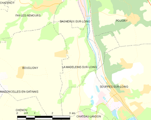
La Madeleine-sur-Loing
- commune in Seine-et-Marne, France
- Country:
- Postal Code: 77570
- Coordinates: 48° 12' 11" N, 2° 42' 15" E
- GPS tracks (wikiloc): [Link]
- Area: 6.16 sq km
- Population: 350

Bougligny
- commune in Seine-et-Marne, France
- Country:
- Postal Code: 77570
- Coordinates: 48° 11' 43" N, 2° 39' 26" E
- GPS tracks (wikiloc): [Link]
- Area: 16.31 sq km
- Population: 737