Baillestavy (Baillestavy)

- commune in Pyrénées-Orientales, France
- Country:

- Postal Code: 66320
- Coordinates: 42° 33' 53" N, 2° 31' 30" E


- GPS tracks (wikiloc): [Link]
- AboveSeaLevel: 585 м m
- Area: 17.89 sq km
- Population: 110
- Web site: http://www.baillestavy.fr/
- Wikipedia en: wiki(en)
- Wikipedia: wiki(fr)
- Wikidata storage: Wikidata: Q1047022
- Wikipedia Commons Category: [Link]
- Freebase ID: [/m/03qlswh]
- Freebase ID: [/m/03qlswh]
- GeoNames ID: Alt: [3035363]
- GeoNames ID: Alt: [3035363]
- SIREN number: [216600130]
- SIREN number: [216600130]
- BnF ID: [152709244]
- BnF ID: [152709244]
- OSM relation ID: [2868083]
- OSM relation ID: [2868083]
- PACTOLS thesaurus ID: [pcrt5ZvMIsIQD9]
- PACTOLS thesaurus ID: [pcrt5ZvMIsIQD9]
- INSEE municipality code: 66013
- INSEE municipality code: 66013
Shares border with regions:

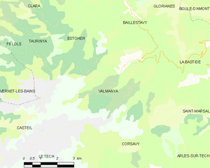
Valmanya
- commune in Pyrénées-Orientales, France
- Country:
- Postal Code: 66320
- Coordinates: 42° 32' 18" N, 2° 32' 3" E
- GPS tracks (wikiloc): [Link]
- Area: 27.63 sq km
- Population: 36
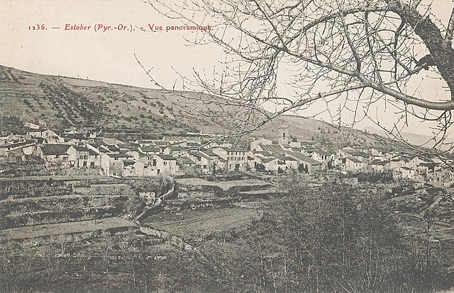

Estoher
- commune in Pyrénées-Orientales, France
- Country:
- Postal Code: 66320
- Coordinates: 42° 36' 3" N, 2° 29' 10" E
- GPS tracks (wikiloc): [Link]
- Area: 26.08 sq km
- Population: 151


Glorianes
- commune in Pyrénées-Orientales, France
- Country:
- Postal Code: 66320
- Coordinates: 42° 35' 26" N, 2° 33' 16" E
- GPS tracks (wikiloc): [Link]
- AboveSeaLevel: 792 м m
- Area: 18.72 sq km
- Population: 23


La Bastide
- commune in Pyrénées-Orientales, France
- Country:
- Postal Code: 66110
- Coordinates: 42° 32' 49" N, 2° 35' 20" E
- GPS tracks (wikiloc): [Link]
- Area: 15.63 sq km
- Population: 73


Finestret
- commune in Pyrénées-Orientales, France
- Country:
- Postal Code: 66320
- Coordinates: 42° 36' 58" N, 2° 30' 41" E
- GPS tracks (wikiloc): [Link]
- Area: 8.43 sq km
- Population: 185