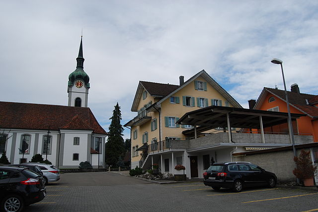
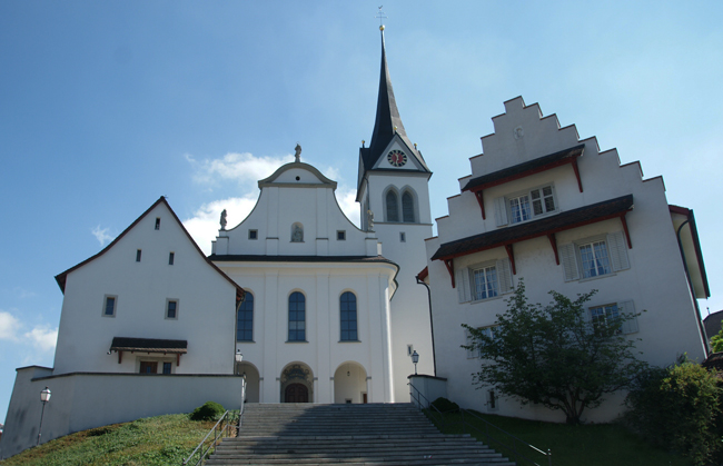
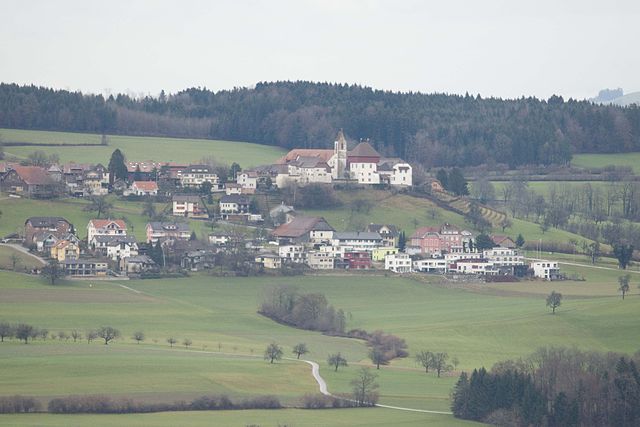
Ballwil (Ballwil)

- municipality in the canton of Lucerne, Switzerland
 Hiking in Ballwil
Ballwil, a charming municipality in the canton of Lucerne, Switzerland, offers beautiful hiking opportunities in the surrounding area. The region features an array of trails that cater to various skill levels, ranging from easy walks to more challenging hikes.
Key Highlights for Hiking in Ballwil:
-
Scenic Trails: The hikes around Ballwil showcase stunning views of the Swiss countryside, including rolling hills, lush forests, and panoramic vistas of the nearby mountains.
-
Accessibility: Many trails are easily accessible from the town, making it convenient for both locals and visitors. The well-marked paths lead through picturesque landscapes and quaint villages.
-
Nature Parks: Nearby nature reserves and parks provide the chance to encounter diverse wildlife and enjoy the flora unique to the region. Keep an eye out for local bird species and native plants along the trails.
-
Cultural Landmarks: Exploring the trails can lead you to historical sites and cultural landmarks, adding a rich context to your hiking experience.
-
Family-Friendly Options: There are several easy hikes suitable for families, ensuring that everyone can enjoy the outdoors together.
Suggested Hikes:
-
Ballwil to Buchrain: This moderate hike offers scenic views and takes you through serene landscapes, passing by charming farms and fields.
-
Bosingenweg Trail: A well-maintained trail suitable for all ages, providing easy access to beautiful spots ideal for a picnic or simply enjoying the scenery.
-
Mountain Trails: For those seeking more of a challenge, trails that lead towards higher elevations in the surrounding hills can offer stunning overlook points.
Tips for Hiking in Ballwil:
-
Weather Preparedness: Swiss weather can change rapidly, so always check the forecast and dress in layers.
-
Local Guidance: Consider consulting local hiking maps or apps for real-time updates on trails and conditions.
-
Sustainability: Respect nature by staying on marked paths and following Leave No Trace principles.
-
Enjoyment and Safety: Whatever trail you choose, take your time to enjoy the journey, stay hydrated, and ensure you have good footwear.
Overall, hiking in Ballwil is a delightful way to experience the natural beauty and tranquility of Switzerland's landscape, making it a rewarding experience for outdoor enthusiasts of all levels.
- Country:

- Postal Code: 6275
- Local Dialing Code: 041
- Licence Plate Code: LU
- Coordinates: 47° 8' 59" N, 8° 18' 59" E


- GPS tracks (wikiloc): [Link]
- AboveSeaLevel: 511 м m
- Area: 8.77 sq km
- Population: 2786
- Web site: http://www.ballwil.ch
- Wikipedia en: wiki(en)
- Wikipedia: wiki(de)
- Wikidata storage: Wikidata: Q7096
- Wikipedia Commons Category: [Link]
- Freebase ID: [/m/0g0y11]
- GeoNames ID: Alt: [2661632]
- VIAF ID: Alt: [240102356]
- OSM relation ID: [1682817]
- GND ID: Alt: [4690362-8]
- HDS ID: [594]
- Swiss municipality code: [1023]
Shares border with regions:


Sins
- municipality in Switzerland
Hiking in Sins
Sins, located in the canton of Aargau in Switzerland, is a charming village that serves as a great starting point for hiking enthusiasts. The surrounding region is characterized by rolling hills, lush meadows, and forests, providing a variety of trails that cater to different skill levels....
- Country:
- Postal Code: 5643
- Local Dialing Code: 041
- Licence Plate Code: AG
- Coordinates: 47° 11' 29" N, 8° 23' 49" E
- GPS tracks (wikiloc): [Link]
- AboveSeaLevel: 410 м m
- Area: 20.28 sq km
- Population: 4315
- Web site: [Link]

Inwil
- municipality in the canton of Lucerne, Switzerland
Hiking in Inwil
Inwil, a charming municipality located in the canton of Lucerne in Switzerland, offers various opportunities for hiking enthusiasts. Nestled in the picturesque surroundings of central Switzerland, it's a great starting point for exploring the beautiful landscapes of the region....
- Country:
- Postal Code: 6034
- Local Dialing Code: 041
- Licence Plate Code: LU
- Coordinates: 47° 7' 44" N, 8° 22' 6" E
- GPS tracks (wikiloc): [Link]
- AboveSeaLevel: 515 м m
- Area: 10.32 sq km
- Population: 2557
- Web site: [Link]

Hochdorf
- municipality in the canton of Lucerne, Switzerland
Hiking in Hochdorf
Hochdorf, located in the Lucerne region of Switzerland, offers a serene and scenic environment for hiking enthusiasts. The area is characterized by picturesque landscapes, featuring rolling hills, lush forests, and beautiful views of the surrounding mountains and lakes....
- Country:
- Postal Code: 6283; 6280
- Local Dialing Code: 041
- Licence Plate Code: LU
- Coordinates: 47° 9' 59" N, 8° 17' 20" E
- GPS tracks (wikiloc): [Link]
- AboveSeaLevel: 500 м m
- Area: 10.30 sq km
- Population: 9832
- Web site: [Link]

Hohenrain
- municipality in the canton of Lucerne, Switzerland
Hiking in Hohenrain
Hohenrain is a scenic village located in the canton of Lucerne, Switzerland. It offers a delightful backdrop for hiking enthusiasts, with its picturesque landscapes, rolling hills, and views of the Swiss Alps. Here are some highlights about hiking in and around Hohenrain:...
- Country:
- Postal Code: 6276
- Local Dialing Code: 041
- Licence Plate Code: LU
- Coordinates: 47° 10' 51" N, 8° 19' 4" E
- GPS tracks (wikiloc): [Link]
- AboveSeaLevel: 604 м m
- Area: 23.52 sq km
- Population: 2474
- Web site: [Link]