Balnot-la-Grange (Balnot-la-Grange)

- commune in Aube, France
- Country:

- Postal Code: 10210
- Coordinates: 47° 59' 9" N, 4° 11' 51" E


- GPS tracks (wikiloc): [Link]
- Area: 20.11 sq km
- Population: 123
- Wikipedia en: wiki(en)
- Wikipedia: wiki(fr)
- Wikidata storage: Wikidata: Q981588
- Wikipedia Commons Category: [Link]
- Freebase ID: [/m/03m8qcy]
- GeoNames ID: Alt: [6446920]
- SIREN number: [211000260]
- BnF ID: [15246121q]
- INSEE municipality code: 10028
Shares border with regions:

Pargues
- commune in Aube, France
- Country:
- Postal Code: 10210
- Coordinates: 48° 1' 56" N, 4° 11' 52" E
- GPS tracks (wikiloc): [Link]
- AboveSeaLevel: 204 м m
- Area: 13.98 sq km
- Population: 134
Étourvy
- commune in Aube, France
- Country:
- Postal Code: 10210
- Coordinates: 47° 57' 26" N, 4° 7' 49" E
- GPS tracks (wikiloc): [Link]
- Area: 15.41 sq km
- Population: 182

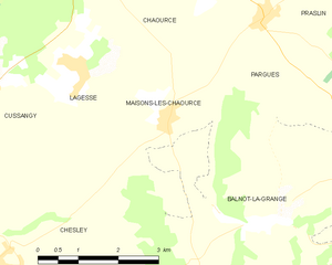
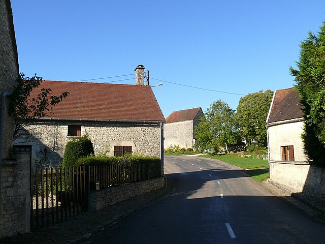
Maisons-lès-Chaource
- commune in Aube, France
- Country:
- Postal Code: 10210
- Coordinates: 48° 0' 35" N, 4° 9' 56" E
- GPS tracks (wikiloc): [Link]
- Area: 5.85 sq km
- Population: 169

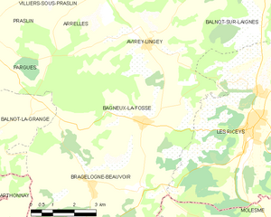
Bagneux-la-Fosse
- commune in Aube, France
- Country:
- Postal Code: 10340
- Coordinates: 47° 59' 33" N, 4° 17' 52" E
- GPS tracks (wikiloc): [Link]
- Area: 22.93 sq km
- Population: 168
Bragelogne-Beauvoir
- commune in Aube, France
- Country:
- Postal Code: 10340
- Coordinates: 47° 58' 6" N, 4° 15' 55" E
- GPS tracks (wikiloc): [Link]
- AboveSeaLevel: 260 м m
- Area: 23.39 sq km
- Population: 246

Arthonnay
- commune in Yonne, France
- Country:
- Postal Code: 89740
- Coordinates: 47° 55' 56" N, 4° 13' 47" E
- GPS tracks (wikiloc): [Link]
- Area: 25.5 sq km
- Population: 164
Villiers-le-Bois
- commune in Aube, France
- Country:
- Postal Code: 10210
- Coordinates: 47° 57' 33" N, 4° 11' 17" E
- GPS tracks (wikiloc): [Link]
- Area: 5.16 sq km
- Population: 94
Chesley
- commune in Aube, France
- Country:
- Postal Code: 10210
- Coordinates: 47° 58' 37" N, 4° 6' 37" E
- GPS tracks (wikiloc): [Link]
- Area: 21.17 sq km
- Population: 324