Banvou (Banvou)

- commune in Orne, France
- Country:

- Postal Code: 61450
- Coordinates: 48° 39' 54" N, 0° 33' 11" E


- GPS tracks (wikiloc): [Link]
- Area: 12.98 sq km
- Population: 633
- Wikipedia en: wiki(en)
- Wikipedia: wiki(fr)
- Wikidata storage: Wikidata: Q1098227
- Wikipedia Commons Category: [Link]
- Freebase ID: [/m/03qgq2v]
- Freebase ID: [/m/03qgq2v]
- GeoNames ID: Alt: [3035095]
- GeoNames ID: Alt: [3035095]
- SIREN number: [216100248]
- SIREN number: [216100248]
- BnF ID: [152679598]
- BnF ID: [152679598]
- INSEE municipality code: 61024
- INSEE municipality code: 61024
Shares border with regions:


Le Châtellier
- commune in Orne, France
- Country:
- Postal Code: 61450
- Coordinates: 48° 40' 33" N, 0° 34' 54" E
- GPS tracks (wikiloc): [Link]
- Area: 8.18 sq km
- Population: 420


Saint-Bômer-les-Forges
- commune in Orne, France
- Country:
- Postal Code: 61700
- Coordinates: 48° 38' 38" N, 0° 38' 0" E
- GPS tracks (wikiloc): [Link]
- Area: 31.08 sq km
- Population: 1043
- Web site: [Link]


Saint-André-de-Messei
- commune in Orne, France
- Country:
- Postal Code: 61440
- Coordinates: 48° 41' 43" N, 0° 31' 18" E
- GPS tracks (wikiloc): [Link]
- Area: 14.99 sq km
- Population: 571

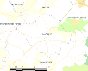
Dompierre
- commune in Orne, France
- Country:
- Postal Code: 61700
- Coordinates: 48° 37' 56" N, 0° 33' 7" E
- GPS tracks (wikiloc): [Link]
- Area: 8.56 sq km
- Population: 396


La Ferrière-aux-Étangs
- commune in Orne, France
- Country:
- Postal Code: 61450
- Coordinates: 48° 39' 46" N, 0° 31' 8" E
- GPS tracks (wikiloc): [Link]
- AboveSeaLevel: 270 м m
- Area: 10.93 sq km
- Population: 1479