Bareilles (Bareilles)

- commune in Hautes-Pyrénées, France
- Country:

- Postal Code: 65240
- Coordinates: 42° 53' 48" N, 0° 25' 26" E


- GPS tracks (wikiloc): [Link]
- Area: 20.84 sq km
- Population: 50
- Wikipedia en: wiki(en)
- Wikipedia: wiki(fr)
- Wikidata storage: Wikidata: Q530873
- Wikipedia Commons Category: [Link]
- Freebase ID: [/m/03nv382]
- Freebase ID: [/m/03nv382]
- GeoNames ID: Alt: [6613497]
- GeoNames ID: Alt: [6613497]
- SIREN number: [216500645]
- SIREN number: [216500645]
- BnF ID: [15270445q]
- BnF ID: [15270445q]
- VIAF ID: Alt: [248345175]
- VIAF ID: Alt: [248345175]
- SUDOC authorities ID: [137120362]
- SUDOC authorities ID: [137120362]
- INSEE municipality code: 65064
- INSEE municipality code: 65064
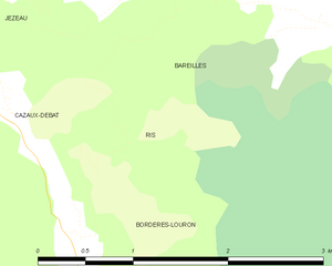
Shares border with regions:


Cazaux-Debat
- commune in Hautes-Pyrénées, France
- Country:
- Postal Code: 65590
- Coordinates: 42° 53' 17" N, 0° 23' 5" E
- GPS tracks (wikiloc): [Link]
- Area: 1.48 sq km
- Population: 30

Ris
- commune in Hautes-Pyrénées, France
- Country:
- Postal Code: 65590
- Coordinates: 42° 53' 14" N, 0° 23' 52" E
- GPS tracks (wikiloc): [Link]
- Area: 1.89 sq km
- Population: 16


Ferrère
- commune in Hautes-Pyrénées, France
- Country:
- Postal Code: 65370
- Coordinates: 42° 57' 12" N, 0° 32' 12" E
- GPS tracks (wikiloc): [Link]
- Area: 57.56 sq km
- Population: 44


Jézeau
- commune in Hautes-Pyrénées, France
- Country:
- Postal Code: 65240
- Coordinates: 42° 54' 3" N, 0° 22' 52" E
- GPS tracks (wikiloc): [Link]
- Area: 12.2 sq km
- Population: 100


Bourg-d'Oueil
- commune in Haute-Garonne, France
- Country:
- Postal Code: 31110
- Coordinates: 42° 51' 33" N, 0° 29' 53" E
- GPS tracks (wikiloc): [Link]
- Area: 9.52 sq km
- Population: 7
- Web site: [Link]


Bordères-Louron
- commune in Hautes-Pyrénées, France
- Country:
- Postal Code: 65590
- Coordinates: 42° 52' 18" N, 0° 23' 43" E
- GPS tracks (wikiloc): [Link]
- Area: 17.41 sq km
- Population: 176