
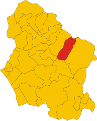
Barga (Barga)
.svg)
- Italian comune
 Hiking in Barga
Barga, located in the Garfagnana region of Tuscany, Italy, is a charming medieval town known for its stunning landscapes and hiking opportunities. The surrounding area is characterized by picturesque mountains, valleys, and rivers, making it a great destination for outdoor enthusiasts.
Hiking Highlights in Barga:
-
Scenic Trails: The trails around Barga offer a mix of easy walks and challenging hikes. You can enjoy routes that provide breathtaking views of the Apuan Alps and the Serchio Valley.
-
Monte Forato: This iconic mountain is known for its distinctive "hole" and offers several hiking routes. The trek to the summit rewards hikers with panoramic views and a sense of accomplishment.
-
The Path of the Barga Castle: A relatively easy hike that leads you through the historical areas of Barga, taking you past old churches and beautiful views of the town itself.
-
Nature Reserves: The nearby Orecchiella Natural Park offers a range of trails with varying difficulty levels, immersing hikers in lush green landscapes and diverse wildlife.
-
Cultural Stops: Many hikes around Barga might also lead you through charming villages and vineyards, allowing for cultural experiences alongside your outdoor adventures.
Tips for Hiking in Barga:
- Season: Spring and autumn are ideal for hiking, as temperatures are mild and the landscapes are particularly beautiful.
- Equipment: Wear good hiking shoes and bring plenty of water, snacks, and a map or GPS device to help you navigate the trails.
- Guided Tours: Consider joining a guided tour if you're unfamiliar with the area, as local guides can offer insights into the natural and cultural history.
- Respect Nature: Don’t forget to follow Leave No Trace principles to preserve the natural beauty of the area.
Overall, hiking in Barga provides a perfect blend of nature, culture, and stunning views, making it a rewarding experience for all levels of hikers.
- Country:

- Postal Code: 55051
- Local Dialing Code: 0583
- Licence Plate Code: LU
- Coordinates: 44° 4' 30" N, 10° 28' 54" E


- GPS tracks (wikiloc): [Link]
- AboveSeaLevel: 410 м m
- Area: 66.47 sq km
- Population: 9898
- Web site: http://www.comune.barga.lu.it
- Wikipedia en: wiki(en)
- Wikipedia: wiki(it)
- Wikidata storage: Wikidata: Q216479
- Wikipedia Commons Gallery: [Link]
- Wikipedia Commons Category: [Link]
- Freebase ID: [/m/067k8m]
- GeoNames ID: Alt: [6539733]
- VIAF ID: Alt: [234599445]
- OSM relation ID: [42834]
- GND ID: Alt: [4080264-4]
- archINFORM location ID: [45821]
- MusicBrainz area ID: [76ed96e2-50c8-4b51-aee1-827fbd0d6583]
- Quora topic ID: [Barga-1]
- UN/LOCODE: [ITZDC]
- ISTAT ID: 046003
- Italian cadastre code: A657
Shares border with regions:


Pievepelago
- Italian comune
Hiking in Pievepelago
Pievepelago is a beautiful village located in the Modena province of Italy, nestled in the Apennine Mountains. This region is renowned for its stunning landscapes, rich biodiversity, and a variety of hiking trails that cater to different skill levels. Here are some key points about hiking in Pievepelago:...
- Country:
- Postal Code: 41027
- Local Dialing Code: 0536
- Licence Plate Code: MO
- Coordinates: 44° 12' 20" N, 10° 37' 21" E
- GPS tracks (wikiloc): [Link]
- AboveSeaLevel: 701 м m
- Area: 76.54 sq km
- Population: 2317
- Web site: [Link]

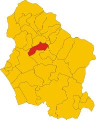
Coreglia Antelminelli
- Italian comune
Hiking in Coreglia Antelminelli
Coreglia Antelminelli is a charming village located in the Garfagnana region of Tuscany, Italy. It offers a picturesque setting for hikers and outdoor enthusiasts. The area is characterized by beautiful landscapes, including hills, valleys, and lush forests. Here are some insights into hiking in and around Coreglia Antelminelli:...
- Country:
- Postal Code: 55025
- Local Dialing Code: 0583
- Licence Plate Code: LU
- Coordinates: 44° 3' 52" N, 10° 31' 35" E
- GPS tracks (wikiloc): [Link]
- AboveSeaLevel: 595 м m
- Area: 52.94 sq km
- Population: 5220
- Web site: [Link]


Fosciandora
- Italian comune
Hiking in Fosciandora
Fosciandora is a small town located in the Lucca province of Tuscany, Italy. It offers a beautiful rural landscape ideal for hiking enthusiasts. The surrounding area features rolling hills, vineyards, olive groves, and stunning views of the Apuan Alps. Here are some insights for hiking in Fosciandora:...
- Country:
- Postal Code: 55020
- Local Dialing Code: 0583
- Licence Plate Code: LU
- Coordinates: 44° 6' 57" N, 10° 27' 34" E
- GPS tracks (wikiloc): [Link]
- AboveSeaLevel: 390 м m
- Area: 19.86 sq km
- Population: 584
- Web site: [Link]


Gallicano
- Italian comune
Hiking in Gallicano
Gallicano, located in the Garfagnana area of Tuscany, Italy, is a fantastic destination for hiking enthusiasts. Surrounded by the stunning Apuane Alps and lush natural landscapes, this region offers a variety of trails that cater to different skill levels....
- Country:
- Postal Code: 55027
- Local Dialing Code: 0583
- Licence Plate Code: LU
- Coordinates: 44° 4' 0" N, 10° 26' 0" E
- GPS tracks (wikiloc): [Link]
- AboveSeaLevel: 186 м m
- Area: 31.04 sq km
- Population: 3733
- Web site: [Link]

Molazzana
- Italian comune
Hiking in Molazzana
Molazzana is a small village located in the Garfagnana region of Tuscany, Italy. Surrounded by the beautiful Apuan Alps and rich in natural beauty, it offers various hiking trails that cater to different experience levels. Here are some highlights about hiking in Molazzana:...
- Country:
- Postal Code: 55020
- Local Dialing Code: 0583
- Licence Plate Code: LU
- Coordinates: 44° 4' 0" N, 10° 25' 0" E
- GPS tracks (wikiloc): [Link]
- AboveSeaLevel: 474 м m
- Area: 31.33 sq km
- Population: 1046
- Web site: [Link]