Bauné (Bauné)

- former commune in Maine-et-Loire, France
- Country:

- Postal Code: 49140
- Coordinates: 47° 29' 56" N, 0° 19' 11" E


- GPS tracks (wikiloc): [Link]
- Area: 20.99 sq km
- Population: 1740
- Wikipedia en: wiki(en)
- Wikipedia: wiki(fr)
- Wikidata storage: Wikidata: Q511501
- Wikipedia Commons Category: [Link]
- Freebase ID: [/m/03qcnxg]
- GeoNames ID: Alt: [6449391]
- BnF ID: [152616219]
- PACTOLS thesaurus ID: [pcrtMc3Zcy8Yi0]
- INSEE municipality code: 49019
Shares border with regions:


Corné
- former commune in Maine-et-Loire, France
- Country:
- Postal Code: 49250
- Coordinates: 47° 28' 14" N, 0° 20' 59" E
- GPS tracks (wikiloc): [Link]
- Area: 16.64 sq km
- Population: 2914
- Web site: [Link]

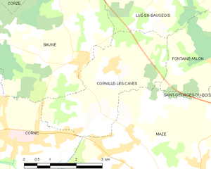
Cornillé-les-Caves
- commune in Maine-et-Loire, France
- Country:
- Postal Code: 49140
- Coordinates: 47° 29' 59" N, 0° 18' 5" E
- GPS tracks (wikiloc): [Link]
- Area: 10.38 sq km
- Population: 485

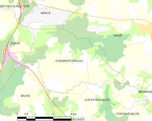
Chaumont-d'Anjou
- former commune in Maine-et-Loire, France
- Country:
- Postal Code: 49140
- Coordinates: 47° 32' 25" N, 0° 16' 56" E
- GPS tracks (wikiloc): [Link]
- Area: 11.98 sq km
- Population: 287
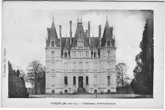

Corzé
- commune in Maine-et-Loire, France
- Country:
- Postal Code: 49140
- Coordinates: 47° 33' 35" N, 0° 23' 28" E
- GPS tracks (wikiloc): [Link]
- Area: 31.49 sq km
- Population: 1796
- Web site: [Link]


Lué-en-Baugeois
- former commune in Maine-et-Loire, France
- Country:
- Postal Code: 49140
- Coordinates: 47° 31' 31" N, 0° 16' 47" E
- GPS tracks (wikiloc): [Link]
- Area: 7.42 sq km
- Population: 328


Sarrigné
- commune in Maine-et-Loire, France
- Country:
- Postal Code: 49800
- Coordinates: 47° 30' 6" N, 0° 23' 7" E
- GPS tracks (wikiloc): [Link]
- Area: 2.97 sq km
- Population: 814
- Web site: [Link]