Bavans (Bavans)

- commune in Doubs, France
 Hiking in Bavans
Bavans is a picturesque village located in the Doubs department of the Bourgogne-Franche-Comté region in eastern France. While it may not be as widely known as some other hiking destinations in the country, its natural beauty offers plenty of opportunities for outdoor enthusiasts.
Here are some highlights and tips for hiking in the Bavans area:
Trails and Scenery
-
Local Trails: The area around Bavans features a variety of hiking trails that wind through lush forests and meadows, offering stunning views of the surrounding landscape. Look for marked paths that vary in difficulty, making them suitable for both beginners and experienced hikers.
-
Rivers and Streams: The region is characterized by its scenic waterways, including nearby rivers and streams which provide serene backdrops for your hikes. Keep an eye out for local wildlife that may inhabit these areas.
-
The Jura Mountains: Although Bavans itself is not in the Jura Mountains, you're relatively close to this impressive mountain range. Consider day trips to hike in the Jura where you can find higher elevations and potentially more challenging trails, such as those leading to the Crêt de la Neige or the Cascades du Hérisson.
Preparation and Considerations
-
Seasonal Conditions: Check the weather conditions before heading out. The best times for hiking in this region are typically late spring through early autumn when the weather is milder and the flora is at its most vibrant.
-
Gear: Since trails can vary in difficulty, ensure you wear appropriate hiking footwear and bring along essential gear, such as a map, water, snacks, and a first aid kit.
-
Respect Nature: Leave no trace of your visit and respect the local flora and fauna. Stick to marked trails to minimize your impact on the environment.
-
Local Amenities: Make sure to explore the village of Bavans itself; it can be a charming spot to rest after a hike, with possible local cuisine and hospitality.
Conclusion
Hiking in and around Bavans can be a tranquil and rewarding experience, especially if you appreciate less crowded, serene natural settings. It can also serve as a great starting point to explore broader hiking opportunities in the region. Always remember to prepare accordingly and enjoy the stunning views that eastern France has to offer!
- Country:

- Postal Code: 25550
- Coordinates: 47° 28' 54" N, 6° 43' 50" E


- GPS tracks (wikiloc): [Link]
- Area: 8.83 sq km
- Population: 3683
- Wikipedia en: wiki(en)
- Wikipedia: wiki(fr)
- Wikidata storage: Wikidata: Q385983
- Wikipedia Commons Category: [Link]
- Freebase ID: [/m/03mgc1b]
- Freebase ID: [/m/03mgc1b]
- GeoNames ID: Alt: [6447833]
- GeoNames ID: Alt: [6447833]
- SIREN number: [212500482]
- SIREN number: [212500482]
- BnF ID: [15252274t]
- BnF ID: [15252274t]
- VIAF ID: Alt: [242738663]
- VIAF ID: Alt: [242738663]
- INSEE municipality code: 25048
- INSEE municipality code: 25048
Shares border with regions:


Étouvans
- commune in Doubs, France
Hiking in Étouvans
Étouvans is a small commune in the Doubs department in eastern France, surrounded by beautiful natural landscapes that are ideal for hiking enthusiasts. The region offers a mix of picturesque countryside, wooded areas, and scenic hills, making it a great destination for outdoor activities....
- Country:
- Postal Code: 25260
- Coordinates: 47° 27' 51" N, 6° 43' 11" E
- GPS tracks (wikiloc): [Link]
- Area: 6.56 sq km
- Population: 809
- Web site: [Link]
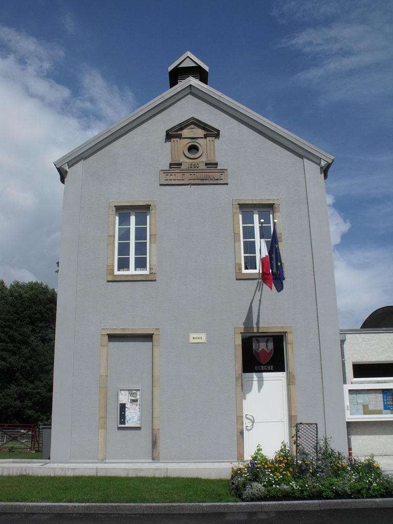
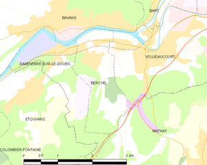
Berche
- commune in Doubs, France
Hiking in Berche
It seems there might be a bit of confusion regarding the term "Berche." If you meant "Berchtesgaden," which is a well-known area for hiking located in Bavaria, Germany, I can provide you with information about that....
- Country:
- Postal Code: 25420
- Coordinates: 47° 28' 21" N, 6° 44' 30" E
- GPS tracks (wikiloc): [Link]
- Area: 3.11 sq km
- Population: 479


Présentevillers
- commune in Doubs, France
Hiking in Présentevillers
Présentevillers is a small village located in the Doubs department in the Bourgogne-Franche-Comté region of eastern France. While it may not be as well-known as some larger hiking destinations, it offers charming surroundings and opportunities for those looking to explore nature....
- Country:
- Postal Code: 25550
- Coordinates: 47° 30' 4" N, 6° 43' 50" E
- GPS tracks (wikiloc): [Link]
- Area: 3.83 sq km
- Population: 452


Sainte-Marie
- commune in Doubs, France
Hiking in Sainte-Marie
Sainte-Marie, located in the Doubs department of the Bourgogne-Franche-Comté region in eastern France, offers a range of beautiful hiking opportunities that are perfect for nature enthusiasts and outdoor adventurers. The region is characterized by its lush landscapes, rolling hills, and picturesque views typical of the Jura Mountains....
- Country:
- Postal Code: 25113
- Coordinates: 47° 30' 27" N, 6° 41' 43" E
- GPS tracks (wikiloc): [Link]
- Area: 7.17 sq km
- Population: 709


Voujeaucourt
- commune in Doubs, France
Hiking in Voujeaucourt
Voujeaucourt is a small commune located in the Doubs department in the Bourgogne-Franche-Comté region of eastern France. While it may not be as widely known as some larger hiking destinations, the surrounding areas offer opportunities for outdoor activities, including hiking....
- Country:
- Postal Code: 25420
- Coordinates: 47° 28' 32" N, 6° 46' 28" E
- GPS tracks (wikiloc): [Link]
- Area: 9.45 sq km
- Population: 3320
- Web site: [Link]