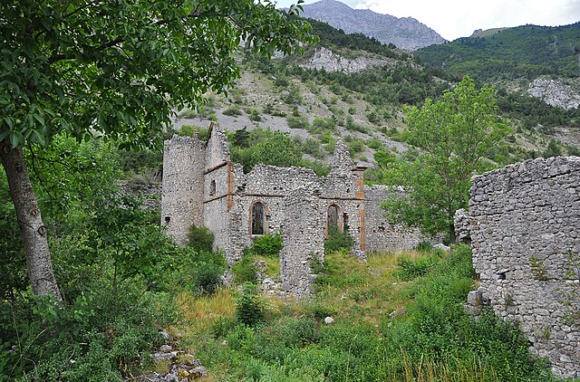
Beaufin (Beaufin)

- commune in Isère, France
 Hiking in Beaufin
Beaufin is not a widely recognized hiking destination, and there may be some confusion about the name. However, if you meant Beaufort, a region in various countries, or perhaps a specific national park or area with a similar name, please clarify!
If you're interested in hiking in a certain region, I can provide information on popular trails, scenery, difficulty levels, and essential tips for hiking in that area. Just let me know the specific location or region you're referring to!
- Country:

- Postal Code: 38970
- Coordinates: 44° 47' 16" N, 5° 57' 36" E


- GPS tracks (wikiloc): [Link]
- Area: 6.36 sq km
- Population: 21
- Wikipedia en: wiki(en)
- Wikipedia: wiki(fr)
- Wikidata storage: Wikidata: Q1154625
- Wikipedia Commons Category: [Link]
- Freebase ID: [/m/03g_74_]
- GeoNames ID: Alt: [6448724]
- SIREN number: [213800311]
- BnF ID: [152578600]
- INSEE municipality code: 38031
Shares border with regions:

Aspres-lès-Corps
- commune in Hautes-Alpes, France
Hiking in Aspres-lès-Corps
Aspres-lès-Corps is a charming village located in the Alpes-de-Haute-Provence region of France, surrounded by breathtaking natural landscapes that are perfect for hiking enthusiasts. The area offers a variety of trails that cater to different skill levels, from easy walks to more challenging hikes....
- Country:
- Postal Code: 05800
- Coordinates: 44° 48' 7" N, 5° 58' 54" E
- GPS tracks (wikiloc): [Link]
- Area: 16.73 sq km
- Population: 109
Le Glaizil
- commune in Hautes-Alpes, France
Hiking in Le Glaizil
Le Glaizil is a picturesque commune located in the Hautes-Alpes department in southeastern France. The surrounding area is known for its stunning landscapes, including mountains, valleys, and diverse flora and fauna, which make it a great destination for hiking enthusiasts....
- Country:
- Postal Code: 05800
- Coordinates: 44° 45' 13" N, 5° 58' 59" E
- GPS tracks (wikiloc): [Link]
- Area: 21.93 sq km
- Population: 174

Saint-Firmin
- commune in Hautes-Alpes, France
Hiking in Saint-Firmin
Saint-Firmin in the Hautes-Alpes region of France is a charming destination for hikers. Nestled in the Écrins National Park, this area is known for its stunning landscapes, rugged mountains, and rich biodiversity. Here are some key aspects to consider when hiking in and around Saint-Firmin:...
- Country:
- Postal Code: 05800
- Coordinates: 44° 46' 53" N, 6° 1' 45" E
- GPS tracks (wikiloc): [Link]
- AboveSeaLevel: 900 м m
- Area: 22.39 sq km
- Population: 468


Corps
- commune in Isère, France
Hiking in Corps
Hiking in Corps, Isère, is a fantastic experience for outdoor enthusiasts, thanks to its stunning natural landscapes and diverse trails. Located in the French Alps, this charming commune serves as a gateway to the Écrins National Park, which boasts dramatic mountain scenery, glacial lakes, and rugged terrain....
- Country:
- Postal Code: 38970
- Coordinates: 44° 49' 6" N, 5° 56' 49" E
- GPS tracks (wikiloc): [Link]
- Area: 11.22 sq km
- Population: 478
- Web site: [Link]


Ambel
- commune in Isère, France
Hiking in Ambel
Hiking in Ambel, located in the Isère department of the Auvergne-Rhône-Alpes region in France, offers a serene experience surrounded by beautiful landscapes, mountainous terrain, and rich biodiversity. Here are some key points to know about hiking in this area:...
- Country:
- Postal Code: 38970
- Coordinates: 44° 48' 18" N, 5° 55' 50" E
- GPS tracks (wikiloc): [Link]
- Area: 4.83 sq km
- Population: 22


Monestier-d'Ambel
- commune in Isère, France
Hiking in Monestier-d'Ambel
Monestier-d'Ambel is a picturesque commune located in the Isère department in the Auvergne-Rhône-Alpes region of southeastern France. Nestled in the French Alps, it offers a variety of hiking opportunities for outdoor enthusiasts. Here are some details about hiking in this area:...
- Country:
- Postal Code: 38970
- Coordinates: 44° 46' 40" N, 5° 55' 37" E
- GPS tracks (wikiloc): [Link]
- Area: 11.02 sq km
- Population: 22
- Web site: [Link]