arrondissement of Grenoble (arrondissement de Grenoble)
- arrondissement of France in the Isère department in the Rhône-Alpes
 Hiking in arrondissement of Grenoble
The Arrondissement of Grenoble, located in the Isère department of the Auvergne-Rhône-Alpes region in southeastern France, offers a wealth of hiking opportunities that cater to all skill levels. The area is characterized by its stunning landscapes, including the French Alps, picturesque valleys, and a variety of ecosystems.
Popular Hiking Locations:
-
Chartreuse Mountains:
- This mountain range provides numerous trails that vary in difficulty, from easy walks to challenging scrambles. The paths often lead to breathtaking viewpoints, such as the Crêt de la Neige and Col de la Charmette.
-
Vercors Regional Natural Park:
- The Vercors region features dramatic limestone cliffs, deep gorges, and vast plateaus. Trails like the Gorges de la Bourne and Plateau de Revard offer spectacular views and unique geological formations.
-
Belledonne Range:
- Known for its high peaks and alpine scenery, Belledonne offers trails ranging from picturesque lakeside strolls, such as the Lac de Bort hike, to more strenuous ascents like Grandes Rousses. It’s a great area for experienced hikers seeking a challenge.
-
Oisans:
- This area is home to stunning alpine landscapes and the iconic glacier. The Alpe d'Huez region features trails that are well-marked and surrounded by scenic views, making it popular among both casual and serious hikers.
Trail Recommendations:
-
Lac de Pavin: A beautiful hike around a volcanic lake, suitable for all ages.
-
Col de l'Alignement: A moderately difficult hike that provides panoramic views of the surrounding mountains.
-
Le Sappey-en-Chartreuse: Offers several trail options for different skill levels, with opportunities to explore local flora and fauna.
Hiking Tips:
-
Prepare for Weather Changes: The mountainous terrain can lead to sudden weather changes. Always check the forecast and dress in layers.
-
Safety First: Carry a map or GPS device, enough water, snacks, and wear appropriate footwear. Always inform someone about your hiking plans.
-
Respect Nature: Stay on marked trails, avoid littering, and follow guidelines to preserve the natural environment.
-
Wildlife Awareness: Be mindful of local wildlife and maintain a safe distance from animals.
Best Time to Hike:
- The hiking season generally runs from spring (April) through late fall (October), with the summer months being the most popular for hikers due to warmer temperatures and drier trails. However, some trails at higher elevations can still be accessible in late autumn or even early winter by seasoned hikers.
Conclusion:
Hiking in the Arrondissement of Grenoble is a fantastic experience for outdoor enthusiasts, with diverse terrain and breathtaking views. Whether you are a beginner or an experienced hiker, the area has something to offer everyone. Always plan ahead and enjoy the beautiful French Alps!
- Country:

- Capital: Grenoble
- Coordinates: 45° 5' 0" N, 5° 50' 0" E


- GPS tracks (wikiloc): [Link]
- Area: 4715 sq km
- Population: 740543
- Wikipedia en: wiki(en)
- Wikipedia: wiki(fr)
- Wikidata storage: Wikidata: Q132224
- Wikipedia Commons Category: [Link]
- Freebase ID: [/m/095htr]
- GeoNames ID: Alt: [3014727]
- INSEE arrondissement code: [381]
- GNS Unique Feature ID: -1430648
Includes regions:

canton of Saint-Ismier
- canton of France (until March 2015)
 Hiking in canton of Saint-Ismier
Canton de Saint-Ismier is located in the Isère department in the Auvergne-Rhône-Alpes region of France. This area is known for its stunning natural landscapes and offers a variety of hiking opportunities suitable for different levels of hikers....
- Country:

- Capital: Saint-Ismier
- Coordinates: 45° 14' 45" N, 5° 49' 49" E


- GPS tracks (wikiloc): [Link]


Grenoble
- commune in Isère, France
Grenoble, situated at the foot of the French Alps, is an excellent base for hiking enthusiasts. The surrounding mountains and natural landscapes offer a diverse range of trails suitable for all experience levels, from leisurely walks to challenging hikes. Here are some key highlights and recommendations for hiking in the Grenoble area:...
- Country:

- Postal Code: 38100; 38000
- Local Dialing Code: 476
- Coordinates: 45° 11' 13" N, 5° 43' 35" E


- GPS tracks (wikiloc): [Link]
- AboveSeaLevel: 212 м m
- Area: 18.13 sq km
- Population: 160649
- Web site: [Link]


canton of Voiron
- canton of France
Canton de Voiron is a beautiful region in the Isère department in the Auvergne-Rhône-Alpes region of southeastern France. It's known for its stunning natural landscapes, including rolling hills, forests, and nearby mountain ranges, making it a great destination for hiking enthusiasts....
- Country:

- Capital: Voiron
- Coordinates: 45° 21' 45" N, 5° 37' 35" E


- GPS tracks (wikiloc): [Link]
- Population: 46447

canton of Villard-de-Lans
- canton of France (until March 2015)
 Hiking in canton of Villard-de-Lans
Canton de Villard-de-Lans, located in the Vercors Regional Natural Park in the French Alps, offers a fantastic range of hiking options for all experience levels. The area is renowned for its stunning landscapes, including dramatic cliffs, lush forests, and beautiful alpine meadows. Here are some highlights and tips for hiking in this region:...
- Country:

- Capital: Villard-de-Lans
- Coordinates: 45° 7' 38" N, 5° 34' 10" E


- GPS tracks (wikiloc): [Link]

canton of Valbonnais
- canton of France (until March 2015)
 Hiking in canton of Valbonnais
Canton de Valbonnais, located in the Isère department of the Auvergne-Rhône-Alpes region in southeastern France, is a stunning area for hiking enthusiasts. Nestled within the French Alps, it offers breathtaking landscapes, diverse flora and fauna, and various hiking trails that cater to all skill levels....
- Country:

- Capital: Valbonnais
- Coordinates: 44° 56' 24" N, 5° 54' 52" E


- GPS tracks (wikiloc): [Link]

canton of Mens
- canton of France (until March 2015)
Canton de Mens, located in the Isère department of the Auvergne-Rhône-Alpes region in southeastern France, offers a beautiful landscape for hiking enthusiasts. This area is characterized by its mountainous terrain, picturesque valleys, and rich biodiversity, making it an ideal spot for both casual walkers and experienced trekkers....


canton of Grenoble-1
- canton of France
 Hiking in canton of Grenoble-1
The Canton of Grenoble, located in the Auvergne-Rhône-Alpes region of France, is surrounded by stunning alpine landscapes, making it an excellent destination for hiking enthusiasts. Here are some key points to consider for hiking in this area:...
- Country:

- Capital: Grenoble
- Coordinates: 45° 11' 24" N, 5° 42' 36" E


- GPS tracks (wikiloc): [Link]
- Population: 46693

canton of Clelles
- canton of France (until March 2015)
Canton de Clelles is a beautiful area located in the French Alps, specifically in the Isère department. It is known for its stunning natural landscapes, rich biodiversity, and a variety of hiking trails suitable for different skill levels. Here are some highlights for hiking in this region:...
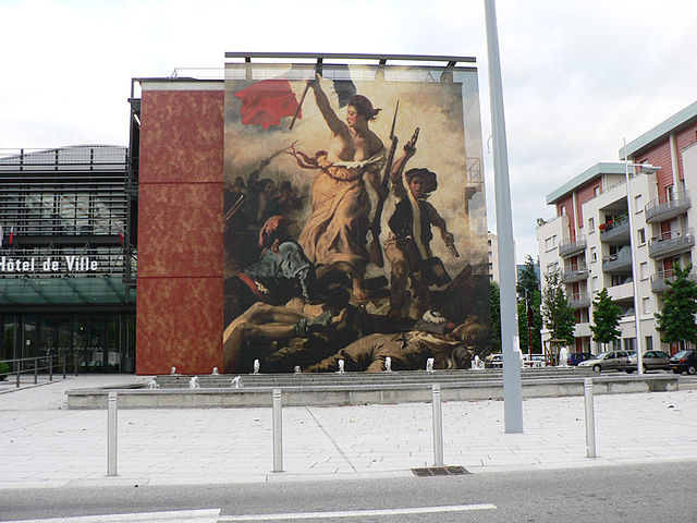
canton of Échirolles-Est
- canton of France (until March 2015)
 Hiking in canton of Échirolles-Est
Canton d'Échirolles-Est is located in the Isère department in the Auvergne-Rhône-Alpes region of France, near the city of Grenoble. This area is known for its stunning natural landscapes and proximity to the French Alps, making it an excellent destination for hiking....
- Country:

- Capital: Échirolles
- Coordinates: 45° 8' 27" N, 5° 44' 0" E


- GPS tracks (wikiloc): [Link]

canton of Saint-Martin-d'Hères-Sud
- canton of France (until March 2015)
 Hiking in canton of Saint-Martin-d'Hères-Sud
Canton de Saint-Martin-d'Hères-Sud, located in the Isère department of southeastern France, offers picturesque landscapes and a variety of hiking opportunities. The region is characterized by its proximity to the French Alps, providing stunning views and diverse terrains....
- Country:

- Capital: Saint-Martin-d'Hères
- Coordinates: 45° 10' 0" N, 5° 46' 0" E


- GPS tracks (wikiloc): [Link]
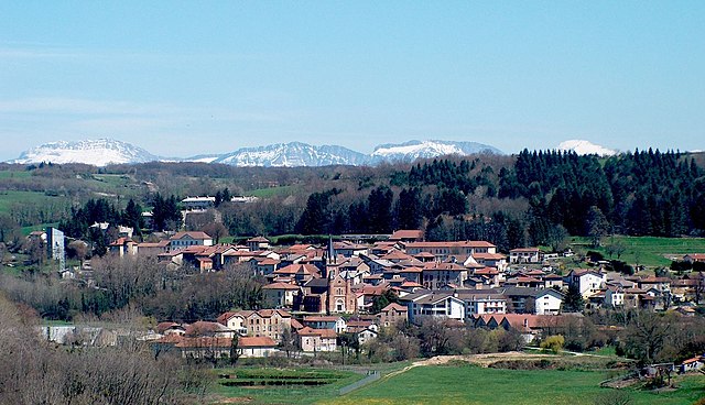
canton of Roybon
- canton of France
Canton de Roybon, located in the Isère department of the Auvergne-Rhône-Alpes region in southeastern France, offers a variety of hiking opportunities for outdoor enthusiasts. This area is characterized by its stunning landscapes, including forests, hills, and valleys, making it ideal for hikers of all skill levels....

canton of Allevard
- canton of France
Canton d'Allevard is a picturesque area located in the French Alps, within the Savoie region. It is known for its stunning mountain landscapes, charming villages, and a variety of outdoor activities, making it a great destination for hiking enthusiasts. Here are some highlights of hiking in this region:...

canton of Corps
- canton of France
Canton de Corps, located in the French Alps, offers a stunning backdrop for hiking enthusiasts. This region is characterized by its breathtaking landscapes, diverse ecosystems, and a variety of trails suitable for different skill levels. Here are some highlights you might find interesting:...

canton of Domène
- canton in Grenoble, France
Canton de Domène, located in the Isère department of the Auvergne-Rhône-Alpes region in France, offers beautiful hiking opportunities amidst stunning alpine scenery. The region is characterized by rolling hills, vibrant forests, and views of the surrounding mountains, including the majestic Chartreuse and Belledonne ranges....


canton of Fontaine-Seyssinet
- canton of France
 Hiking in canton of Fontaine-Seyssinet
The Canton of Fontaine-Seyssinet, nestled in the beautiful Isère department of the Auvergne-Rhône-Alpes region in southeastern France, offers a variety of hiking opportunities that range from easy walks to more challenging treks. Here are some highlights and key features of hiking in this area:...
- Country:

- Capital: Fontaine
- Coordinates: 45° 10' 45" N, 5° 41' 22" E


- GPS tracks (wikiloc): [Link]
- Population: 38146

canton of Goncelin
- canton of France
Canton de Goncelin, located in the Isère department of the Auvergne-Rhône-Alpes region in southeastern France, offers a variety of hiking opportunities that cater to different skill levels and preferences. The area features stunning landscapes, including mountains, valleys, and natural parks, primarily due to its proximity to the Chartreuse and Belledonne mountain ranges....


canton of Grenoble-2
- canton of France
 Hiking in canton of Grenoble-2
Hiking in the Canton of Grenoble (Canton de Grenoble) offers a fabulous experience for outdoor enthusiasts, thanks to its stunning natural landscapes, diverse terrain, and proximity to the French Alps. Here’s an overview of what you can expect when hiking in this region:...
- Country:

- Capital: Grenoble
- Coordinates: 45° 12' 0" N, 5° 43' 48" E


- GPS tracks (wikiloc): [Link]
- Population: 46641


canton of Grenoble-3
- canton of France
 Hiking in canton of Grenoble-3
The Canton of Grenoble-3 is located in the French department of Isère, in the Auvergne-Rhône-Alpes region. This area, characterized by its stunning alpine scenery, offers a variety of hiking opportunities suitable for all skill levels. Here are some key points to consider when hiking in this region:...
- Country:

- Capital: Grenoble
- Coordinates: 45° 10' 48" N, 5° 44' 24" E


- GPS tracks (wikiloc): [Link]
- Population: 49129


canton of Grenoble-4
- canton of France
 Hiking in canton of Grenoble-4
Hiking in the Canton of Grenoble, also known as Grenoble-Alpes Métropole, offers a beautiful blend of alpine scenery, diverse trails, and cultural landmarks. The region is renowned for its stunning mountainous landscapes, including parts of the French Alps, making it a popular destination for both novice and experienced hikers. Here are some highlights and tips for hiking in the area:...
- Country:

- Capital: Grenoble
- Coordinates: 45° 10' 48" N, 5° 43' 12" E


- GPS tracks (wikiloc): [Link]
- Population: 44095

canton of La Mure
- canton of France
Canton de La Mure, situated in the Isère department in the Auvergne-Rhône-Alpes region of southeastern France, offers a variety of hiking opportunities that showcase its stunning natural landscapes. Here are some key highlights and tips for hiking in the area:...
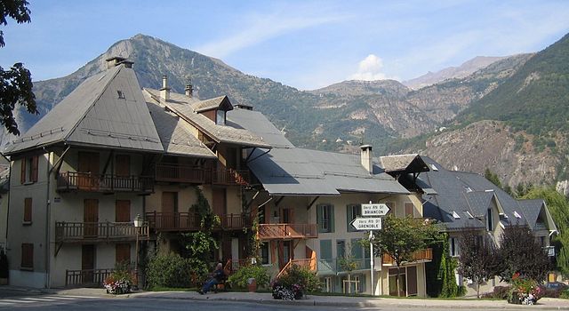
canton of Le Bourg-d'Oisans
- canton of France
 Hiking in canton of Le Bourg-d'Oisans
Canton du Bourg-d'Oisans is a beautiful region in the French Alps, located in the Isère department. It is well-known for its stunning landscapes, dramatic mountain scenery, and a wide range of hiking opportunities that cater to all levels, from beginners to experienced hikers....
- Country:

- Capital: Le Bourg-d'Oisans
- Coordinates: 45° 3' 49" N, 6° 4' 10" E


- GPS tracks (wikiloc): [Link]
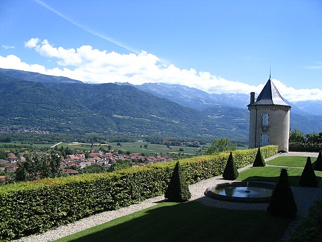
canton of Le Touvet
- canton of France
Canton du Touvet is a beautiful area located in the Chartreuse massif in the Auvergne-Rhône-Alpes region of France. It offers a variety of hiking opportunities surrounded by stunning alpine landscapes, rich flora and fauna, and breathtaking views of the surrounding mountains. Here are some highlights and tips for hiking in this region:...


canton of Meylan
- canton of France
Meylan, located in the Auvergne-Rhône-Alpes region of France, is situated near the French Alps. This scenic area offers a wide variety of hiking opportunities for all skill levels, allowing hikers to enjoy stunning views, diverse landscapes, and the rich natural environment....
- Country:

- Capital: Meylan
- Coordinates: 45° 13' 20" N, 5° 45' 51" E


- GPS tracks (wikiloc): [Link]
- Population: 44039
canton of Monestier-de-Clermont
- canton of France
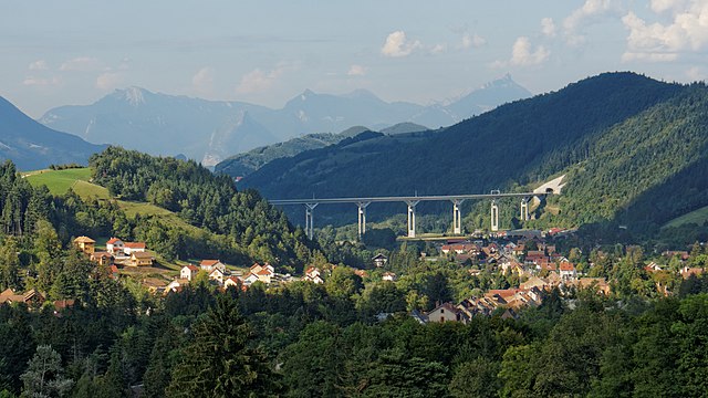
 Hiking in canton of Monestier-de-Clermont
Canton de Monestier-de-Clermont, located in the Isère department of the Auvergne-Rhône-Alpes region in southeastern France, offers a variety of hiking opportunities that showcase the stunning natural landscapes of the French Alps. This area is characterized by its diverse terrain, which includes rolling hills, rugged mountains, and picturesque valleys....
- Country:

- Capital: Monestier-de-Clermont
- Coordinates: 44° 56' 32" N, 5° 37' 9" E


- GPS tracks (wikiloc): [Link]

canton of Pont-en-Royans
- canton of France
 Hiking in canton of Pont-en-Royans
Canton de Pont-en-Royans, located in the Isère department of the Auvergne-Rhône-Alpes region in France, is a stunning area known for its dramatic landscapes, picturesque villages, and numerous hiking opportunities. Here are some highlights and tips for hiking in this region:...
- Country:

- Capital: Pont-en-Royans
- Coordinates: 45° 5' 32" N, 5° 21' 27" E


- GPS tracks (wikiloc): [Link]
canton of Rives
- canton of France
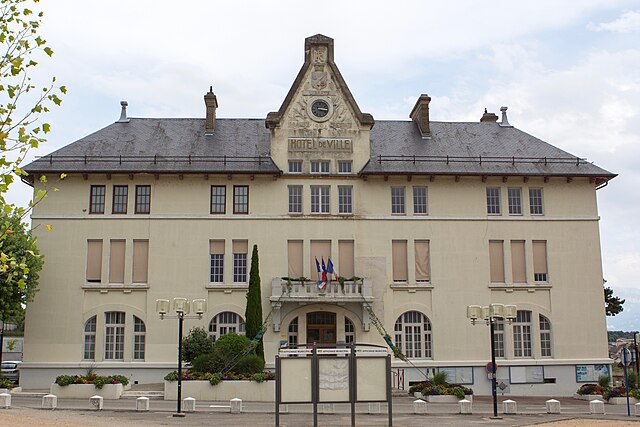
Canton de Rives, located in the Auvergne-Rhône-Alpes region of France, is known for its picturesque landscapes, rolling hills, and beautiful natural scenery, making it a fantastic destination for hiking enthusiasts. Here are some key points to consider:...

canton of Saint-Marcellin
- canton of France
 Hiking in canton of Saint-Marcellin
Canton de Saint-Marcellin is nestled in the Isère department in the Auvergne-Rhône-Alpes region of southeastern France, and it offers some fantastic hiking opportunities amidst stunning natural landscapes. The area is characterized by diverse terrains, including rolling hills, valleys, and moderately challenging mountainous areas, making it suitable for hikers of various levels....
- Country:

- Capital: Saint-Marcellin
- Coordinates: 45° 9' 39" N, 5° 16' 50" E


- GPS tracks (wikiloc): [Link]

canton of Saint-Martin-d'Hères-Nord
- canton of France
 Hiking in canton of Saint-Martin-d'Hères-Nord
Canton de Saint-Martin-d'Hères-Nord is located in the Auvergne-Rhône-Alpes region of southeastern France, which is known for its diverse landscapes, including mountains and valleys. While Saint-Martin-d'Hères itself is more urban and residential, the surrounding regions offer beautiful hiking opportunities....
- Country:

- Capital: Saint-Martin-d'Hères
- Coordinates: 45° 10' 0" N, 5° 46' 0" E


- GPS tracks (wikiloc): [Link]

canton of Saint-Étienne-de-Saint-Geoirs
- canton of France
 Hiking in canton of Saint-Étienne-de-Saint-Geoirs
Canton de Saint-Étienne-de-Saint-Geoirs is a beautiful area located in the Isère department in the Auvergne-Rhône-Alpes region of France. This region offers a variety of hiking opportunities, suitable for both beginners and experienced hikers....
- Country:

- Capital: Saint-Étienne-de-Saint-Geoirs
- Coordinates: 45° 18' 1" N, 5° 23' 4" E


- GPS tracks (wikiloc): [Link]

canton of Vif
- canton of France
Canton de Vif, located in the picturesque region of the French Alps, offers a fantastic array of hiking opportunities for outdoor enthusiasts. Nestled between the mountains, this area is characterized by stunning landscapes, diverse ecosystems, and charming villages....

canton of Vinay
- canton of France
Canton de Vinay, located in the Isère department in the Auvergne-Rhône-Alpes region of France, offers stunning landscapes and a variety of hiking opportunities suitable for different skill levels. The region is characterized by rolling hills, lush forests, and picturesque views of the surrounding Alps, making it a delightful destination for both casual walkers and experienced hikers....

canton of Vizille
- canton of France
Canton de Vizille, located in the Isère department in the Auvergne-Rhône-Alpes region of France, is an excellent destination for hiking enthusiasts. It's known for its beautiful natural landscapes, historical sites, and the proximity to the French Alps. Here are some highlights and tips for hiking in this area:...

Pontcharra
- commune in Isère, France
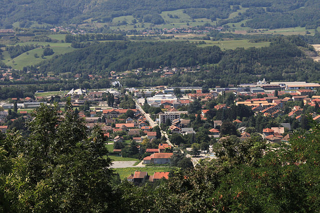
Pontcharra is a charming town located in the Auvergne-Rhône-Alpes region of France, nestled in the Isère department. It offers great opportunities for hiking, surrounded by beautiful natural landscapes, including the Chartreuse and Belledonne mountain ranges. Here’s an overview of what you can expect when hiking in and around Pontcharra:...
- Country:

- Postal Code: 38530
- Coordinates: 45° 25' 59" N, 6° 0' 55" E


- GPS tracks (wikiloc): [Link]
- Area: 15.58 sq km
- Population: 7258
- Web site: [Link]

canton of Fontaine-Sassenage
- canton of France (until March 2015)
 Hiking in canton of Fontaine-Sassenage
Canton de Fontaine-Sassenage, located in the Auvergne-Rhône-Alpes region of France, offers a beautiful and diverse landscape for hiking enthusiasts. Nestled near the city of Grenoble, it features a mix of mountainous terrain, lush forests, and stunning views of the surrounding Alps. Here are some highlights and tips for hiking in this area:...

canton of Saint-Égrève
- canton of France (until March 2015)
 Hiking in canton of Saint-Égrève
Canton de Saint-Égrève is a beautiful area located near the city of Grenoble in the Auvergne-Rhône-Alpes region of France. It offers a mix of natural beauty, scenic trails, and outdoor activities perfect for hiking enthusiasts. Here are some key points about hiking in this area:...
- Country:

- Capital: Saint-Égrève
- Coordinates: 45° 15' 6" N, 5° 42' 10" E


- GPS tracks (wikiloc): [Link]

canton of Échirolles-Ouest
- canton of France (until March 2015)
 Hiking in canton of Échirolles-Ouest
Canton d'Échirolles-Ouest, located in the Isère department of the Auvergne-Rhône-Alpes region in southeastern France, offers a variety of hiking opportunities that cater to different skill levels and preferences. The area is characterized by its beautiful landscapes, including hills, valleys, and proximity to the Vercors and Chartreuse mountain ranges. Here are some highlights for hiking in this region:...
- Country:

- Capital: Échirolles
- Coordinates: 45° 8' 0" N, 5° 43' 0" E


- GPS tracks (wikiloc): [Link]

canton of Eybens
- canton of France (until March 2015)
Canton d'Eybens is located in the Isère department in the Auvergne-Rhône-Alpes region of southeastern France, near the vibrant city of Grenoble. This area offers both beautiful landscapes and a variety of hiking opportunities ranging from easy walks to more challenging trails....


canton of Tullins
- canton of France
The Canton of Tullins, located in the Isère department of southeastern France, offers a variety of hiking opportunities that showcase the region's natural beauty. Nestled at the foothills of the French Alps, this area is known for its diverse landscapes, including rolling hills, lush forests, and stunning panoramic views of the surrounding mountains....
- Country:

- Capital: Tullins
- Coordinates: 45° 16' 23" N, 5° 28' 11" E


- GPS tracks (wikiloc): [Link]
- Population: 38888

canton of Saint-Laurent-du-Pont
- canton of France (until March 2015)
 Hiking in canton of Saint-Laurent-du-Pont
Canton de Saint-Laurent-du-Pont, located in the Auvergne-Rhône-Alpes region of France, is a beautiful area known for its stunning landscapes and hiking opportunities. The region is adorned with picturesque mountains, lush forests, and charming villages, making it an excellent destination for outdoor enthusiasts....
- Country:

- Capital: Saint-Laurent-du-Pont
- Coordinates: 45° 23' 0" N, 5° 44' 0" E


- GPS tracks (wikiloc): [Link]
