Beaugeay (Beaugeay)

- commune in Charente-Maritime, France
- Country:

- Postal Code: 17620
- Coordinates: 45° 52' 26" N, 1° 0' 2" E


- GPS tracks (wikiloc): [Link]
- Area: 14.51 sq km
- Population: 760
- Web site: http://www.ville-beaugeay.fr
- Wikipedia en: wiki(en)
- Wikipedia: wiki(fr)
- Wikidata storage: Wikidata: Q1081447
- Wikipedia Commons Category: [Link]
- Freebase ID: [/m/03mcfz4]
- GeoNames ID: Alt: [3034298]
- SIREN number: [211700364]
- BnF ID: [15248898q]
- INSEE municipality code: 17036
Shares border with regions:

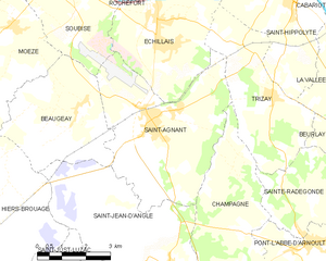
Saint-Agnant
- commune in Charente-Maritime, France
- Country:
- Postal Code: 17620
- Coordinates: 45° 52' 20" N, 0° 57' 41" E
- GPS tracks (wikiloc): [Link]
- Area: 22.49 sq km
- Population: 2673
- Web site: [Link]


Moëze
- commune in Charente-Maritime, France
- Country:
- Postal Code: 17780
- Coordinates: 45° 54' 17" N, 1° 2' 9" E
- GPS tracks (wikiloc): [Link]
- Area: 21.17 sq km
- Population: 554


Saint-Jean-d'Angle
- commune in Charente-Maritime, France
- Country:
- Postal Code: 17620
- Coordinates: 45° 49' 8" N, 0° 56' 48" E
- GPS tracks (wikiloc): [Link]
- Area: 21.61 sq km
- Population: 686
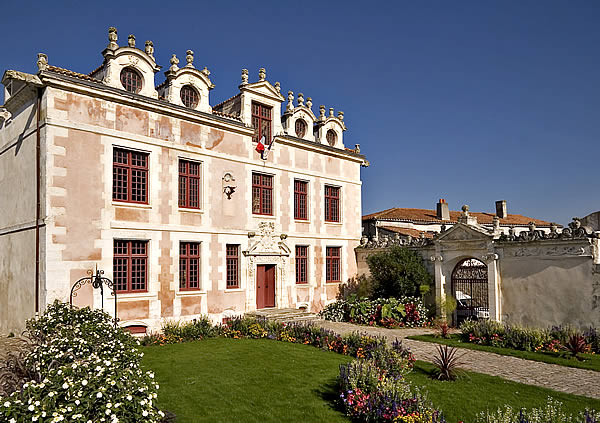
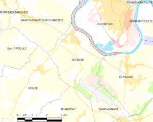
Soubise
- commune in Charente-Maritime, France
- Country:
- Postal Code: 17780
- Coordinates: 45° 55' 31" N, 1° 0' 32" E
- GPS tracks (wikiloc): [Link]
- Area: 10.93 sq km
- Population: 2970
- Web site: [Link]


Hiers-Brouage
- commune in Charente-Maritime, France
- Country:
- Postal Code: 17320
- Coordinates: 45° 50' 59" N, 1° 4' 32" E
- GPS tracks (wikiloc): [Link]
- Area: 31.35 sq km
- Population: 630
- Web site: [Link]