Bellefontaine (Bellefontaine)

- former commune in Manche, France
- Country:

- Postal Code: 50520
- Coordinates: 48° 41' 20" N, 0° 58' 27" E


- GPS tracks (wikiloc): [Link]
- Area: 6.73 sq km
- Population: 133
- Wikipedia en: wiki(en)
- Wikipedia: wiki(fr)
- Wikidata storage: Wikidata: Q1063697
- Wikipedia Commons Category: [Link]
- Freebase ID: [/m/03x_vls]
- Freebase ID: [/m/03x_vls]
- GeoNames ID: Alt: [6449468]
- GeoNames ID: Alt: [6449468]
- BnF ID: [152620227]
- BnF ID: [152620227]
- INSEE municipality code: 50043
- INSEE municipality code: 50043
Shares border with regions:


Juvigny-le-Tertre
- former commune in Manche, France
- Country:
- Postal Code: 50520
- Coordinates: 48° 40' 37" N, 1° 1' 16" E
- GPS tracks (wikiloc): [Link]
- Area: 7.5 sq km
- Population: 576


Chérencé-le-Roussel
- former commune in Manche, France
- Country:
- Postal Code: 50520
- Coordinates: 48° 42' 31" N, 1° 1' 1" E
- GPS tracks (wikiloc): [Link]
- Area: 10.95 sq km
- Population: 305

Saint-Barthélemy
- commune in Manche, France
- Country:
- Postal Code: 50140
- Coordinates: 48° 40' 53" N, 0° 57' 10" E
- GPS tracks (wikiloc): [Link]
- Area: 6.81 sq km
- Population: 328

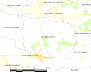
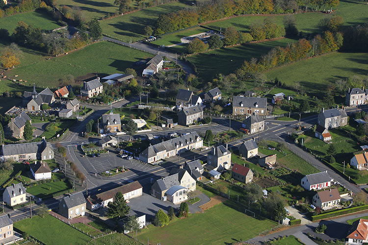
Le Mesnil-Tôve
- former commune in Manche, France
- Country:
- Postal Code: 50520
- Coordinates: 48° 42' 3" N, 1° 1' 21" E
- GPS tracks (wikiloc): [Link]
- Area: 11.74 sq km
- Population: 237