
Manche (Manche)


- French department
- Country:

- Capital: Saint-Lô
- Coordinates: 49° 3' 0" N, 1° 15' 0" E


- GPS tracks (wikiloc): [Link]
- Area: 5938 sq km
- Population: 499287
- Web site: http://www.manche.pref.gouv.fr/
- Wikipedia en: wiki(en)
- Wikipedia: wiki(fr)
- Wikidata storage: Wikidata: Q12589
- Wikipedia Commons Gallery: [Link]
- Wikipedia Commons Category: [Link]
- Wikipedia Commons Maps Category: [Link]
- Freebase ID: [/m/0mgrh]
- GeoNames ID: Alt: [2996268]
- SIREN number: [225005024]
- BnF ID: [11999083d]
- VIAF ID: Alt: [135561010]
- OSM relation ID: [7404]
- GND ID: Alt: [4100082-1]
- archINFORM location ID: [1015]
- Library of Congress authority ID: Alt: [n81119935]
- MusicBrainz area ID: [0661dde5-f97f-41df-a812-dc3f85f2704d]
- TGN ID: [7002966]
- SUDOC authorities ID: [028085434]
- NUTS code: [FR252]
- INSEE department code: [50]
- ISO 3166-2 code: FR-50
Includes regions:


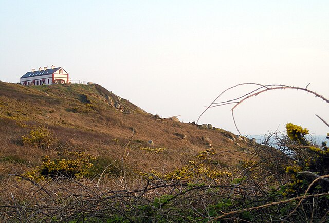
Biville
- former commune in Manche, France
- Country:
- Postal Code: 50440
- Coordinates: 49° 36' 46" N, 1° 49' 21" E
- GPS tracks (wikiloc): [Link]
- Area: 8.7 sq km
- Population: 549
- Web site: [Link]


Cuves
- commune in Manche, France
- Country:
- Postal Code: 50670
- Coordinates: 48° 43' 8" N, 1° 6' 19" E
- GPS tracks (wikiloc): [Link]
- Area: 9.69 sq km
- Population: 286

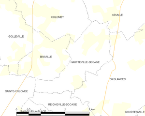
Hautteville-Bocage
- commune in Manche, France
- Country:
- Postal Code: 50390
- Coordinates: 49° 25' 33" N, 1° 27' 53" E
- GPS tracks (wikiloc): [Link]
- Area: 4.22 sq km
- Population: 149


Cavigny
- commune in Manche, France
- Country:
- Postal Code: 50620
- Coordinates: 49° 11' 36" N, 1° 6' 35" E
- GPS tracks (wikiloc): [Link]
- Area: 6.78 sq km
- Population: 246


Couville
- commune in Manche, France
- Country:
- Postal Code: 50690
- Coordinates: 49° 33' 13" N, 1° 41' 9" E
- GPS tracks (wikiloc): [Link]
- Area: 8.6 sq km
- Population: 1107
- Web site: [Link]

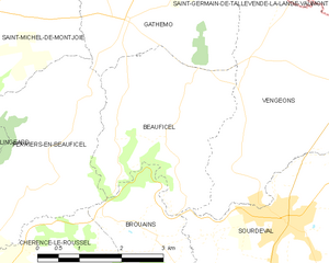
Beauficel
- commune in Manche, France
- Country:
- Postal Code: 50150
- Coordinates: 48° 44' 24" N, 0° 57' 37" E
- GPS tracks (wikiloc): [Link]
- Area: 9.13 sq km
- Population: 153


Belval
- commune in Manche, France
- Country:
- Postal Code: 50210
- Coordinates: 49° 2' 22" N, 1° 21' 49" E
- GPS tracks (wikiloc): [Link]
- Area: 5.72 sq km
- Population: 312


Golleville
- commune in Manche, France
- Country:
- Postal Code: 50390
- Coordinates: 49° 26' 11" N, 1° 30' 58" E
- GPS tracks (wikiloc): [Link]
- Area: 6.46 sq km
- Population: 175


Bolleville
- former commune in Manche, France
- Country:
- Postal Code: 50250
- Coordinates: 49° 18' 4" N, 1° 34' 33" E
- GPS tracks (wikiloc): [Link]
- Area: 6.09 sq km
- Population: 371


Dangy
- commune in Manche, France
- Country:
- Postal Code: 50750
- Coordinates: 49° 2' 42" N, 1° 13' 29" E
- GPS tracks (wikiloc): [Link]
- Area: 9.93 sq km
- Population: 647


Carantilly
- commune in Manche, France
- Country:
- Postal Code: 50570
- Coordinates: 49° 3' 55" N, 1° 14' 26" E
- GPS tracks (wikiloc): [Link]
- Area: 10.7 sq km
- Population: 653


Beslon
- commune in Manche, France
- Country:
- Postal Code: 50800
- Coordinates: 48° 50' 56" N, 1° 9' 5" E
- GPS tracks (wikiloc): [Link]
- Area: 17.24 sq km
- Population: 561

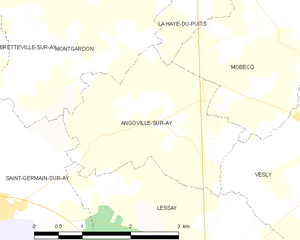
Angoville-sur-Ay
- former commune in Manche, France
- Country:
- Postal Code: 50430
- Coordinates: 49° 15' 11" N, 1° 32' 54" E
- GPS tracks (wikiloc): [Link]
- Area: 6.72 sq km
- Population: 239

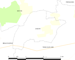
Chevry
- former commune in Manche, France
- Country:
- Postal Code: 50420
- Coordinates: 48° 58' 5" N, 1° 7' 12" E
- GPS tracks (wikiloc): [Link]
- Area: 3.62 sq km
- Population: 124


Baudreville
- former commune in Manche, France
- Country:
- Postal Code: 50250
- Coordinates: 49° 18' 19" N, 1° 37' 54" E
- GPS tracks (wikiloc): [Link]
- Area: 4.67 sq km
- Population: 90


Gonneville
- former commune in Manche, France
- Country:
- Postal Code: 50330
- Coordinates: 49° 38' 7" N, 1° 28' 24" E
- GPS tracks (wikiloc): [Link]
- Area: 15.36 sq km
- Population: 906

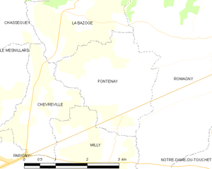
Fontenay
- former commune in Manche, France
- Country:
- Postal Code: 50140
- Coordinates: 48° 37' 42" N, 1° 1' 48" E
- GPS tracks (wikiloc): [Link]
- Area: 6.85 sq km
- Population: 314


Le Chefresne
- former commune in Manche, France
- Country:
- Postal Code: 50410
- Coordinates: 48° 54' 11" N, 1° 9' 16" E
- GPS tracks (wikiloc): [Link]
- Area: 11.28 sq km
- Population: 307
- Web site: [Link]
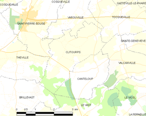
Clitourps
- commune in Manche, France
- Country:
- Postal Code: 50330
- Coordinates: 49° 39' 21" N, 1° 22' 16" E
- GPS tracks (wikiloc): [Link]
- Area: 6.3 sq km
- Population: 199


Baubigny
- commune in Manche, France
- Country:
- Postal Code: 50270
- Coordinates: 49° 25' 48" N, 1° 48' 14" E
- GPS tracks (wikiloc): [Link]
- Area: 6.41 sq km
- Population: 152


Fontenay-sur-Mer
- commune in Manche, France
- Country:
- Postal Code: 50310
- Coordinates: 49° 29' 21" N, 1° 18' 56" E
- GPS tracks (wikiloc): [Link]
- Area: 8.18 sq km
- Population: 181


Breuville
- commune in Manche, France
- Country:
- Postal Code: 50260
- Coordinates: 49° 32' 10" N, 1° 40' 21" E
- GPS tracks (wikiloc): [Link]
- Area: 8.41 sq km
- Population: 422


Les Champs-de-Losque
- former commune in Manche, France
- Country:
- Postal Code: 50620
- Coordinates: 49° 10' 58" N, 1° 13' 53" E
- GPS tracks (wikiloc): [Link]
- Area: 9.31 sq km
- Population: 185


Brainville
- commune in Manche, France
- Country:
- Postal Code: 50200
- Coordinates: 49° 5' 10" N, 1° 29' 53" E
- GPS tracks (wikiloc): [Link]
- Area: 3.19 sq km
- Population: 226


Barenton
- commune in Manche, France
- Country:
- Postal Code: 50720
- Coordinates: 48° 35' 57" N, 0° 49' 55" E
- GPS tracks (wikiloc): [Link]
- Area: 34.88 sq km
- Population: 1190
- Web site: [Link]


La Colombe
- commune in Manche, France
- Country:
- Postal Code: 50800
- Coordinates: 48° 52' 28" N, 1° 10' 57" E
- GPS tracks (wikiloc): [Link]
- Area: 14.37 sq km
- Population: 621


Glatigny
- former commune in Manche, France
- Country:
- Postal Code: 50250
- Coordinates: 49° 16' 38" N, 1° 37' 49" E
- GPS tracks (wikiloc): [Link]
- Area: 4.99 sq km
- Population: 168


Chanteloup
- commune in Manche, France
- Country:
- Postal Code: 50510
- Coordinates: 48° 53' 57" N, 1° 29' 14" E
- GPS tracks (wikiloc): [Link]
- Area: 4.17 sq km
- Population: 354


Carneville
- commune in Manche, France
- Country:
- Postal Code: 50330
- Coordinates: 49° 39' 50" N, 1° 26' 46" E
- GPS tracks (wikiloc): [Link]
- Area: 6.88 sq km
- Population: 238


Doville
- commune in Manche, France
- Country:
- Postal Code: 50250
- Coordinates: 49° 19' 54" N, 1° 32' 25" E
- GPS tracks (wikiloc): [Link]
- Area: 11.09 sq km
- Population: 317


Auvers
- commune in Manche, France
- Country:
- Postal Code: 50500
- Coordinates: 49° 17' 46" N, 1° 19' 27" E
- GPS tracks (wikiloc): [Link]
- Area: 18.76 sq km
- Population: 674

Digosville
- commune in Manche, France
- Country:
- Postal Code: 50110
- Coordinates: 49° 37' 51" N, 1° 31' 31" E
- GPS tracks (wikiloc): [Link]
- Area: 9.27 sq km
- Population: 1511
- Web site: [Link]

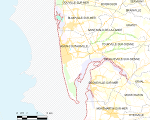
Agon-Coutainville
- commune in Manche, France
- Country:
- Postal Code: 50230
- Coordinates: 49° 2' 32" N, 1° 34' 36" E
- GPS tracks (wikiloc): [Link]
- Area: 12.35 sq km
- Population: 2796
- Web site: [Link]


Aumeville-Lestre
- commune in Manche, France
- Country:
- Postal Code: 50630
- Coordinates: 49° 32' 22" N, 1° 19' 17" E
- GPS tracks (wikiloc): [Link]
- Area: 2.44 sq km
- Population: 127


Les Cresnays
- commune in Manche, France
- Country:
- Postal Code: 50370
- Coordinates: 48° 43' 8" N, 1° 7' 19" E
- GPS tracks (wikiloc): [Link]
- Area: 9.78 sq km
- Population: 236


La Baleine
- commune in Manche, France
- Country:
- Postal Code: 50450
- Coordinates: 48° 55' 28" N, 1° 19' 4" E
- GPS tracks (wikiloc): [Link]
- Area: 4.13 sq km
- Population: 92


Beaucoudray
- commune in Manche, France
- Country:
- Postal Code: 50420
- Coordinates: 48° 57' 31" N, 1° 8' 31" E
- GPS tracks (wikiloc): [Link]
- Area: 4.7 sq km
- Population: 141
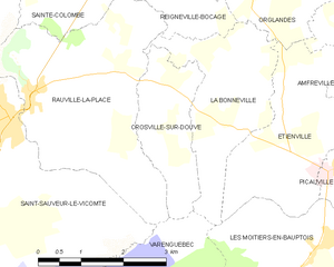
Crosville-sur-Douve
- commune in Manche, France
- Country:
- Postal Code: 50360
- Coordinates: 49° 23' 20" N, 1° 29' 3" E
- GPS tracks (wikiloc): [Link]
- Area: 4.06 sq km
- Population: 63

Hambye
- commune in Manche, France
- Country:
- Postal Code: 50450
- Coordinates: 48° 56' 53" N, 1° 15' 51" E
- GPS tracks (wikiloc): [Link]
- Area: 29.57 sq km
- Population: 1154
- Web site: [Link]


Marigny
- former commune in Manche, France
- Country:
- Postal Code: 50570
- Coordinates: 49° 5' 56" N, 1° 14' 26" E
- GPS tracks (wikiloc): [Link]
- Area: 10.31 sq km
- Population: 2325


Beauvoir
- commune in Manche, France
- Country:
- Postal Code: 50170
- Coordinates: 48° 35' 50" N, 1° 30' 17" E
- GPS tracks (wikiloc): [Link]
- Area: 14.29 sq km
- Population: 410


Donville-les-Bains
- commune in Manche, France
- Country:
- Postal Code: 50350
- Coordinates: 48° 50' 55" N, 1° 34' 39" E
- GPS tracks (wikiloc): [Link]
- Area: 2.75 sq km
- Population: 3152
- Web site: [Link]


Airel
- commune in Manche, France
- Country:
- Postal Code: 50680
- Coordinates: 49° 13' 7" N, 1° 4' 46" E
- GPS tracks (wikiloc): [Link]
- Area: 10.17 sq km
- Population: 536


Saint-Pair-sur-Mer
- commune in Manche, France
- Country:
- Postal Code: 50380
- Coordinates: 48° 48' 54" N, 1° 34' 7" E
- GPS tracks (wikiloc): [Link]
- Area: 14.42 sq km
- Population: 4025
- Web site: [Link]

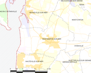
Montmartin-sur-Mer
- commune in Manche, France
- Country:
- Postal Code: 50590
- Coordinates: 48° 59' 19" N, 1° 31' 29" E
- GPS tracks (wikiloc): [Link]
- Area: 9.81 sq km
- Population: 1350
- Web site: [Link]


Gouville-sur-Mer
- commune in Manche, France
- Country:
- Postal Code: 50560
- Coordinates: 49° 5' 50" N, 1° 34' 50" E
- GPS tracks (wikiloc): [Link]
- Area: 13.24 sq km
- Population: 2013
- Web site: [Link]


La Croix-Avranchin
- former commune in Manche, France
- Country:
- Postal Code: 50240
- Coordinates: 48° 32' 46" N, 1° 23' 0" E
- GPS tracks (wikiloc): [Link]
- Area: 10.79 sq km
- Population: 452


Champeaux
- commune in Manche, France
- Country:
- Postal Code: 50530
- Coordinates: 48° 44' 20" N, 1° 31' 43" E
- GPS tracks (wikiloc): [Link]
- Area: 4.29 sq km
- Population: 361
- Web site: [Link]
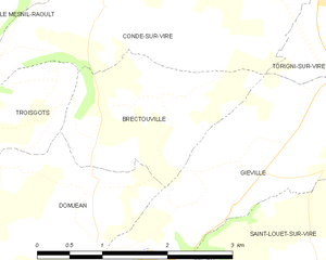
Brectouville
- former commune in Manche, France
- Country:
- Postal Code: 50160
- Coordinates: 49° 1' 19" N, 1° 1' 21" E
- GPS tracks (wikiloc): [Link]
- Area: 3.74 sq km
- Population: 166


Giéville
- former commune in Manche, France
- Country:
- Postal Code: 50160
- Coordinates: 49° 0' 52" N, 0° 58' 46" E
- GPS tracks (wikiloc): [Link]
- Area: 10.33 sq km
- Population: 670


Les Chambres
- former commune in Manche, France
- Country:
- Postal Code: 50320
- Coordinates: 48° 45' 59" N, 1° 23' 17" E
- GPS tracks (wikiloc): [Link]
- Area: 4.18 sq km
- Population: 137


Azeville
- commune in Manche, France
- Country:
- Postal Code: 50310
- Coordinates: 49° 27' 34" N, 1° 18' 46" E
- GPS tracks (wikiloc): [Link]
- Area: 3 sq km
- Population: 95


Créances
- commune in Manche, France
- Country:
- Postal Code: 50710
- Coordinates: 49° 12' 4" N, 1° 34' 1" E
- GPS tracks (wikiloc): [Link]
- Area: 20.32 sq km
- Population: 2201
- Web site: [Link]

Hamelin
- commune in Manche, France
- Country:
- Postal Code: 50730
- Coordinates: 48° 32' 38" N, 1° 12' 34" E
- GPS tracks (wikiloc): [Link]
- Area: 2.46 sq km
- Population: 98


Boisyvon
- commune in Manche, France
- Country:
- Postal Code: 50800
- Coordinates: 48° 48' 20" N, 1° 7' 44" E
- GPS tracks (wikiloc): [Link]
- Area: 3.85 sq km
- Population: 110


Gonfreville
- commune in Manche, France
- Country:
- Postal Code: 50190
- Coordinates: 49° 14' 18" N, 1° 24' 2" E
- GPS tracks (wikiloc): [Link]
- Area: 9.04 sq km
- Population: 149


Crasville
- commune in Manche, France
- Country:
- Postal Code: 50630
- Coordinates: 49° 33' 7" N, 1° 20' 21" E
- GPS tracks (wikiloc): [Link]
- Area: 7.18 sq km
- Population: 266


Beuvrigny
- commune in Manche, France
- Country:
- Postal Code: 50420
- Coordinates: 48° 58' 5" N, 1° 0' 16" E
- GPS tracks (wikiloc): [Link]
- Area: 6.77 sq km
- Population: 134

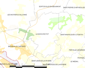
La Haye-d'Ectot
- commune in Manche, France
- Country:
- Postal Code: 50270
- Coordinates: 49° 23' 31" N, 1° 43' 54" E
- GPS tracks (wikiloc): [Link]
- Area: 7.32 sq km
- Population: 238


Étienville
- commune in Manche, France
- Country:
- Postal Code: 50360
- Coordinates: 49° 22' 41" N, 1° 26' 9" E
- GPS tracks (wikiloc): [Link]
- Area: 7.36 sq km
- Population: 375
- Web site: [Link]


Boisroger
- former commune in Manche, France
- Country:
- Postal Code: 50200
- Coordinates: 49° 5' 33" N, 1° 32' 20" E
- GPS tracks (wikiloc): [Link]
- Area: 5.3 sq km
- Population: 245

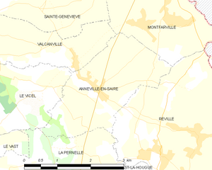
Anneville-en-Saire
- commune in Manche, France
- Country:
- Postal Code: 50760
- Coordinates: 49° 38' 10" N, 1° 17' 11" E
- GPS tracks (wikiloc): [Link]
- Area: 6 sq km
- Population: 397

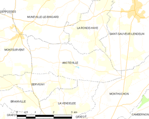
Ancteville
- commune in Manche, France
- Country:
- Postal Code: 50200
- Coordinates: 49° 6' 10" N, 1° 28' 44" E
- GPS tracks (wikiloc): [Link]
- Area: 7.74 sq km
- Population: 249


Bricqueville-sur-Mer
- commune in Manche, France
- Country:
- Postal Code: 50290
- Coordinates: 48° 54' 48" N, 1° 31' 19" E
- GPS tracks (wikiloc): [Link]
- Area: 12.88 sq km
- Population: 1195
- Web site: [Link]


Condé-sur-Vire
- former commune in Manche, France
- Country:
- Postal Code: 50890
- Coordinates: 49° 3' 8" N, 1° 2' 14" E
- GPS tracks (wikiloc): [Link]
- Area: 24.85 sq km
- Population: 3382
- Web site: [Link]


Branville-Hague
- former commune in Manche, France
- Country:
- Postal Code: 50440
- Coordinates: 49° 39' 19" N, 1° 47' 7" E
- GPS tracks (wikiloc): [Link]
- Area: 2.12 sq km
- Population: 166
- Web site: [Link]


Hardinvast
- commune in Manche, France
- Country:
- Postal Code: 50690
- Coordinates: 49° 34' 43" N, 1° 38' 52" E
- GPS tracks (wikiloc): [Link]
- Area: 7.3 sq km
- Population: 877
- Web site: [Link]


Fourneaux
- commune in Manche, France
- Country:
- Postal Code: 50420
- Coordinates: 48° 57' 52" N, 1° 2' 10" E
- GPS tracks (wikiloc): [Link]
- Area: 3.34 sq km
- Population: 150


Montjoie-Saint-Martin
- commune in Manche, France
- Country:
- Postal Code: 50240
- Coordinates: 48° 31' 56" N, 1° 17' 28" E
- GPS tracks (wikiloc): [Link]
- Area: 7.49 sq km
- Population: 252


Courtils
- commune in Manche, France
- Country:
- Postal Code: 50220
- Coordinates: 48° 37' 39" N, 1° 24' 32" E
- GPS tracks (wikiloc): [Link]
- Area: 5.39 sq km
- Population: 221


Domjean
- commune in Manche, France
- Country:
- Postal Code: 50420
- Coordinates: 48° 59' 13" N, 1° 1' 57" E
- GPS tracks (wikiloc): [Link]
- Area: 16.57 sq km
- Population: 1087


Colomby
- commune in Manche, France
- Country:
- Postal Code: 50700
- Coordinates: 49° 27' 23" N, 1° 29' 35" E
- GPS tracks (wikiloc): [Link]
- Area: 11.16 sq km
- Population: 519

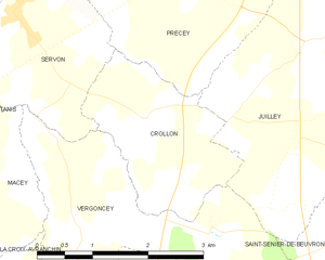
Crollon
- commune in Manche, France
- Country:
- Postal Code: 50220
- Coordinates: 48° 35' 6" N, 1° 23' 3" E
- GPS tracks (wikiloc): [Link]
- Area: 4.68 sq km
- Population: 299


Brillevast
- commune in Manche, France
- Country:
- Postal Code: 50330
- Coordinates: 49° 37' 39" N, 1° 24' 52" E
- GPS tracks (wikiloc): [Link]
- Area: 9.07 sq km
- Population: 332


Braffais
- former commune in Manche, France
- Country:
- Postal Code: 50870
- Coordinates: 48° 45' 25" N, 1° 15' 40" E
- GPS tracks (wikiloc): [Link]
- Area: 5.79 sq km
- Population: 192

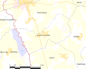
Aucey-la-Plaine
- commune in Manche, France
- Country:
- Postal Code: 50170
- Coordinates: 48° 31' 38" N, 1° 28' 41" E
- GPS tracks (wikiloc): [Link]
- Area: 9.39 sq km
- Population: 439


Beauchamps
- commune in Manche, France
- Country:
- Postal Code: 50320
- Coordinates: 48° 49' 56" N, 1° 21' 32" E
- GPS tracks (wikiloc): [Link]
- Area: 4.1 sq km
- Population: 393


Catz
- commune in Manche, France
- Country:
- Postal Code: 50500
- Coordinates: 49° 18' 39" N, 1° 10' 48" E
- GPS tracks (wikiloc): [Link]
- Area: 2.78 sq km
- Population: 141


Catteville
- commune in Manche, France
- Country:
- Postal Code: 50390
- Coordinates: 49° 21' 21" N, 1° 34' 11" E
- GPS tracks (wikiloc): [Link]
- Area: 4.57 sq km
- Population: 106


Bretteville-sur-Ay
- commune in Manche, France
- Country:
- Postal Code: 50430
- Coordinates: 49° 15' 37" N, 1° 37' 57" E
- GPS tracks (wikiloc): [Link]
- Area: 9.75 sq km
- Population: 388
- Web site: [Link]

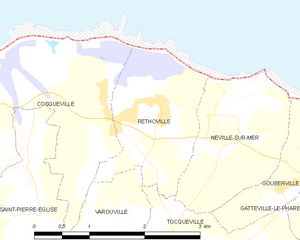
Réthoville
- former commune in Manche, France
- Country:
- Postal Code: 50330
- Coordinates: 49° 41' 47" N, 1° 21' 28" E
- GPS tracks (wikiloc): [Link]
- Area: 3.43 sq km
- Population: 130

Le Valdécie
- former commune in Manche, France
- Country:
- Postal Code: 50260
- Coordinates: 49° 25' 26" N, 1° 39' 10" E
- GPS tracks (wikiloc): [Link]
- Area: 4 sq km
- Population: 146


Le Vrétot
- former commune in Manche, France
- Country:
- Postal Code: 50260
- Coordinates: 49° 27' 7" N, 1° 42' 39" E
- GPS tracks (wikiloc): [Link]
- Area: 20.56 sq km
- Population: 631


La Vendelée
- commune in Manche, France
- Country:
- Postal Code: 50200
- Coordinates: 49° 4' 52" N, 1° 27' 45" E
- GPS tracks (wikiloc): [Link]
- Area: 5.04 sq km
- Population: 448


Les Veys
- former commune in Manche, France
- Country:
- Postal Code: 50500
- Coordinates: 49° 18' 54" N, 1° 9' 9" E
- GPS tracks (wikiloc): [Link]
- Area: 14.88 sq km
- Population: 410


Le Vicel
- commune in Manche, France
- Country:
- Postal Code: 50760
- Coordinates: 49° 38' 5" N, 1° 18' 36" E
- GPS tracks (wikiloc): [Link]
- Area: 4.74 sq km
- Population: 126


Le Theil
- former commune in Manche, France
- Country:
- Postal Code: 50330
- Coordinates: 49° 36' 33" N, 1° 28' 20" E
- GPS tracks (wikiloc): [Link]
- AboveSeaLevel: 120 м m
- Area: 13.81 sq km
- Population: 668
- Web site: [Link]


Saint-Pois
- commune in Manche, France
- Country:
- Postal Code: 50670
- Coordinates: 48° 44' 58" N, 1° 4' 1" E
- GPS tracks (wikiloc): [Link]
- Area: 7.78 sq km
- Population: 508


Saint-Martin-de-Cenilly
- commune in Manche, France
- Country:
- Postal Code: 50210
- Coordinates: 48° 58' 56" N, 1° 16' 54" E
- GPS tracks (wikiloc): [Link]
- Area: 6.76 sq km
- Population: 186


Saint-Martin-d'Aubigny
- commune in Manche, France
- Country:
- Postal Code: 50190
- Coordinates: 49° 9' 54" N, 1° 21' 0" E
- GPS tracks (wikiloc): [Link]
- Area: 15.16 sq km
- Population: 595
- Web site: [Link]


Saint-Pierre-d'Arthéglise
- commune in Manche, France
- Country:
- Postal Code: 50270
- Coordinates: 49° 24' 52" N, 1° 41' 39" E
- GPS tracks (wikiloc): [Link]
- Area: 5.36 sq km
- Population: 132
- Web site: [Link]

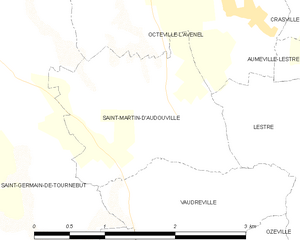
Saint-Martin-d'Audouville
- commune in Manche, France
- Country:
- Postal Code: 50310
- Coordinates: 49° 31' 43" N, 1° 21' 44" E
- GPS tracks (wikiloc): [Link]
- Area: 3.64 sq km
- Population: 134

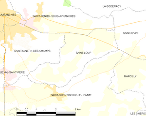
Saint-Loup
- commune in Manche, France
- Country:
- Postal Code: 50300
- Coordinates: 48° 40' 4" N, 1° 17' 42" E
- GPS tracks (wikiloc): [Link]
- Area: 6.45 sq km
- Population: 716
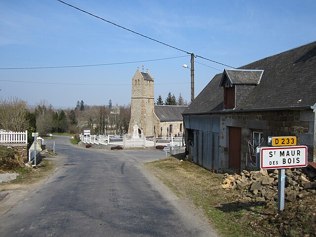
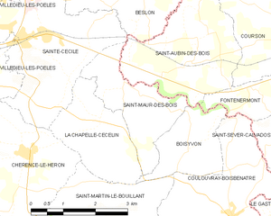
Saint-Maur-des-Bois
- commune in Manche, France
- Country:
- Postal Code: 50800
- Coordinates: 48° 49' 20" N, 1° 9' 27" E
- GPS tracks (wikiloc): [Link]
- Area: 4.97 sq km
- Population: 148


Saint-Nicolas-de-Pierrepont
- commune in Manche, France
- Country:
- Postal Code: 50250
- Coordinates: 49° 19' 24" N, 1° 35' 14" E
- GPS tracks (wikiloc): [Link]
- Area: 8.13 sq km
- Population: 300

Saint-Pellerin
- former commune in Manche, France
- Country:
- Postal Code: 50500
- Coordinates: 49° 17' 52" N, 1° 10' 42" E
- GPS tracks (wikiloc): [Link]
- Area: 4.37 sq km
- Population: 387


Saint-Samson-de-Bonfossé
- former commune in Manche, France
- Country:
- Postal Code: 50750
- Coordinates: 49° 2' 56" N, 1° 7' 44" E
- GPS tracks (wikiloc): [Link]
- Area: 6.28 sq km
- Population: 851

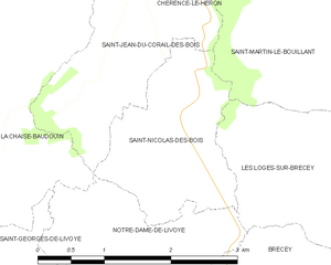
Saint-Nicolas-des-Bois
- commune in Manche, France
- Country:
- Postal Code: 50370
- Coordinates: 48° 45' 21" N, 1° 11' 38" E
- GPS tracks (wikiloc): [Link]
- AboveSeaLevel: 88 м m
- Area: 3.57 sq km
- Population: 99


Saint-Planchers
- commune in Manche, France
- Country:
- Postal Code: 50400
- Coordinates: 48° 49' 23" N, 1° 31' 33" E
- GPS tracks (wikiloc): [Link]
- Area: 11.96 sq km
- Population: 1351
- Web site: [Link]


Saint-Marcouf
- commune in Manche, France
- Country:
- Postal Code: 50310
- Coordinates: 49° 28' 23" N, 1° 17' 27" E
- GPS tracks (wikiloc): [Link]
- AboveSeaLevel: 20 м m
- Area: 13.38 sq km
- Population: 342


Saint-Michel-de-la-Pierre
- commune in Manche, France
- Country:
- Postal Code: 50490
- Coordinates: 49° 8' 18" N, 1° 23' 7" E
- GPS tracks (wikiloc): [Link]
- Area: 4.25 sq km
- Population: 211

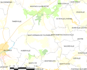
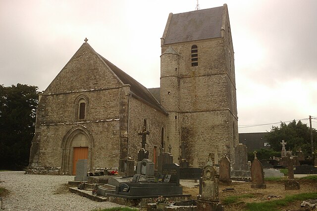
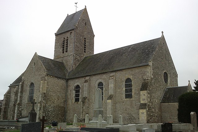
Saint-Germain-de-Tournebut
- commune in Manche, France
- Country:
- Postal Code: 50700
- Coordinates: 49° 31' 58" N, 1° 23' 47" E
- GPS tracks (wikiloc): [Link]
- Area: 13.91 sq km
- Population: 418


Saint-Georges-de-Livoye
- commune in Manche, France
- Country:
- Postal Code: 50370
- Coordinates: 48° 44' 12" N, 1° 12' 59" E
- GPS tracks (wikiloc): [Link]
- Area: 5.53 sq km
- Population: 203


Saint-Lô-d'Ourville
- commune in Manche, France
- Country:
- Postal Code: 50580
- Coordinates: 49° 20' 5" N, 1° 40' 10" E
- GPS tracks (wikiloc): [Link]
- Area: 10.7 sq km
- Population: 517


Saint-Cyr
- commune in Manche, France
- Country:
- Postal Code: 50310
- Coordinates: 49° 29' 17" N, 1° 25' 10" E
- GPS tracks (wikiloc): [Link]
- Area: 5.7 sq km
- Population: 189


Saint-Gilles
- commune in Manche, France
- Country:
- Postal Code: 50180
- Coordinates: 49° 6' 17" N, 1° 10' 32" E
- GPS tracks (wikiloc): [Link]
- Area: 7.84 sq km
- Population: 871


Saint-Georges-de-Bohon
- former commune in Manche, France
- Country:
- Postal Code: 50500
- Coordinates: 49° 15' 2" N, 1° 16' 10" E
- GPS tracks (wikiloc): [Link]
- Area: 13.96 sq km
- Population: 403


Saint-Georges-de-la-Rivière
- commune in Manche, France
- Country:
- Postal Code: 50270
- Coordinates: 49° 21' 51" N, 1° 43' 45" E
- GPS tracks (wikiloc): [Link]
- AboveSeaLevel: 20 м m
- Area: 3.79 sq km
- Population: 280
- Web site: [Link]


Saint-Jacques-de-Néhou
- commune in Manche, France
- Country:
- Postal Code: 50390
- Coordinates: 49° 25' 5" N, 1° 36' 47" E
- GPS tracks (wikiloc): [Link]
- Area: 21.49 sq km
- Population: 592


Saint-Jean-des-Champs
- commune in Manche, France
- Country:
- Postal Code: 50320
- Coordinates: 48° 49' 39" N, 1° 27' 53" E
- GPS tracks (wikiloc): [Link]
- Area: 19.4 sq km
- Population: 1388

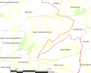
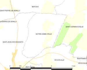
Saint-Germain-d'Elle
- commune in Manche, France
- Country:
- Postal Code: 50810
- Coordinates: 49° 7' 21" N, 0° 55' 11" E
- GPS tracks (wikiloc): [Link]
- Area: 8.87 sq km
- Population: 220

Saint-Jores
- former commune in Manche, France
- Country:
- Postal Code: 50250
- Coordinates: 49° 18' 11" N, 1° 25' 18" E
- GPS tracks (wikiloc): [Link]
- Area: 12.73 sq km
- Population: 363


Saint-Georges-Montcocq
- commune in Manche, France
- Country:
- Postal Code: 50000
- Coordinates: 49° 7' 42" N, 1° 5' 38" E
- GPS tracks (wikiloc): [Link]
- AboveSeaLevel: 90 м m
- Area: 8.94 sq km
- Population: 884
- Web site: [Link]


Saint-Ébremond-de-Bonfossé
- former commune in Manche, France
- Country:
- Postal Code: 50750
- Coordinates: 49° 4' 0" N, 1° 8' 58" E
- GPS tracks (wikiloc): [Link]
- Area: 11.9 sq km
- Population: 727


Sainte-Colombe
- commune in Manche, France
- Country:
- Postal Code: 50390
- Coordinates: 49° 25' 18" N, 1° 31' 20" E
- GPS tracks (wikiloc): [Link]
- Area: 4.99 sq km
- Population: 215


Sainte-Geneviève
- commune in Manche, France
- Country:
- Postal Code: 50760
- Coordinates: 49° 39' 25" N, 1° 18' 44" E
- GPS tracks (wikiloc): [Link]
- Area: 4.95 sq km
- Population: 322


Saint-Jean-de-la-Haize
- commune in Manche, France
- Country:
- Postal Code: 50300
- Coordinates: 48° 42' 15" N, 1° 21' 39" E
- GPS tracks (wikiloc): [Link]
- Area: 8.95 sq km
- Population: 499


Notre-Dame-de-Livoye
- commune in Manche, France
- Country:
- Postal Code: 50370
- Coordinates: 48° 44' 39" N, 1° 12' 24" E
- GPS tracks (wikiloc): [Link]
- Area: 3.54 sq km
- Population: 139


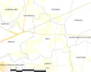
Parigny
- former commune in Manche, France
- Country:
- Postal Code: 50600
- Coordinates: 48° 35' 42" N, 1° 4' 41" E
- GPS tracks (wikiloc): [Link]
- Area: 11.62 sq km
- Population: 1876
- Web site: [Link]

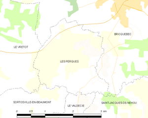
Les Perques
- former commune in Manche, France
- Country:
- Postal Code: 50260
- Coordinates: 49° 26' 43" N, 1° 39' 29" E
- GPS tracks (wikiloc): [Link]
- Area: 4.85 sq km
- Population: 196


Pierreville
- commune in Manche, France
- Country:
- Postal Code: 50340
- Coordinates: 49° 28' 24" N, 1° 46' 54" E
- GPS tracks (wikiloc): [Link]
- Area: 10.11 sq km
- Population: 735


Saint-André-de-Bohon
- commune in Manche, France
- Country:
- Postal Code: 50500
- Coordinates: 49° 14' 4" N, 1° 15' 8" E
- GPS tracks (wikiloc): [Link]
- Area: 10.43 sq km
- Population: 334


La Rochelle-Normande
- former commune in Manche, France
- Country:
- Postal Code: 50530
- Coordinates: 48° 45' 54" N, 1° 26' 4" E
- GPS tracks (wikiloc): [Link]
- Area: 7.53 sq km
- Population: 330


Le Petit-Celland
- commune in Manche, France
- Country:
- Postal Code: 50370
- Coordinates: 48° 41' 46" N, 1° 12' 37" E
- GPS tracks (wikiloc): [Link]
- Area: 6.57 sq km
- Population: 210
- Web site: [Link]


Saint-Brice-de-Landelles
- commune in Manche, France
- Country:
- Postal Code: 50730
- Coordinates: 48° 32' 1" N, 1° 9' 9" E
- GPS tracks (wikiloc): [Link]
- AboveSeaLevel: 185 м m
- Area: 14.77 sq km
- Population: 689


Néville-sur-Mer
- former commune in Manche, France
- Country:
- Postal Code: 50330
- Coordinates: 49° 41' 29" N, 1° 20' 17" E
- GPS tracks (wikiloc): [Link]
- Area: 3.46 sq km
- Population: 190


La Mouche
- commune in Manche, France
- Country:
- Postal Code: 50320
- Coordinates: 48° 47' 37" N, 1° 20' 59" E
- GPS tracks (wikiloc): [Link]
- Area: 4.43 sq km
- Population: 246
- Web site: [Link]


Quettreville-sur-Sienne
- commune in Manche, France
- Country:
- Postal Code: 50660
- Coordinates: 48° 58' 11" N, 1° 28' 5" E
- GPS tracks (wikiloc): [Link]
- Area: 16.14 sq km
- Population: 1478
- Web site: [Link]

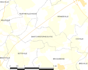
Saint-Christophe-du-Foc
- commune in Manche, France
- Country:
- Postal Code: 50340
- Coordinates: 49° 33' 21" N, 1° 44' 30" E
- GPS tracks (wikiloc): [Link]
- Area: 3.58 sq km
- Population: 435


Les Pieux
- commune in Manche, France
- Country:
- Postal Code: 50340
- Coordinates: 49° 30' 47" N, 1° 48' 28" E
- GPS tracks (wikiloc): [Link]
- Area: 15.25 sq km
- Population: 3147
- Web site: [Link]


Nouainville
- commune in Manche, France
- Country:
- Postal Code: 50690
- Coordinates: 49° 37' 26" N, 1° 40' 57" E
- GPS tracks (wikiloc): [Link]
- Area: 3.81 sq km
- Population: 552


Précorbin
- former commune in Manche, France
- Country:
- Postal Code: 50810
- Coordinates: 49° 5' 8" N, 0° 57' 43" E
- GPS tracks (wikiloc): [Link]
- Area: 7.21 sq km
- Population: 523
- Web site: [Link]


Saint-Jean-de-Savigny
- commune in Manche, France
- Country:
- Postal Code: 50680
- Coordinates: 49° 11' 40" N, 0° 59' 34" E
- GPS tracks (wikiloc): [Link]
- Area: 7.58 sq km
- Population: 428

Notre-Dame-d'Elle
- former commune in Manche, France
- Country:
- Postal Code: 50810
- Coordinates: 49° 6' 39" N, 0° 57' 35" E
- GPS tracks (wikiloc): [Link]
- Area: 2.85 sq km
- Population: 181


Reffuveille
- commune in Manche, France
- Country:
- Postal Code: 50520
- Coordinates: 48° 40' 6" N, 1° 6' 55" E
- GPS tracks (wikiloc): [Link]
- Area: 23.34 sq km
- Population: 501


Saint-Jean-de-Daye
- commune in Manche, France
- Country:
- Postal Code: 50880
- Coordinates: 49° 13' 40" N, 1° 8' 16" E
- GPS tracks (wikiloc): [Link]
- Area: 4.24 sq km
- Population: 617


Rauville-la-Place
- commune in Manche, France
- Country:
- Postal Code: 50390
- Coordinates: 49° 23' 18" N, 1° 30' 17" E
- GPS tracks (wikiloc): [Link]
- Area: 11.88 sq km
- Population: 386

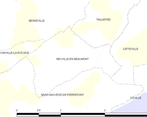
Neuville-en-Beaumont
- commune in Manche, France
- Country:
- Postal Code: 50250
- Coordinates: 49° 20' 52" N, 1° 35' 58" E
- GPS tracks (wikiloc): [Link]
- Area: 1.69 sq km
- Population: 39


Saint-André-de-l'Épine
- commune in Manche, France
- Country:
- Postal Code: 50680
- Coordinates: 49° 8' 22" N, 1° 0' 39" E
- GPS tracks (wikiloc): [Link]
- Area: 7.24 sq km
- Population: 560
- Web site: [Link]


Saint-Jean-du-Corail
- former commune in Manche, France
- Country:
- Postal Code: 50140
- Coordinates: 48° 36' 33" N, 0° 54' 33" E
- GPS tracks (wikiloc): [Link]
- Area: 14.04 sq km
- Population: 243


Ozeville
- commune in Manche, France
- Country:
- Postal Code: 50310
- Coordinates: 49° 30' 8" N, 1° 20' 22" E
- GPS tracks (wikiloc): [Link]
- Area: 4.7 sq km
- Population: 156

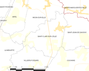
Saint-Clair-sur-l'Elle
- commune in Manche, France
- Country:
- Postal Code: 50680
- Coordinates: 49° 11' 32" N, 1° 1' 46" E
- GPS tracks (wikiloc): [Link]
- Area: 7.99 sq km
- Population: 944
- Web site: [Link]


Réville
- commune in Manche, France
- Country:
- Postal Code: 50760
- Coordinates: 49° 37' 8" N, 1° 15' 29" E
- GPS tracks (wikiloc): [Link]
- Area: 10.55 sq km
- Population: 1092


Saint-Brice
- commune in Manche, France
- Country:
- Postal Code: 50300
- Coordinates: 48° 41' 54" N, 1° 18' 28" E
- GPS tracks (wikiloc): [Link]
- AboveSeaLevel: 80 м m
- Area: 2.55 sq km
- Population: 138
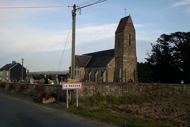

Le Perron
- commune in Manche, France
- Country:
- Postal Code: 50160
- Coordinates: 49° 3' 9" N, 0° 54' 5" E
- GPS tracks (wikiloc): [Link]
- Area: 4.66 sq km
- Population: 215


Prétot-Sainte-Suzanne
- former commune in Manche, France
- Country:
- Postal Code: 50250
- Coordinates: 49° 19' 29" N, 1° 26' 14" E
- GPS tracks (wikiloc): [Link]
- Area: 11.64 sq km
- Population: 295

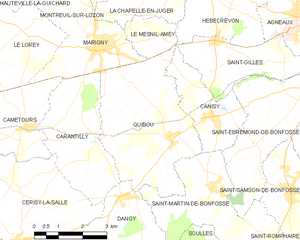
Quibou
- commune in Manche, France
- Country:
- Postal Code: 50750
- Coordinates: 49° 4' 0" N, 1° 12' 0" E
- GPS tracks (wikiloc): [Link]
- Area: 17.15 sq km
- Population: 933


Saint-Hilaire-Petitville
- commune in Manche, France
- Country:
- Postal Code: 50500
- Coordinates: 49° 18' 14" N, 1° 13' 40" E
- GPS tracks (wikiloc): [Link]
- Area: 9.99 sq km
- Population: 1385
- Web site: [Link]


Saint-Georges-d'Elle
- commune in Manche, France
- Country:
- Postal Code: 50680
- Coordinates: 49° 8' 54" N, 0° 58' 17" E
- GPS tracks (wikiloc): [Link]
- Area: 8.96 sq km
- Population: 397


Rouxeville
- former commune in Manche, France
- Country:
- Postal Code: 50810
- Coordinates: 49° 6' 5" N, 0° 56' 53" E
- GPS tracks (wikiloc): [Link]
- Area: 5.83 sq km
- Population: 344


La Pernelle
- commune in Manche, France
- Country:
- Postal Code: 50630
- Coordinates: 49° 37' 11" N, 1° 17' 55" E
- GPS tracks (wikiloc): [Link]
- Area: 7.23 sq km
- Population: 253


Quinéville
- commune in Manche, France
- Country:
- Postal Code: 50310
- Coordinates: 49° 30' 44" N, 1° 17' 50" E
- GPS tracks (wikiloc): [Link]
- Area: 4.6 sq km
- Population: 286

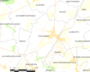
Pont-Hébert
- former commune in Manche, France
- Country:
- Postal Code: 50880
- Coordinates: 49° 10' 1" N, 1° 8' 0" E
- GPS tracks (wikiloc): [Link]
- Area: 14.99 sq km
- Population: 1722

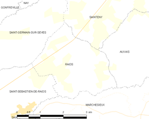
Raids
- commune in Manche, France
- Country:
- Postal Code: 50500
- Coordinates: 49° 13' 1" N, 1° 20' 39" E
- GPS tracks (wikiloc): [Link]
- Area: 6.8 sq km
- Population: 182


Nay
- commune in Manche, France
- Country:
- Postal Code: 50190
- Coordinates: 49° 14' 23" N, 1° 22' 25" E
- GPS tracks (wikiloc): [Link]
- Area: 2.51 sq km
- Population: 73


Rauville-la-Bigot
- commune in Manche, France
- Country:
- Postal Code: 50260
- Coordinates: 49° 31' 7" N, 1° 41' 1" E
- GPS tracks (wikiloc): [Link]
- Area: 17.16 sq km
- Population: 1155


Montfarville
- commune in Manche, France
- Country:
- Postal Code: 50760
- Coordinates: 49° 39' 16" N, 1° 16' 11" E
- GPS tracks (wikiloc): [Link]
- Area: 5.4 sq km
- Population: 811


Monthuchon
- commune in Manche, France
- Country:
- Postal Code: 50200
- Coordinates: 49° 4' 56" N, 1° 25' 19" E
- GPS tracks (wikiloc): [Link]
- Area: 7.66 sq km
- Population: 651

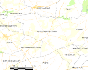
Notre-Dame-de-Cenilly
- commune in Manche, France
- Country:
- Postal Code: 50210
- Coordinates: 48° 59' 43" N, 1° 15' 29" E
- GPS tracks (wikiloc): [Link]
- Area: 25.23 sq km
- Population: 675


Le Mesnil
- commune in Manche, France
- Country:
- Postal Code: 50580
- Coordinates: 49° 22' 9" N, 1° 41' 41" E
- GPS tracks (wikiloc): [Link]
- Area: 3.45 sq km
- Population: 217


Morsalines
- commune in Manche, France
- Country:
- Postal Code: 50630
- Coordinates: 49° 34' 22" N, 1° 18' 46" E
- GPS tracks (wikiloc): [Link]
- Area: 3.65 sq km
- Population: 201


Morville
- commune in Manche, France
- Country:
- Postal Code: 50700
- Coordinates: 49° 28' 25" N, 1° 30' 45" E
- GPS tracks (wikiloc): [Link]
- Area: 7.08 sq km
- Population: 258
- Web site: [Link]


Moyon
- former commune in Manche, France
- Country:
- Postal Code: 50860
- Coordinates: 49° 0' 3" N, 1° 7' 7" E
- GPS tracks (wikiloc): [Link]
- Area: 23.74 sq km
- Population: 1145
- Web site: [Link]


Margueray
- commune in Manche, France
- Country:
- Postal Code: 50410
- Coordinates: 48° 53' 47" N, 1° 8' 34" E
- GPS tracks (wikiloc): [Link]
- Area: 4.64 sq km
- Population: 132


Le Rozel
- commune in Manche, France
- Country:
- Postal Code: 50340
- Coordinates: 49° 29' 13" N, 1° 49' 44" E
- GPS tracks (wikiloc): [Link]
- Area: 5.52 sq km
- Population: 250


Négreville
- commune in Manche, France
- Country:
- Postal Code: 50260
- Coordinates: 49° 29' 23" N, 1° 32' 50" E
- GPS tracks (wikiloc): [Link]
- Area: 11.48 sq km
- Population: 807


Marchésieux
- commune in Manche, France
- Country:
- Postal Code: 50190
- Coordinates: 49° 11' 15" N, 1° 17' 28" E
- GPS tracks (wikiloc): [Link]
- Area: 19.89 sq km
- Population: 724

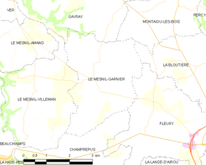
Le Mesnil-Garnier
- commune in Manche, France
- Country:
- Postal Code: 50450
- Coordinates: 48° 51' 55" N, 1° 18' 35" E
- GPS tracks (wikiloc): [Link]
- Area: 10.41 sq km
- Population: 232

Folligny
- commune in Manche, France
- Country:
- Postal Code: 50320
- Coordinates: 48° 49' 26" N, 1° 24' 41" E
- GPS tracks (wikiloc): [Link]
- Area: 11.8 sq km
- Population: 1079


Guilberville
- former commune in Manche, France
- Country:
- Postal Code: 50160
- Coordinates: 48° 59' 18" N, 0° 56' 51" E
- GPS tracks (wikiloc): [Link]
- Area: 22.15 sq km
- Population: 1209
- Web site: [Link]

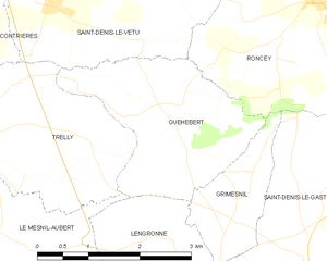
Guéhébert
- commune in Manche, France
- Country:
- Postal Code: 50210
- Coordinates: 48° 58' 12" N, 1° 22' 24" E
- GPS tracks (wikiloc): [Link]
- AboveSeaLevel: 67 м m
- Area: 6.29 sq km
- Population: 121

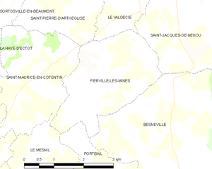
Fierville-les-Mines
- commune in Manche, France
- Country:
- Postal Code: 50580
- Coordinates: 49° 23' 27" N, 1° 40' 10" E
- GPS tracks (wikiloc): [Link]
- Area: 7.44 sq km
- Population: 331


La Lucerne-d'Outremer
- commune in Manche, France
- Country:
- Postal Code: 50320
- Coordinates: 48° 47' 4" N, 1° 25' 36" E
- GPS tracks (wikiloc): [Link]
- Area: 14.48 sq km
- Population: 838


Le Lorey
- commune in Manche, France
- Country:
- Postal Code: 50570
- Coordinates: 49° 5' 38" N, 1° 18' 23" E
- GPS tracks (wikiloc): [Link]
- Area: 14.57 sq km
- Population: 614


Marcilly
- commune in Manche, France
- Country:
- Postal Code: 50220
- Coordinates: 48° 38' 53" N, 1° 15' 7" E
- GPS tracks (wikiloc): [Link]
- AboveSeaLevel: 21 м m
- Area: 8.86 sq km
- Population: 341

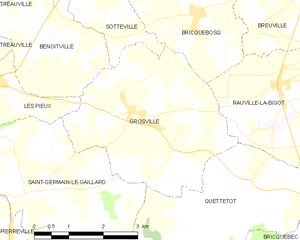
Grosville
- commune in Manche, France
- Country:
- Postal Code: 50340
- Coordinates: 49° 30' 34" N, 1° 44' 35" E
- GPS tracks (wikiloc): [Link]
- Area: 13.15 sq km
- Population: 787

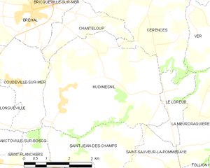
Hudimesnil
- commune in Manche, France
- Country:
- Postal Code: 50510
- Coordinates: 48° 51' 46" N, 1° 29' 33" E
- GPS tracks (wikiloc): [Link]
- Area: 18.68 sq km
- Population: 873


Éroudeville
- commune in Manche, France
- Country:
- Postal Code: 50310
- Coordinates: 49° 28' 36" N, 1° 23' 23" E
- GPS tracks (wikiloc): [Link]
- Area: 4.86 sq km
- Population: 237


Flottemanville
- commune in Manche, France
- Country:
- Postal Code: 50700
- Coordinates: 49° 28' 28" N, 1° 27' 19" E
- GPS tracks (wikiloc): [Link]
- Area: 4.85 sq km
- Population: 184


Le Loreur
- commune in Manche, France
- Country:
- Postal Code: 50510
- Coordinates: 48° 52' 10" N, 1° 25' 52" E
- GPS tracks (wikiloc): [Link]
- Area: 3.23 sq km
- Population: 274


Lapenty
- commune in Manche, France
- Country:
- Postal Code: 50600
- Coordinates: 48° 34' 45" N, 1° 0' 25" E
- GPS tracks (wikiloc): [Link]
- Area: 14.89 sq km
- Population: 387
- Web site: [Link]


Macey
- former commune in Manche, France
- Country:
- Postal Code: 50170
- Coordinates: 48° 33' 42" N, 1° 26' 9" E
- GPS tracks (wikiloc): [Link]
- Area: 5.87 sq km
- Population: 125
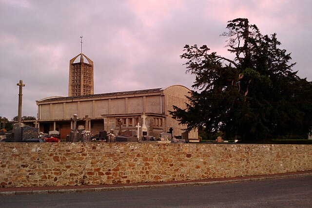
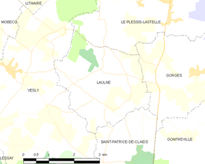
Laulne
- commune in Manche, France
- Country:
- Postal Code: 50430
- Coordinates: 49° 14' 57" N, 1° 28' 18" E
- GPS tracks (wikiloc): [Link]
- Area: 9.06 sq km
- Population: 174


Husson
- former commune in Manche, France
- Country:
- Postal Code: 50640
- Coordinates: 48° 34' 12" N, 0° 53' 33" E
- GPS tracks (wikiloc): [Link]
- Area: 13.59 sq km
- Population: 182

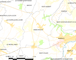
Hébécrevon
- former commune in Manche, France
- Country:
- Postal Code: 50180
- Coordinates: 49° 7' 34" N, 1° 9' 59" E
- GPS tracks (wikiloc): [Link]
- Area: 13.39 sq km
- Population: 1129


Fervaches
- former commune in Manche, France
- Country:
- Postal Code: 50420
- Coordinates: 48° 59' 42" N, 1° 5' 8" E
- GPS tracks (wikiloc): [Link]
- Area: 4.89 sq km
- Population: 393


Le Mesnil-Gilbert
- commune in Manche, France
- Country:
- Postal Code: 50670
- Coordinates: 48° 42' 53" N, 1° 3' 52" E
- GPS tracks (wikiloc): [Link]
- Area: 7.85 sq km
- Population: 141


Montchaton
- former commune in Manche, France
- Country:
- Postal Code: 50660
- Coordinates: 49° 0' 31" N, 1° 29' 55" E
- GPS tracks (wikiloc): [Link]
- Area: 6.5 sq km
- Population: 315

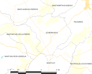
Le Mesnilbus
- commune in Manche, France
- Country:
- Postal Code: 50490
- Coordinates: 49° 8' 0" N, 1° 20' 58" E
- GPS tracks (wikiloc): [Link]
- Area: 4.98 sq km
- Population: 333

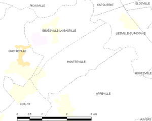
Houtteville
- former commune in Manche, France
- Country:
- Postal Code: 50250
- Coordinates: 49° 20' 18" N, 1° 21' 44" E
- GPS tracks (wikiloc): [Link]
- Area: 4.51 sq km
- Population: 79


Heugueville-sur-Sienne
- commune in Manche, France
- Country:
- Postal Code: 50200
- Coordinates: 49° 2' 8" N, 1° 31' 27" E
- GPS tracks (wikiloc): [Link]
- Area: 5.88 sq km
- Population: 540


Juvigny-le-Tertre
- former commune in Manche, France
- Country:
- Postal Code: 50520
- Coordinates: 48° 40' 37" N, 1° 1' 16" E
- GPS tracks (wikiloc): [Link]
- Area: 7.5 sq km
- Population: 576


Bellefontaine
- former commune in Manche, France
- Country:
- Postal Code: 50520
- Coordinates: 48° 41' 20" N, 0° 58' 27" E
- GPS tracks (wikiloc): [Link]
- Area: 6.73 sq km
- Population: 133


Les Chéris
- former commune in Manche, France
- Country:
- Postal Code: 50220
- Coordinates: 48° 38' 1" N, 1° 15' 37" E
- GPS tracks (wikiloc): [Link]
- Area: 5.87 sq km
- Population: 263

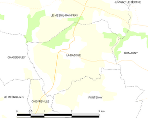
La Bazoge
- former commune in Manche, France
- Country:
- Postal Code: 50520
- Coordinates: 48° 38' 45" N, 1° 1' 44" E
- GPS tracks (wikiloc): [Link]
- Area: 5.8 sq km
- Population: 151


Bricqueville-la-Blouette
- commune in Manche, France
- Country:
- Postal Code: 50200
- Coordinates: 49° 2' 3" N, 1° 28' 43" E
- GPS tracks (wikiloc): [Link]
- Area: 6.25 sq km
- Population: 561
- Web site: [Link]


Chaulieu
- commune in Manche, France
- Country:
- Postal Code: 50150
- Coordinates: 48° 44' 8" N, 0° 51' 43" E
- GPS tracks (wikiloc): [Link]
- Area: 10.64 sq km
- Population: 302

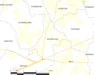
Chèvreville
- former commune in Manche, France
- Country:
- Postal Code: 50600
- Coordinates: 48° 36' 51" N, 1° 2' 50" E
- GPS tracks (wikiloc): [Link]
- Area: 4.45 sq km
- Population: 214


Le Mesnil-au-Val
- commune in Manche, France
- Country:
- Postal Code: 50110
- Coordinates: 49° 36' 24" N, 1° 31' 28" E
- GPS tracks (wikiloc): [Link]
- Area: 13.34 sq km
- Population: 727


Héauville
- commune in Manche, France
- Country:
- Postal Code: 50340
- Coordinates: 49° 34' 52" N, 1° 48' 0" E
- GPS tracks (wikiloc): [Link]
- Area: 10.83 sq km
- Population: 479


La Bloutière
- commune in Manche, France
- Country:
- Postal Code: 50800
- Coordinates: 48° 52' 30" N, 1° 14' 21" E
- GPS tracks (wikiloc): [Link]
- Area: 9.31 sq km
- Population: 421


La Chaise-Baudouin
- commune in Manche, France
- Country:
- Postal Code: 50370
- Coordinates: 48° 45' 49" N, 1° 14' 13" E
- GPS tracks (wikiloc): [Link]
- Area: 12.06 sq km
- Population: 489

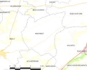
Montabot
- commune in Manche, France
- Country:
- Postal Code: 50410
- Coordinates: 48° 56' 5" N, 1° 7' 31" E
- GPS tracks (wikiloc): [Link]
- Area: 11.56 sq km
- Population: 274


Gavray
- commune in Manche, France
- Country:
- Postal Code: 50450
- Coordinates: 48° 54' 40" N, 1° 21' 2" E
- GPS tracks (wikiloc): [Link]
- Area: 20.6 sq km
- Population: 1462
- Web site: [Link]


Cosqueville
- former commune in Manche, France
- Country:
- Postal Code: 50330
- Coordinates: 49° 41' 39" N, 1° 24' 32" E
- GPS tracks (wikiloc): [Link]
- Area: 10.9 sq km
- Population: 582


Lingeard
- commune in Manche, France
- Country:
- Postal Code: 50670
- Coordinates: 48° 44' 20" N, 1° 1' 35" E
- GPS tracks (wikiloc): [Link]
- Area: 3.65 sq km
- Population: 80


La Godefroy
- commune in Manche, France
- Country:
- Postal Code: 50300
- Coordinates: 48° 41' 23" N, 1° 17' 21" E
- GPS tracks (wikiloc): [Link]
- Area: 3.65 sq km
- Population: 266


Maupertus-sur-Mer
- commune in Manche, France
- Country:
- Postal Code: 50330
- Coordinates: 49° 39' 28" N, 1° 29' 4" E
- GPS tracks (wikiloc): [Link]
- Area: 3.42 sq km
- Population: 221

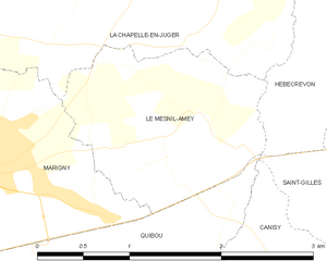
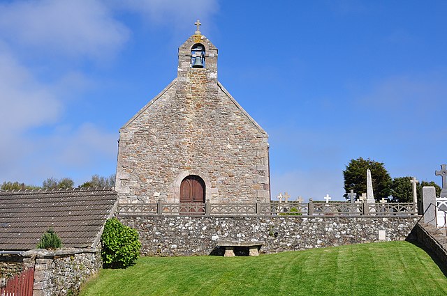
Le Mesnil-Amey
- commune in Manche, France
- Country:
- Postal Code: 50570
- Coordinates: 49° 6' 14" N, 1° 12' 42" E
- GPS tracks (wikiloc): [Link]
- Area: 2.81 sq km
- Population: 272


Ferrières
- former commune in Manche, France
- Country:
- Postal Code: 50640
- Coordinates: 48° 32' 38" N, 0° 57' 27" E
- GPS tracks (wikiloc): [Link]
- AboveSeaLevel: 129 м m
- Area: 3.51 sq km
- Population: 53


Magneville
- commune in Manche, France
- Country:
- Postal Code: 50260
- Coordinates: 49° 26' 51" N, 1° 32' 45" E
- GPS tracks (wikiloc): [Link]
- Area: 9.49 sq km
- Population: 335

Herqueville
- former commune in Manche, France
- Country:
- Postal Code: 50440
- Coordinates: 49° 40' 3" N, 1° 52' 39" E
- GPS tracks (wikiloc): [Link]
- Area: 2.91 sq km
- Population: 159


Lozon
- former commune in Manche, France
- Country:
- Postal Code: 50570
- Coordinates: 49° 8' 33" N, 1° 15' 46" E
- GPS tracks (wikiloc): [Link]
- Area: 8.86 sq km
- Population: 301


Le Grand-Celland
- commune in Manche, France
- Country:
- Postal Code: 50370
- Coordinates: 48° 40' 51" N, 1° 11' 9" E
- GPS tracks (wikiloc): [Link]
- Area: 12.45 sq km
- Population: 575
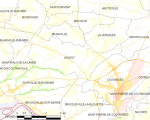
Gratot
- commune in Manche, France
- Country:
- Postal Code: 50200
- Coordinates: 49° 4' 7" N, 1° 29' 45" E
- GPS tracks (wikiloc): [Link]
- Area: 10.73 sq km
- Population: 646
- Web site: [Link]


Le Guislain
- commune in Manche, France
- Country:
- Postal Code: 50410
- Coordinates: 48° 58' 20" N, 1° 13' 44" E
- GPS tracks (wikiloc): [Link]
- Area: 5.39 sq km
- Population: 128


Gathemo
- commune in Manche, France
- Country:
- Postal Code: 50150
- Coordinates: 48° 45' 55" N, 0° 58' 33" E
- GPS tracks (wikiloc): [Link]
- Area: 10.41 sq km
- Population: 242


Coudeville-sur-Mer
- commune in Manche, France
- Country:
- Postal Code: 50290
- Coordinates: 48° 52' 52" N, 1° 31' 37" E
- GPS tracks (wikiloc): [Link]
- Area: 8.7 sq km
- Population: 859
- Web site: [Link]


Le Mesnil-Amand
- commune in Manche, France
- Country:
- Postal Code: 50450
- Coordinates: 48° 52' 53" N, 1° 21' 46" E
- GPS tracks (wikiloc): [Link]
- Area: 6.78 sq km
- Population: 174


La Barre-de-Semilly
- commune in Manche, France
- Country:
- Postal Code: 50810
- Coordinates: 49° 6' 41" N, 1° 2' 3" E
- GPS tracks (wikiloc): [Link]
- Area: 7.74 sq km
- Population: 992


Les Moitiers-d'Allonne
- commune in Manche, France
- Country:
- Postal Code: 50270
- Coordinates: 49° 24' 6" N, 1° 46' 46" E
- GPS tracks (wikiloc): [Link]
- Area: 17.21 sq km
- Population: 661
- Web site: [Link]


Chérencé-le-Roussel
- former commune in Manche, France
- Country:
- Postal Code: 50520
- Coordinates: 48° 42' 31" N, 1° 1' 1" E
- GPS tracks (wikiloc): [Link]
- Area: 10.95 sq km
- Population: 305


L'Étang-Bertrand
- commune in Manche, France
- Country:
- Postal Code: 50260
- Coordinates: 49° 27' 54" N, 1° 33' 46" E
- GPS tracks (wikiloc): [Link]
- Area: 8.74 sq km
- Population: 339


Le Dézert
- commune in Manche, France
- Country:
- Postal Code: 50620
- Coordinates: 49° 12' 15" N, 1° 9' 52" E
- GPS tracks (wikiloc): [Link]
- Area: 14.58 sq km
- Population: 573
- Web site: [Link]

Joganville
- commune in Manche, France
- Country:
- Postal Code: 50310
- Coordinates: 49° 28' 12" N, 1° 20' 56" E
- GPS tracks (wikiloc): [Link]
- Area: 2.87 sq km
- Population: 108


Gouvets
- commune in Manche, France
- Country:
- Postal Code: 50420
- Coordinates: 48° 55' 57" N, 1° 5' 47" E
- GPS tracks (wikiloc): [Link]
- Area: 11.01 sq km
- Population: 268


Bricquebosq
- commune in Manche, France
- Country:
- Postal Code: 50340
- Coordinates: 49° 32' 6" N, 1° 43' 6" E
- GPS tracks (wikiloc): [Link]
- Area: 8.05 sq km
- Population: 582


Écausseville
- commune in Manche, France
- Country:
- Postal Code: 50310
- Coordinates: 49° 27' 44" N, 1° 22' 28" E
- GPS tracks (wikiloc): [Link]
- Area: 5.27 sq km
- Population: 100


La Lande-d'Airou
- commune in Manche, France
- Country:
- Postal Code: 50800
- Coordinates: 48° 48' 58" N, 1° 17' 25" E
- GPS tracks (wikiloc): [Link]
- Area: 15.1 sq km
- Population: 514


Chérencé-le-Héron
- commune in Manche, France
- Country:
- Postal Code: 50800
- Coordinates: 48° 48' 7" N, 1° 11' 48" E
- GPS tracks (wikiloc): [Link]
- AboveSeaLevel: 230 м m
- Area: 9.54 sq km
- Population: 388


La Haye-Bellefond
- commune in Manche, France
- Country:
- Postal Code: 50410
- Coordinates: 48° 59' 1" N, 1° 11' 3" E
- GPS tracks (wikiloc): [Link]
- Area: 2.82 sq km
- Population: 84


Équeurdreville-Hainneville
- former commune in Manche, France
- Country:
- Postal Code: 50120
- Coordinates: 49° 38' 54" N, 1° 39' 17" E
- GPS tracks (wikiloc): [Link]
- AboveSeaLevel: 10 м m
- Area: 12.83 sq km
- Population: 16992
- Web site: [Link]

Brévands
- former commune in Manche, France
- Country:
- Postal Code: 50500
- Coordinates: 49° 19' 54" N, 1° 11' 0" E
- GPS tracks (wikiloc): [Link]
- Area: 13.87 sq km
- Population: 306

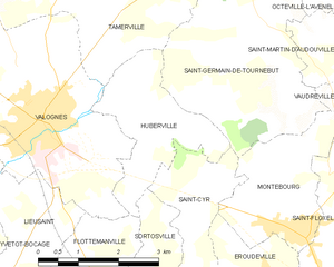
Huberville
- commune in Manche, France
- Country:
- Postal Code: 50700
- Coordinates: 49° 30' 37" N, 1° 26' 15" E
- GPS tracks (wikiloc): [Link]
- Area: 5.76 sq km
- Population: 370

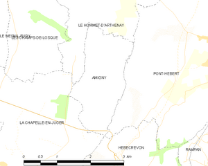
Amigny
- commune in Manche, France
- Country:
- Postal Code: 50620
- Coordinates: 49° 9' 20" N, 1° 10' 46" E
- GPS tracks (wikiloc): [Link]
- Area: 3.69 sq km
- Population: 144


Bion
- former commune in Manche, France
- Country:
- Postal Code: 50140
- Coordinates: 48° 37' 11" N, 0° 55' 9" E
- GPS tracks (wikiloc): [Link]
- Area: 12.67 sq km
- Population: 378


Jobourg
- former commune in Manche, France
- Country:
- Postal Code: 50440
- Coordinates: 49° 40' 58" N, 1° 54' 14" E
- GPS tracks (wikiloc): [Link]
- Area: 10.15 sq km
- Population: 482


Saint-Sauveur-de-Pierrepont
- commune in Manche, France
- Country:
- Postal Code: 50250
- Coordinates: 49° 20' 8" N, 1° 35' 39" E
- GPS tracks (wikiloc): [Link]
- Area: 8.18 sq km
- Population: 138


Saint-Martin-le-Gréard
- commune in Manche, France
- Country:
- Postal Code: 50690
- Coordinates: 49° 33' 27" N, 1° 39' 3" E
- GPS tracks (wikiloc): [Link]
- Area: 2.86 sq km
- Population: 491
- Web site: [Link]


Saint-Sauveur-la-Pommeraye
- commune in Manche, France
- Country:
- Postal Code: 50510
- Coordinates: 48° 50' 46" N, 1° 26' 42" E
- GPS tracks (wikiloc): [Link]
- Area: 5.27 sq km
- Population: 346

Saint-Patrice-de-Claids
- commune in Manche, France
- Country:
- Postal Code: 50190
- Coordinates: 49° 13' 48" N, 1° 26' 13" E
- GPS tracks (wikiloc): [Link]
- Area: 5.58 sq km
- Population: 165


Hocquigny
- commune in Manche, France
- Country:
- Postal Code: 50320
- Coordinates: 48° 48' 49" N, 1° 24' 20" E
- GPS tracks (wikiloc): [Link]
- Area: 3.05 sq km
- Population: 185


Saint-Cyr-du-Bailleul
- commune in Manche, France
- Country:
- Postal Code: 50720
- Coordinates: 48° 33' 57" N, 0° 48' 0" E
- GPS tracks (wikiloc): [Link]
- Area: 23.41 sq km
- Population: 393


Le Mesnil-Villeman
- commune in Manche, France
- Country:
- Postal Code: 50450
- Coordinates: 48° 51' 52" N, 1° 19' 39" E
- GPS tracks (wikiloc): [Link]
- Area: 10.8 sq km
- Population: 240
- Web site: [Link]


Le Mesnil-Véneron
- commune in Manche, France
- Country:
- Postal Code: 50620
- Coordinates: 49° 13' 35" N, 1° 9' 52" E
- GPS tracks (wikiloc): [Link]
- Area: 2.86 sq km
- Population: 128


Le Mesnil-Rainfray
- former commune in Manche, France
- Country:
- Postal Code: 50520
- Coordinates: 48° 40' 1" N, 1° 3' 23" E
- GPS tracks (wikiloc): [Link]
- Area: 11.47 sq km
- Population: 212


Le Mesnil-Raoult
- former commune in Manche, France
- Country:
- Postal Code: 50420
- Coordinates: 49° 2' 4" N, 1° 3' 38" E
- GPS tracks (wikiloc): [Link]
- Area: 3.98 sq km
- Population: 375


Millières
- commune in Manche, France
- Country:
- Postal Code: 50190
- Coordinates: 49° 11' 8" N, 1° 27' 33" E
- GPS tracks (wikiloc): [Link]
- Area: 20.27 sq km
- Population: 788

Le Mesnil-Rouxelin
- commune in Manche, France
- Country:
- Postal Code: 50000
- Coordinates: 49° 8' 52" N, 1° 5' 11" E
- GPS tracks (wikiloc): [Link]
- Area: 4.74 sq km
- Population: 518

Le Mesnillard
- commune in Manche, France
- Country:
- Postal Code: 50600
- Coordinates: 48° 37' 38" N, 1° 4' 22" E
- GPS tracks (wikiloc): [Link]
- Area: 9.75 sq km
- Population: 282

La Chapelle-Cécelin
- commune in Manche, France
- Country:
- Postal Code: 50800
- Coordinates: 48° 48' 39" N, 1° 9' 38" E
- GPS tracks (wikiloc): [Link]
- Area: 5.22 sq km
- Population: 238


Saint-Clément-Rancoudray
- commune in Manche, France
- Country:
- Postal Code: 50140
- Coordinates: 48° 40' 28" N, 0° 53' 12" E
- GPS tracks (wikiloc): [Link]
- AboveSeaLevel: 315 м m
- Area: 32.1 sq km
- Population: 545

Milly
- former commune in Manche, France
- Country:
- Postal Code: 50600
- Coordinates: 48° 36' 8" N, 1° 1' 12" E
- GPS tracks (wikiloc): [Link]
- Area: 9.65 sq km
- Population: 339

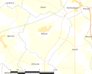
Précey
- commune in Manche, France
- Country:
- Postal Code: 50220
- Coordinates: 48° 36' 27" N, 1° 22' 39" E
- GPS tracks (wikiloc): [Link]
- Area: 7.73 sq km
- Population: 539
- Web site: [Link]


Saint-Aubin-des-Préaux
- commune in Manche, France
- Country:
- Postal Code: 50380
- Coordinates: 48° 48' 15" N, 1° 30' 28" E
- GPS tracks (wikiloc): [Link]
- Area: 8.24 sq km
- Population: 425
- Web site: [Link]


Anneville-sur-Mer
- commune in Manche, France
- Country:
- Postal Code: 50560
- Coordinates: 49° 7' 6" N, 1° 34' 49" E
- GPS tracks (wikiloc): [Link]
- Area: 3.73 sq km
- Population: 241

Le Mesnil-Vigot
- former commune in Manche, France
- Country:
- Postal Code: 50570
- Coordinates: 49° 9' 20" N, 1° 16' 55" E
- GPS tracks (wikiloc): [Link]
- Area: 3.26 sq km
- Population: 219


Saint-Denis-le-Vêtu
- commune in Manche, France
- Country:
- Postal Code: 50210
- Coordinates: 48° 59' 10" N, 1° 24' 11" E
- GPS tracks (wikiloc): [Link]
- Area: 14.08 sq km
- Population: 618

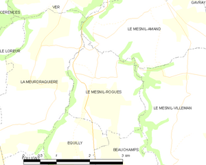
Le Mesnil-Rogues
- commune in Manche, France
- Country:
- Postal Code: 50450
- Coordinates: 48° 51' 46" N, 1° 22' 52" E
- GPS tracks (wikiloc): [Link]
- Area: 4.78 sq km
- Population: 155


Sainteny
- former commune in Manche, France
- Country:
- Postal Code: 50500
- Coordinates: 49° 14' 18" N, 1° 18' 51" E
- GPS tracks (wikiloc): [Link]
- AboveSeaLevel: 23 м m
- Area: 21.63 sq km
- Population: 866

Flamanville
- commune in Manche, France
- Country:
- Postal Code: 50340
- Coordinates: 49° 31' 51" N, 1° 51' 59" E
- GPS tracks (wikiloc): [Link]
- Area: 7.22 sq km
- Population: 1724
- Web site: [Link]


Équilly
- commune in Manche, France
- Country:
- Postal Code: 50320
- Coordinates: 48° 50' 24" N, 1° 23' 13" E
- GPS tracks (wikiloc): [Link]
- Area: 5.65 sq km
- Population: 194


Les Loges-sur-Brécey
- commune in Manche, France
- Country:
- Postal Code: 50370
- Coordinates: 48° 45' 57" N, 1° 10' 33" E
- GPS tracks (wikiloc): [Link]
- Area: 5.27 sq km
- Population: 145


Carquebut
- commune in Manche, France
- Country:
- Postal Code: 50480
- Coordinates: 49° 22' 21" N, 1° 19' 48" E
- GPS tracks (wikiloc): [Link]
- Area: 8.54 sq km
- Population: 335

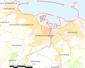
Cherbourg-Octeville
- former city in Manche, France
- Country:
- Postal Code: 50130; 50100
- Coordinates: 49° 38' 20" N, 1° 37' 30" E
- GPS tracks (wikiloc): [Link]
- AboveSeaLevel: 15 м m
- Area: 14.26 sq km
- Population: 36673
- Web site: [Link]


Ducey
- former commune in Manche, France
- Country:
- Postal Code: 50220
- Coordinates: 48° 37' 6" N, 1° 17' 26" E
- GPS tracks (wikiloc): [Link]
- Area: 11.21 sq km
- Population: 2486

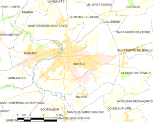
Saint-Lô
- commune in Manche, France
- Country:
- Postal Code: 50000
- Coordinates: 49° 6' 52" N, 1° 5' 30" E
- GPS tracks (wikiloc): [Link]
- AboveSeaLevel: 14 м m
- Area: 23.19 sq km
- Population: 19301
- Web site: [Link]


Liesville-sur-Douve
- commune in Manche, France
- Country:
- Postal Code: 50480
- Coordinates: 49° 21' 15" N, 1° 19' 19" E
- GPS tracks (wikiloc): [Link]
- Area: 5.24 sq km
- Population: 203
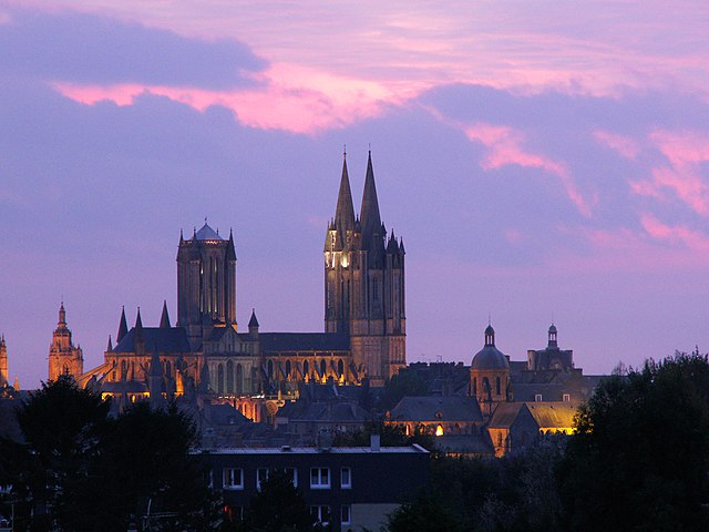
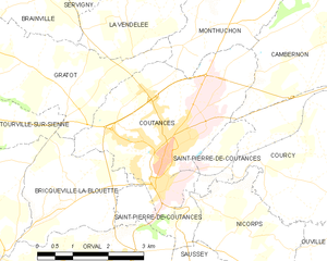
Coutances
- commune in Manche, France
- Country:
- Postal Code: 50200
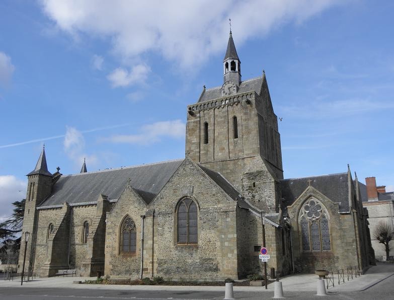
- Coordinates: 49° 3' 0" N, 1° 26' 0" E
- GPS tracks (wikiloc): [Link]
- AboveSeaLevel: 92 м m
- Area: 12.51 sq km
- Population: 8688
- Web site: [Link]

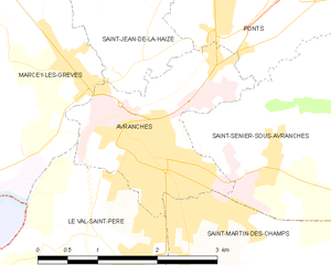
Avranches
- commune in Manche, France
- Country:
- Postal Code: 50300
- Coordinates: 48° 41' 4" N, 1° 21' 25" E
- GPS tracks (wikiloc): [Link]
- Area: 4.5 sq km
- Population: 7766
- Web site: [Link]

Le Mesnil-Angot
- former commune in Manche, France
- Country:
- Postal Code: 50620
- Coordinates: 49° 13' 0" N, 1° 12' 0" E
- GPS tracks (wikiloc): [Link]

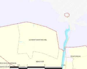
Le Mont-Saint-Michel
- island commune in Manche, Normandy, France
- Country:
- Postal Code: 50170
- Coordinates: 48° 38' 9" N, 1° 30' 37" E
- GPS tracks (wikiloc): [Link]
- Area: 3.97 sq km
- Population: 33
- Web site: [Link]
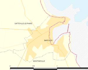
Barfleur
- commune in Manche, France
- Country:
- Postal Code: 50760
- Coordinates: 49° 40' 13" N, 1° 15' 53" E
- GPS tracks (wikiloc): [Link]
- Area: 0.6 sq km
- Population: 579
- Web site: [Link]

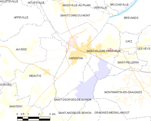
Carentan
- former commune in Manche, France
- Country:
- Postal Code: 50500
- Coordinates: 49° 18' 12" N, 1° 14' 54" E
- GPS tracks (wikiloc): [Link]
- AboveSeaLevel: 6 м m
- Area: 15.66 sq km
- Population: 5892
- Web site: [Link]


Saint-Quentin-sur-le-Homme
- commune in Manche, France
- Country:
- Postal Code: 50220
- Coordinates: 48° 38' 51" N, 1° 19' 0" E
- GPS tracks (wikiloc): [Link]
- Area: 16.84 sq km
- Population: 1219
- Web site: [Link]


Bréhal
- commune in Manche, France
- Country:
- Postal Code: 50290
- Coordinates: 48° 53' 54" N, 1° 30' 42" E
- GPS tracks (wikiloc): [Link]
- Area: 12.71 sq km
- Population: 3277
- Web site: [Link]

Graignes
- former commune in Manche, France
- Country:
- Postal Code: 50620
- Coordinates: 49° 15' 0" N, 1° 12' 0" E
- GPS tracks (wikiloc): [Link]


Sainte-Mère-Église
- former commune in Manche, France
- Country:
- Postal Code: 50480
- Coordinates: 49° 24' 32" N, 1° 19' 4" E
- GPS tracks (wikiloc): [Link]
- AboveSeaLevel: 34 м m
- Area: 17.68 sq km
- Population: 1618
- Web site: [Link]


Écoquenéauville
- former commune in Manche, France
- Country:
- Postal Code: 50480
- Coordinates: 49° 24' 7" N, 1° 17' 31" E
- GPS tracks (wikiloc): [Link]
- Area: 3.52 sq km
- Population: 79


Saint-Michel-de-Montjoie
- commune in Manche, France
- Country:
- Postal Code: 50670
- Coordinates: 48° 45' 48" N, 1° 1' 39" E
- GPS tracks (wikiloc): [Link]
- Area: 14.46 sq km
- Population: 320
Cendres
- former commune in France
- Country:
- Coordinates: 48° 33' 5" N, 1° 30' 54" E
- GPS tracks (wikiloc): [Link]


Mortain
- former commune in Manche, France
- Country:
- Postal Code: 50140
- Coordinates: 48° 38' 52" N, 0° 56' 27" E
- GPS tracks (wikiloc): [Link]
- Area: 7.44 sq km
- Population: 1582
- Web site: [Link]

Pontorson
- commune in Manche, France
- Country:
- Postal Code: 50170
- Coordinates: 48° 33' 12" N, 1° 30' 26" E
- GPS tracks (wikiloc): [Link]
- AboveSeaLevel: 18 м m
- Area: 43.01 sq km
- Population: 3836
- Web site: [Link]


Granville
- commune in Manche, France
- Country:
- Postal Code: 50400
- Coordinates: 48° 50' 17" N, 1° 35' 13" E
- GPS tracks (wikiloc): [Link]
- Area: 9.9 sq km
- Population: 13175
- Web site: [Link]

Saint-Michel-de-Loups
- former commune in Manche, France
- Country:
- Coordinates: 48° 45' 51" N, 1° 31' 48" E
- GPS tracks (wikiloc): [Link]
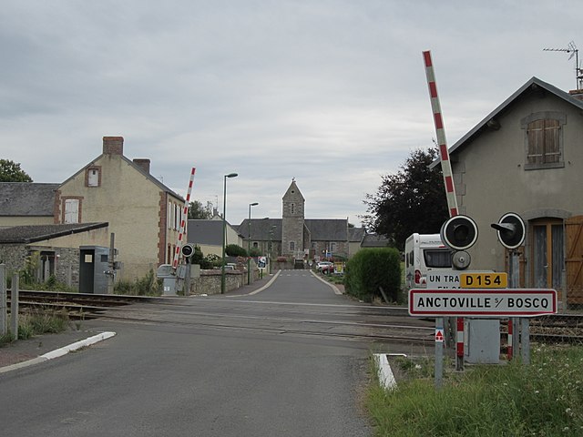
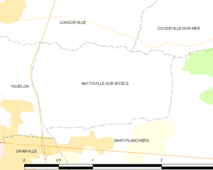
Anctoville-sur-Boscq
- commune in Manche, France
- Country:
- Postal Code: 50400
- Coordinates: 48° 50' 38" N, 1° 31' 56" E
- GPS tracks (wikiloc): [Link]
- AboveSeaLevel: 49 м m
- Area: 2.15 sq km
- Population: 464
- Web site: [Link]

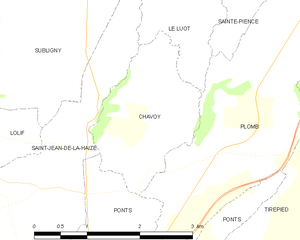
Chavoy
- commune in Manche, France
- Country:
- Postal Code: 50870
- Coordinates: 48° 43' 38" N, 1° 20' 1" E
- GPS tracks (wikiloc): [Link]
- Area: 3.7 sq km
- Population: 126
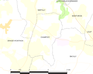
Champcey
- former commune in Manche, France
- Country:
- Postal Code: 50530
- Coordinates: 48° 43' 33" N, 1° 26' 47" E
- GPS tracks (wikiloc): [Link]
- Area: 3.24 sq km
- Population: 225
- Web site: [Link]


La Bonneville
- commune in Manche, France
- Country:
- Postal Code: 50360
- Coordinates: 49° 23' 32" N, 1° 27' 15" E
- GPS tracks (wikiloc): [Link]
- Area: 6.31 sq km
- Population: 202

Amfreville
- former commune in Manche, France
- Country:
- Postal Code: 50480
- Coordinates: 49° 24' 36" N, 1° 23' 34" E
- GPS tracks (wikiloc): [Link]
- Area: 10.1 sq km
- Population: 286


Dragey-Ronthon
- commune in Manche, France
- Country:
- Postal Code: 50530
- Coordinates: 48° 43' 0" N, 1° 30' 0" E
- GPS tracks (wikiloc): [Link]
- AboveSeaLevel: 40 м m
- Area: 15.17 sq km
- Population: 817
- Web site: [Link]


Saint-Jean-de-la-Rivière
- commune in Manche, France
- Country:
- Postal Code: 50270
- Coordinates: 49° 22' 13" N, 1° 44' 19" E
- GPS tracks (wikiloc): [Link]
- Area: 3.57 sq km
- Population: 348
- Web site: [Link]


Couvains
- commune in Manche, France
- Country:
- Postal Code: 50680
- Coordinates: 49° 9' 57" N, 1° 0' 25" E
- GPS tracks (wikiloc): [Link]
- AboveSeaLevel: 100 м m
- Area: 15.03 sq km
- Population: 482


Audouville-la-Hubert
- commune in Manche, France
- Country:
- Postal Code: 50480
- Coordinates: 49° 24' 38" N, 1° 14' 30" E
- GPS tracks (wikiloc): [Link]
- Area: 6.4 sq km
- Population: 80


Agneaux
- commune in Manche, France
- Country:
- Postal Code: 50180
- Coordinates: 49° 7' 0" N, 1° 6' 40" E
- GPS tracks (wikiloc): [Link]
- AboveSeaLevel: 60 м m
- Area: 6.5 sq km
- Population: 4036
- Web site: [Link]


Bourguenolles
- commune in Manche, France
- Country:
- Postal Code: 50800
- Coordinates: 48° 48' 15" N, 1° 17' 52" E
- GPS tracks (wikiloc): [Link]
- Area: 7.65 sq km
- Population: 340


Beaumont-Hague
- former commune in Manche, France
- Country:
- Postal Code: 50440
- Coordinates: 49° 39' 49" N, 1° 50' 14" E
- GPS tracks (wikiloc): [Link]
- Area: 7.9 sq km
- Population: 1458

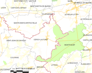
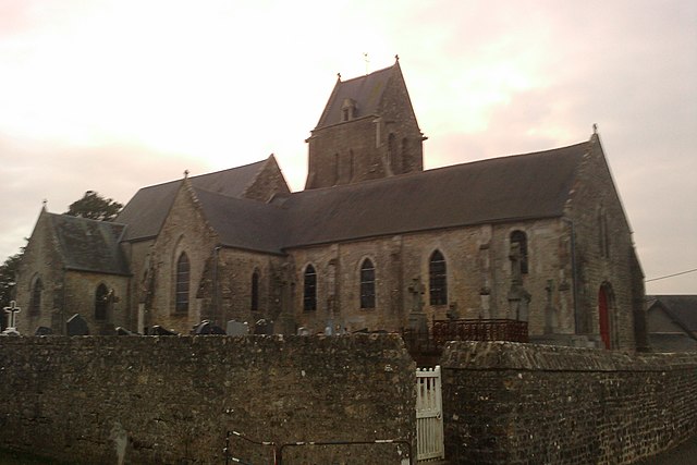
Cerisy-la-Forêt
- commune in Manche, France
- Country:
- Postal Code: 50680
- Coordinates: 49° 11' 42" N, 0° 56' 12" E
- GPS tracks (wikiloc): [Link]
- Area: 23.81 sq km
- Population: 979


Barneville-Carteret
- commune in Manche, France
- Country:
- Postal Code: 50270
- Coordinates: 49° 22' 52" N, 1° 45' 10" E
- GPS tracks (wikiloc): [Link]
- AboveSeaLevel: 47 м m
- Area: 10.29 sq km
- Population: 2218
- Web site: [Link]


Champcervon
- former commune in Manche, France
- Country:
- Postal Code: 50320
- Coordinates: 48° 46' 39" N, 1° 23' 43" E
- GPS tracks (wikiloc): [Link]
- Area: 5.63 sq km
- Population: 215


Néhou
- commune in Manche, France
- Country:
- Postal Code: 50390
- Coordinates: 49° 25' 12" N, 1° 32' 31" E
- GPS tracks (wikiloc): [Link]
- Area: 15.98 sq km
- Population: 611


Huisnes-sur-Mer
- commune in Manche, France
- Country:
- Postal Code: 50170
- Coordinates: 48° 36' 30" N, 1° 27' 1" E
- GPS tracks (wikiloc): [Link]
- Area: 6.75 sq km
- Population: 189

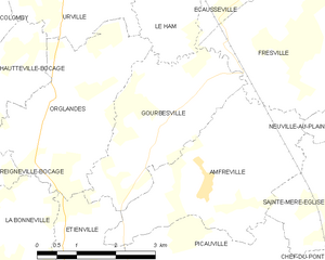
Gourbesville
- former commune in Manche, France
- Country:
- Postal Code: 50480
- Coordinates: 49° 25' 15" N, 1° 24' 36" E
- GPS tracks (wikiloc): [Link]
- Area: 8.18 sq km
- Population: 171


Beuzeville-au-Plain
- former commune in Manche, France
- Country:
- Postal Code: 50480
- Coordinates: 49° 25' 50" N, 1° 17' 10" E
- GPS tracks (wikiloc): [Link]
- Area: 2.04 sq km
- Population: 48

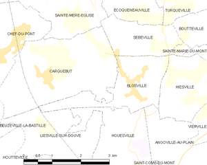
Blosville
- commune in Manche, France
- Country:
- Postal Code: 50480
- Coordinates: 49° 22' 24" N, 1° 17' 27" E
- GPS tracks (wikiloc): [Link]
- Area: 4.22 sq km
- Population: 306

Angoville-au-Plain
- former commune in Manche, France
- Country:
- Postal Code: 50480
- Coordinates: 49° 20' 54" N, 1° 15' 15" E
- GPS tracks (wikiloc): [Link]
- Area: 5.68 sq km
- Population: 85


Beuzeville-la-Bastille
- commune in Manche, France
- Country:
- Postal Code: 50360
- Coordinates: 49° 21' 25" N, 1° 22' 15" E
- GPS tracks (wikiloc): [Link]
- Area: 4.34 sq km
- Population: 151

Bricquebec
- former commune in Manche, France
- Country:
- Postal Code: 50260
- Coordinates: 49° 28' 12" N, 1° 37' 45" E
- GPS tracks (wikiloc): [Link]
- Area: 32.66 sq km
- Population: 4123


Canisy
- former commune in Manche, France
- Country:
- Postal Code: 50860
- Coordinates: 49° 4' 34" N, 1° 10' 32" E
- GPS tracks (wikiloc): [Link]
- Area: 6.25 sq km
- Population: 1049
- Web site: [Link]


Brucheville
- commune in Manche, France
- Country:
- Postal Code: 50480
- Coordinates: 49° 22' 24" N, 1° 12' 19" E
- GPS tracks (wikiloc): [Link]
- Area: 13.33 sq km
- Population: 145


Auderville
- former commune in Manche, France
- Country:
- Postal Code: 50440
- Coordinates: 49° 42' 43" N, 1° 55' 53" E
- GPS tracks (wikiloc): [Link]
- Area: 4.33 sq km
- Population: 244


Boutteville
- commune in Manche, France
- Country:
- Postal Code: 50480
- Coordinates: 49° 23' 21" N, 1° 15' 32" E
- GPS tracks (wikiloc): [Link]
- Area: 1.82 sq km
- Population: 67


Hauteville-la-Guichard
- commune in Manche, France
- Country:
- Postal Code: 50570
- Coordinates: 49° 7' 35" N, 1° 18' 7" E
- GPS tracks (wikiloc): [Link]
- AboveSeaLevel: 75 м m
- Area: 11.98 sq km
- Population: 469
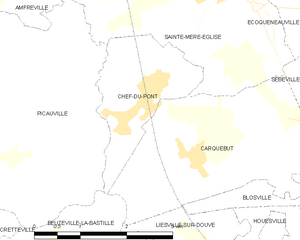
Chef-du-Pont
- former commune in Manche, France
- Country:
- Postal Code: 50480
- Coordinates: 49° 23' 4" N, 1° 20' 39" E
- GPS tracks (wikiloc): [Link]
- Area: 3.78 sq km
- Population: 679
- Web site: [Link]


Foucarville
- former commune in Manche, France
- Country:
- Postal Code: 50480
- Coordinates: 49° 26' 30" N, 1° 15' 26" E
- GPS tracks (wikiloc): [Link]
- Area: 5.06 sq km
- Population: 126


Saint-James
- former commune in Manche, France
- Country:
- Postal Code: 50240
- Coordinates: 48° 31' 18" N, 1° 19' 35" E
- GPS tracks (wikiloc): [Link]
- Area: 17.96 sq km
- Population: 2833
- Web site: [Link]


Quettehou
- commune in Manche, France
- Country:
- Postal Code: 50630
- Coordinates: 49° 35' 33" N, 1° 18' 13" E
- GPS tracks (wikiloc): [Link]
- Area: 16.17 sq km
- Population: 1584
- Web site: [Link]


Le Ham
- commune in Manche, France
- Country:
- Postal Code: 50310
- Coordinates: 49° 27' 3" N, 1° 25' 3" E
- GPS tracks (wikiloc): [Link]
- Area: 3.86 sq km
- Population: 318


Bérigny
- commune in Manche, France
- Country:
- Postal Code: 50810
- Coordinates: 49° 8' 34" N, 0° 56' 27" E
- GPS tracks (wikiloc): [Link]
- Area: 12.15 sq km
- Population: 422


Le Tanu
- commune in Manche, France
- Country:
- Postal Code: 50320
- Coordinates: 48° 48' 59" N, 1° 20' 43" E
- GPS tracks (wikiloc): [Link]
- Area: 10.12 sq km
- Population: 376


Montreuil-sur-Lozon
- commune in Manche, France
- Country:
- Postal Code: 50570
- Coordinates: 49° 8' 14" N, 1° 14' 14" E
- GPS tracks (wikiloc): [Link]
- Area: 6.45 sq km
- Population: 329


Saint-Germain-des-Vaux
- former commune in Manche, France
- Country:
- Postal Code: 50440
- Coordinates: 49° 42' 43" N, 1° 55' 12" E
- GPS tracks (wikiloc): [Link]
- Area: 6.36 sq km
- Population: 343


Remilly-sur-Lozon
- former commune in Manche, France
- Country:
- Postal Code: 50570
- Coordinates: 49° 10' 51" N, 1° 15' 25" E
- GPS tracks (wikiloc): [Link]
- Area: 9.56 sq km
- Population: 687
- Web site: [Link]


Carolles
- commune in Manche, France
- Country:
- Postal Code: 50740
- Coordinates: 48° 45' 4" N, 1° 33' 37" E
- GPS tracks (wikiloc): [Link]
- AboveSeaLevel: 70 м m
- Area: 3.85 sq km
- Population: 754
- Web site: [Link]


Notre-Dame-du-Touchet
- former commune in Manche, France
- Country:
- Postal Code: 50140
- Coordinates: 48° 34' 57" N, 0° 57' 24" E
- GPS tracks (wikiloc): [Link]
- Area: 17.65 sq km
- Population: 633


Bacilly
- commune in Manche, France
- Country:
- Postal Code: 50530
- Coordinates: 48° 42' 4" N, 1° 26' 27" E
- GPS tracks (wikiloc): [Link]
- Area: 15.88 sq km
- Population: 929
- Web site: [Link]
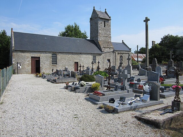

Angey
- former commune in Manche, France
- Country:
- Postal Code: 50530
- Coordinates: 48° 45' 2" N, 1° 29' 28" E
- GPS tracks (wikiloc): [Link]
- Area: 2.47 sq km
- Population: 266
- Web site: [Link]

Martigny
- former commune in Manche, France
- Country:
- Postal Code: 50600
- Coordinates: 48° 36' 52" N, 1° 6' 19" E
- GPS tracks (wikiloc): [Link]
- AboveSeaLevel: 120 м m
- Area: 8.89 sq km
- Population: 284


Cametours
- commune in Manche, France
- Country:
- Postal Code: 50570
- Coordinates: 49° 4' 6" N, 1° 16' 49" E
- GPS tracks (wikiloc): [Link]
- Area: 7.22 sq km
- Population: 431


Ponts
- commune in Manche, France
- Country:
- Postal Code: 50300
- Coordinates: 48° 42' 12" N, 1° 20' 42" E
- GPS tracks (wikiloc): [Link]
- Area: 6.7 sq km
- Population: 615
- Web site: [Link]


Saint-Germain-sur-Sèves
- commune in Manche, France
- Country:
- Postal Code: 50190
- Coordinates: 49° 13' 18" N, 1° 22' 15" E
- GPS tracks (wikiloc): [Link]
- Area: 8.19 sq km
- Population: 195


Saint-Jean-du-Corail-des-Bois
- commune in Manche, France
- Country:
- Postal Code: 50370
- Coordinates: 48° 46' 3" N, 1° 12' 4" E
- GPS tracks (wikiloc): [Link]
- Area: 3.63 sq km
- Population: 71

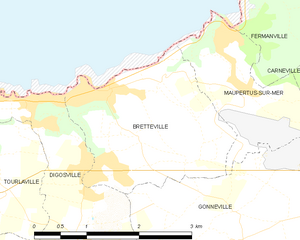
Bretteville
- commune in Manche, France
- Country:
- Postal Code: 50110
- Coordinates: 49° 39' 22" N, 1° 31' 14" E
- GPS tracks (wikiloc): [Link]
- AboveSeaLevel: 69 м m
- Area: 5.78 sq km
- Population: 1089
- Web site: [Link]


La Feuillie
- commune in Manche, France
- Country:
- Postal Code: 50190
- Coordinates: 49° 10' 39" N, 1° 28' 49" E
- GPS tracks (wikiloc): [Link]
- Area: 12.46 sq km
- Population: 273


Hyenville
- former commune in Manche, France
- Country:
- Postal Code: 50660
- Coordinates: 48° 59' 39" N, 1° 28' 7" E
- GPS tracks (wikiloc): [Link]
- Area: 3.39 sq km
- Population: 346


La Trinité
- commune in Manche, France
- Country:
- Postal Code: 50800
- Coordinates: 48° 47' 26" N, 1° 14' 7" E
- GPS tracks (wikiloc): [Link]
- Area: 9.16 sq km
- Population: 400


Muneville-le-Bingard
- commune in Manche, France
- Country:
- Postal Code: 50490
- Coordinates: 49° 7' 15" N, 1° 28' 45" E
- GPS tracks (wikiloc): [Link]
- Area: 19.81 sq km
- Population: 700


Graignes-Mesnil-Angot
- commune in Manche, France
- Country:
- Postal Code: 50620
- Coordinates: 49° 14' 17" N, 1° 12' 5" E
- GPS tracks (wikiloc): [Link]
- Area: 18.35 sq km
- Population: 784


Grimesnil
- commune in Manche, France
- Country:
- Postal Code: 50450
- Coordinates: 48° 57' 14" N, 1° 21' 0" E
- GPS tracks (wikiloc): [Link]
- Area: 2.61 sq km
- Population: 62

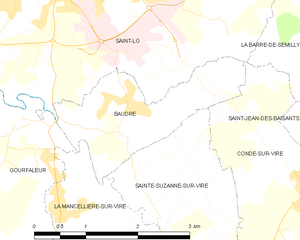
Baudre
- commune in Manche, France
- Country:
- Postal Code: 50000
- Coordinates: 49° 5' 21" N, 1° 4' 23" E
- GPS tracks (wikiloc): [Link]
- Area: 3.81 sq km
- Population: 544
- Web site: [Link]


Montanel
- former commune in Manche, France
- Country:
- Postal Code: 50240
- Coordinates: 48° 29' 44" N, 1° 25' 13" E
- GPS tracks (wikiloc): [Link]
- Area: 15.4 sq km
- Population: 377

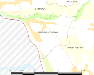
Saint-Jean-le-Thomas
- commune in Manche, France
- Country:
- Postal Code: 50530
- Coordinates: 48° 43' 48" N, 1° 31' 1" E
- GPS tracks (wikiloc): [Link]
- Area: 2.38 sq km
- Population: 423

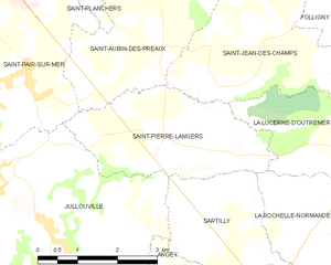
Saint-Pierre-Langers
- commune in Manche, France
- Country:
- Postal Code: 50530
- Coordinates: 48° 47' 4" N, 1° 29' 52" E
- GPS tracks (wikiloc): [Link]
- Area: 8.4 sq km
- Population: 565

Le Mesnil-Aubert
- commune in Manche, France
- Country:
- Postal Code: 50510
- Coordinates: 48° 56' 46" N, 1° 24' 48" E
- GPS tracks (wikiloc): [Link]
- Area: 5.96 sq km
- Population: 176


Besneville
- commune in Manche, France
- Country:
- Postal Code: 50390
- Coordinates: 49° 22' 4" N, 1° 37' 39" E
- GPS tracks (wikiloc): [Link]
- Area: 18.27 sq km
- Population: 667


Montaigu-la-Brisette
- commune in Manche, France
- Country:
- Postal Code: 50700
- Coordinates: 49° 33' 54" N, 1° 25' 11" E
- GPS tracks (wikiloc): [Link]
- Area: 14.71 sq km
- Population: 511
- Web site: [Link]

Hauteville-sur-Mer
- commune in Manche, France
- Country:
- Postal Code: 50590
- Coordinates: 48° 58' 34" N, 1° 32' 24" E
- GPS tracks (wikiloc): [Link]
- Area: 3.31 sq km
- Population: 689


Le Mesnil-Eury
- commune in Manche, France
- Country:
- Postal Code: 50570
- Coordinates: 49° 9' 5" N, 1° 14' 15" E
- GPS tracks (wikiloc): [Link]
- Area: 3.46 sq km
- Population: 178
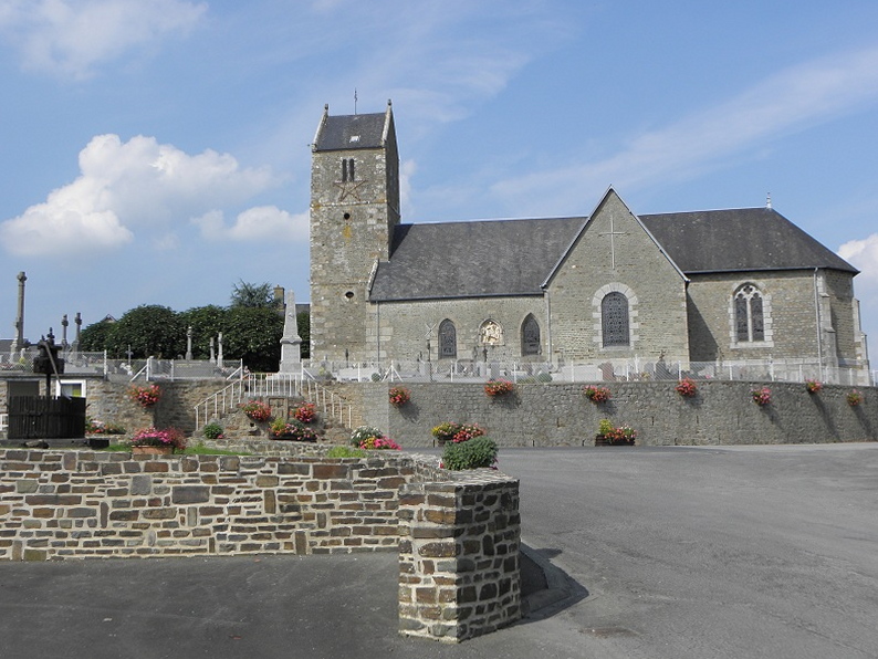

Juilley
- commune in Manche, France
- Country:
- Postal Code: 50220
- Coordinates: 48° 35' 58" N, 1° 20' 38" E
- GPS tracks (wikiloc): [Link]
- Area: 11.23 sq km
- Population: 688


Méautis
- commune in Manche, France
- Country:
- Postal Code: 50500
- Coordinates: 49° 16' 41" N, 1° 17' 58" E
- GPS tracks (wikiloc): [Link]
- Area: 16.98 sq km
- Population: 647

Cambernon
- commune in Manche, France
- Country:
- Postal Code: 50200
- Coordinates: 49° 4' 49" N, 1° 23' 8" E
- GPS tracks (wikiloc): [Link]
- Area: 17.01 sq km
- Population: 733
- Web site: [Link]


Lamberville
- commune in Manche, France
- Country:
- Postal Code: 50160
- Coordinates: 49° 4' 48" N, 0° 54' 31" E
- GPS tracks (wikiloc): [Link]
- Area: 7.12 sq km
- Population: 174


Saint-Martin-des-Champs
- commune in Manche, France
- Country:
- Postal Code: 50300
- Coordinates: 48° 40' 10" N, 1° 19' 52" E
- GPS tracks (wikiloc): [Link]
- Area: 6.49 sq km
- Population: 2327


Longueville
- commune in Manche, France
- Country:
- Postal Code: 50290
- Coordinates: 48° 51' 13" N, 1° 33' 6" E
- GPS tracks (wikiloc): [Link]
- Area: 4.07 sq km
- Population: 619


Sainte-Cécile
- commune in Manche, France
- Country:
- Postal Code: 50800
- Coordinates: 48° 50' 8" N, 1° 11' 22" E
- GPS tracks (wikiloc): [Link]
- Area: 11.29 sq km
- Population: 829
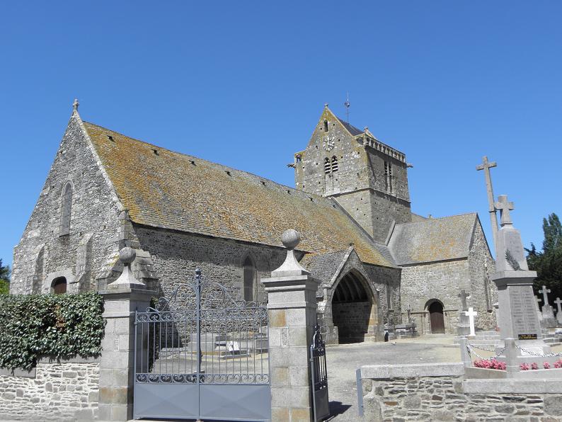

Genêts
- commune in Manche, France
- Country:
- Postal Code: 50530
- Coordinates: 48° 41' 3" N, 1° 28' 36" E
- GPS tracks (wikiloc): [Link]
- Area: 6.89 sq km
- Population: 431
- Web site: [Link]


Montsurvent
- commune in Manche, France
- Country:
- Postal Code: 50200
- Coordinates: 49° 6' 54" N, 1° 29' 52" E
- GPS tracks (wikiloc): [Link]
- Area: 8.33 sq km
- Population: 418


Les Moitiers-en-Bauptois
- former commune in Manche, France
- Country:
- Postal Code: 50360
- Coordinates: 49° 21' 55" N, 1° 26' 12" E
- GPS tracks (wikiloc): [Link]
- Area: 8.04 sq km
- Population: 337


Cretteville
- former commune in Manche, France
- Country:
- Postal Code: 50250
- Coordinates: 49° 20' 34" N, 1° 23' 16" E
- GPS tracks (wikiloc): [Link]
- Area: 6.83 sq km
- Population: 215


Cérences
- commune in Manche, France
- Country:
- Postal Code: 50510
- Coordinates: 48° 54' 59" N, 1° 26' 8" E
- GPS tracks (wikiloc): [Link]
- Area: 26.04 sq km
- Population: 1877
- Web site: [Link]
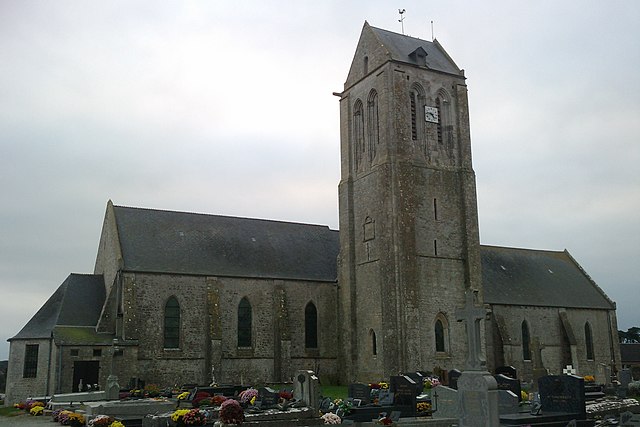
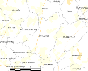
Orglandes
- commune in Manche, France
- Country:
- Postal Code: 50390
- Coordinates: 49° 25' 18" N, 1° 26' 58" E
- GPS tracks (wikiloc): [Link]
- Area: 9.26 sq km
- Population: 364


Camprond
- commune in Manche, France
- Country:
- Postal Code: 50210
- Coordinates: 49° 5' 18" N, 1° 20' 52" E
- GPS tracks (wikiloc): [Link]
- Area: 6.27 sq km
- Population: 425

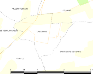
La Luzerne
- commune in Manche, France
- Country:
- Postal Code: 50680
- Coordinates: 49° 8' 20" N, 1° 3' 1" E
- GPS tracks (wikiloc): [Link]
- Area: 1.94 sq km
- Population: 79


Montpinchon
- commune in Manche, France
- Country:
- Postal Code: 50210
- Coordinates: 49° 1' 20" N, 1° 18' 36" E
- GPS tracks (wikiloc): [Link]
- Area: 16.94 sq km
- Population: 546


Coigny
- former commune in Manche, France
- Country:
- Postal Code: 50250
- Coordinates: 49° 19' 23" N, 1° 23' 2" E
- GPS tracks (wikiloc): [Link]
- Area: 4.5 sq km
- Population: 163


Céaux
- commune in Manche, France
- Country:
- Postal Code: 50220
- Coordinates: 48° 37' 54" N, 1° 23' 15" E
- GPS tracks (wikiloc): [Link]
- Area: 8.39 sq km
- Population: 436


Lieusaint
- commune in Manche, France
- Country:
- Postal Code: 50700
- Coordinates: 49° 28' 30" N, 1° 28' 40" E
- GPS tracks (wikiloc): [Link]
- Area: 5.22 sq km
- Population: 423
- Web site: [Link]
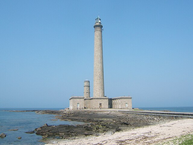

Gatteville-le-Phare
- commune in Manche, France
- Country:
- Postal Code: 50760
- Coordinates: 49° 41' 10" N, 1° 17' 1" E
- GPS tracks (wikiloc): [Link]
- Area: 9.7 sq km
- Population: 489

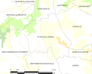
Octeville-l'Avenel
- commune in Manche, France
- Country:
- Postal Code: 50630
- Coordinates: 49° 32' 37" N, 1° 21' 15" E
- GPS tracks (wikiloc): [Link]
- AboveSeaLevel: 40 м m
- Area: 6.86 sq km
- Population: 211


Montebourg
- commune in Manche, France
- Country:
- Postal Code: 50310
- Coordinates: 49° 29' 16" N, 1° 22' 46" E
- GPS tracks (wikiloc): [Link]
- Area: 5.89 sq km
- Population: 2082
- Web site: [Link]


Omonville-la-Petite
- former commune in Manche, France
- Country:
- Postal Code: 50440
- Coordinates: 49° 42' 1" N, 1° 52' 58" E
- GPS tracks (wikiloc): [Link]
- Area: 6.16 sq km
- Population: 145


Le Hommet-d'Arthenay
- former commune in Manche, France
- Country:
- Postal Code: 50620
- Coordinates: 49° 11' 24" N, 1° 11' 16" E
- GPS tracks (wikiloc): [Link]
- Area: 14.85 sq km
- Population: 395
- Web site: [Link]


Saint-Vaast-la-Hougue
- commune in Manche, France
- Country:
- Postal Code: 50550
- Coordinates: 49° 35' 17" N, 1° 16' 3" E
- GPS tracks (wikiloc): [Link]
- Area: 6.28 sq km
- Population: 1828
- Web site: [Link]


Les Loges-Marchis
- commune in Manche, France
- Country:
- Postal Code: 50600
- Coordinates: 48° 32' 31" N, 1° 5' 18" E
- GPS tracks (wikiloc): [Link]
- Area: 19.78 sq km
- Population: 1009

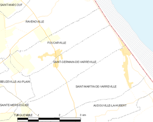
Saint-Germain-de-Varreville
- commune in Manche, France
- Country:
- Postal Code: 50480
- Coordinates: 49° 26' 16" N, 1° 15' 26" E
- GPS tracks (wikiloc): [Link]
- Area: 5.81 sq km
- Population: 117


Saint-Pierre-Église
- commune in Manche, France
- Country:
- Postal Code: 50840
- Coordinates: 49° 40' 6" N, 1° 24' 14" E
- GPS tracks (wikiloc): [Link]
- Area: 8.06 sq km
- Population: 1795


Moon-sur-Elle
- commune in Manche, France
- Country:
- Postal Code: 50680
- Coordinates: 49° 12' 32" N, 1° 2' 40" E
- GPS tracks (wikiloc): [Link]
- Area: 9.84 sq km
- Population: 849

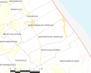
Saint-Martin-de-Varreville
- commune in Manche, France
- Country:
- Postal Code: 50480
- Coordinates: 49° 25' 35" N, 1° 14' 14" E
- GPS tracks (wikiloc): [Link]
- Area: 8.36 sq km
- Population: 195


Saint-Côme-du-Mont
- former commune in Manche, France
- Country:
- Postal Code: 50500
- Coordinates: 49° 20' 9" N, 1° 16' 20" E
- GPS tracks (wikiloc): [Link]
- Area: 12.91 sq km
- Population: 515
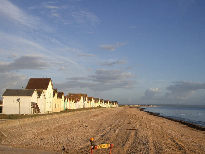

Ravenoville
- commune in Manche, France
- Country:
- Postal Code: 50480
- Coordinates: 49° 27' 24" N, 1° 16' 14" E
- GPS tracks (wikiloc): [Link]
- Area: 11.65 sq km
- Population: 256


Neuville-au-Plain
- commune in Manche, France
- Country:
- Postal Code: 50480
- Coordinates: 49° 25' 39" N, 1° 19' 48" E
- GPS tracks (wikiloc): [Link]
- Area: 4.7 sq km
- Population: 91


Lessay
- former commune in Manche, France
- Country:
- Postal Code: 50430
- Coordinates: 49° 13' 5" N, 1° 31' 50" E
- GPS tracks (wikiloc): [Link]
- Area: 22.23 sq km
- Population: 2014
- Web site: [Link]


Houesville
- former commune in Manche, France
- Country:
- Postal Code: 50480
- Coordinates: 49° 21' 3" N, 1° 17' 16" E
- GPS tracks (wikiloc): [Link]
- Area: 5.38 sq km
- Population: 325


Le Neufbourg
- commune in Manche, France
- Country:
- Postal Code: 50140
- Coordinates: 48° 39' 25" N, 0° 56' 52" E
- GPS tracks (wikiloc): [Link]
- Area: 2.25 sq km
- Population: 426


Portbail
- commune in Manche, France
- Country:
- Postal Code: 50580
- Coordinates: 49° 20' 7" N, 1° 41' 46" E
- GPS tracks (wikiloc): [Link]
- Area: 19.56 sq km
- Population: 1586
- Web site: [Link]


Montbray
- commune in Manche, France
- Country:
- Postal Code: 50410
- Coordinates: 48° 52' 49" N, 1° 5' 44" E
- GPS tracks (wikiloc): [Link]
- Area: 14.04 sq km
- Population: 352


Saint-Martin-de-Bonfossé
- commune in Manche, France
- Country:
- Postal Code: 50750
- Coordinates: 49° 3' 12" N, 1° 10' 11" E
- GPS tracks (wikiloc): [Link]
- Area: 12.68 sq km
- Population: 532


La Haye-Pesnel
- commune in Manche, France
- Country:
- Postal Code: 50320
- Coordinates: 48° 47' 44" N, 1° 23' 48" E
- GPS tracks (wikiloc): [Link]
- Area: 6.29 sq km
- Population: 1360


Canteloup
- commune in Manche, France
- Country:
- Postal Code: 50330
- Coordinates: 49° 38' 44" N, 1° 21' 8" E
- GPS tracks (wikiloc): [Link]
- AboveSeaLevel: 120 м m
- Area: 4.28 sq km
- Population: 222

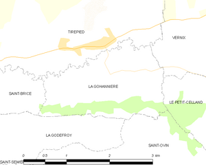
La Gohannière
- commune in Manche, France
- Country:
- Postal Code: 50300
- Coordinates: 48° 42' 23" N, 1° 15' 17" E
- GPS tracks (wikiloc): [Link]
- Area: 3.78 sq km
- Population: 118


Le Teilleul
- commune in Manche, France
- Country:
- Postal Code: 50640
- Coordinates: 48° 32' 18" N, 0° 52' 24" E
- GPS tracks (wikiloc): [Link]
- Area: 30.45 sq km
- Population: 1220


Saint-Maurice-en-Cotentin
- commune in Manche, France
- Country:
- Postal Code: 50270
- Coordinates: 49° 23' 25" N, 1° 42' 21" E
- GPS tracks (wikiloc): [Link]
- Area: 7.46 sq km
- Population: 263


Le Fresne-Poret
- commune in Manche, France
- Country:
- Postal Code: 50850
- Coordinates: 48° 42' 37" N, 0° 49' 47" E
- GPS tracks (wikiloc): [Link]
- Area: 10.08 sq km
- Population: 212


Placy-Montaigu
- former commune in Manche, France
- Country:
- Postal Code: 50160
- Coordinates: 49° 1' 49" N, 0° 54' 21" E
- GPS tracks (wikiloc): [Link]
- Area: 8.99 sq km
- Population: 233


Saint-Denis-le-Gast
- commune in Manche, France
- Country:
- Postal Code: 50450
- Coordinates: 48° 56' 25" N, 1° 19' 46" E
- GPS tracks (wikiloc): [Link]
- Area: 16.73 sq km
- Population: 549


Montmartin-en-Graignes
- commune in Manche, France
- Country:
- Postal Code: 50620
- Coordinates: 49° 16' 31" N, 1° 8' 48" E
- GPS tracks (wikiloc): [Link]
- Area: 30.34 sq km
- Population: 588


arrondissement of Coutances
- arrondissement of France
- Country:
- Capital: Coutances
- Coordinates: 49° 10' 0" N, 1° 30' 0" E
- GPS tracks (wikiloc): [Link]
- Area: 1762 sq km
- Population: 71055


La Mancellière-sur-Vire
- former commune in Manche, France
- Country:
- Postal Code: 50750
- Coordinates: 49° 4' 8" N, 1° 4' 13" E
- GPS tracks (wikiloc): [Link]
- Area: 6.8 sq km
- Population: 496

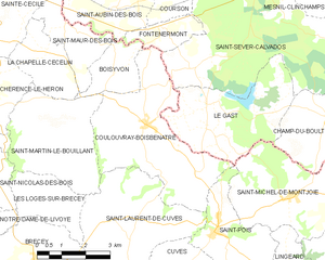
Coulouvray-Boisbenâtre
- commune in Manche, France
- Country:
- Postal Code: 50670
- Coordinates: 48° 47' 13" N, 1° 6' 33" E
- GPS tracks (wikiloc): [Link]
- Area: 17.25 sq km
- Population: 553

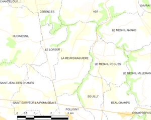
La Meurdraquière
- commune in Manche, France
- Country:
- Postal Code: 50510
- Coordinates: 48° 50' 57" N, 1° 24' 32" E
- GPS tracks (wikiloc): [Link]
- Area: 7.6 sq km
- Population: 168


La Meauffe
- commune in Manche, France
- Country:
- Postal Code: 50880
- Coordinates: 49° 10' 35" N, 1° 6' 40" E
- GPS tracks (wikiloc): [Link]
- Area: 10.22 sq km
- Population: 1069
- Web site: [Link]


La Ronde-Haye
- commune in Manche, France
- Country:
- Postal Code: 50490
- Coordinates: 49° 7' 35" N, 1° 26' 29" E
- GPS tracks (wikiloc): [Link]
- Area: 6.67 sq km
- Population: 357


Hérenguerville
- commune in Manche, France
- Country:
- Postal Code: 50660
- Coordinates: 48° 58' 37" N, 1° 30' 4" E
- GPS tracks (wikiloc): [Link]
- Area: 2.71 sq km
- Population: 208


Montrabot
- commune in Manche, France
- Country:
- Postal Code: 50810
- Coordinates: 49° 6' 30" N, 0° 53' 27" E
- GPS tracks (wikiloc): [Link]
- Area: 3.86 sq km
- Population: 73


Saint-Louet-sur-Vire
- commune in Manche, France
- Country:
- Postal Code: 50420
- Coordinates: 48° 59' 29" N, 0° 59' 32" E
- GPS tracks (wikiloc): [Link]
- Area: 7.33 sq km
- Population: 206


Saint-Floxel
- commune in Manche, France
- Country:
- Postal Code: 50310
- Coordinates: 49° 29' 31" N, 1° 21' 4" E
- GPS tracks (wikiloc): [Link]
- Area: 8.45 sq km
- Population: 485


Flottemanville-Hague
- former commune in Manche, France
- Country:
- Postal Code: 50690
- Coordinates: 49° 37' 18" N, 1° 43' 20" E
- GPS tracks (wikiloc): [Link]
- Area: 11.39 sq km
- Population: 934
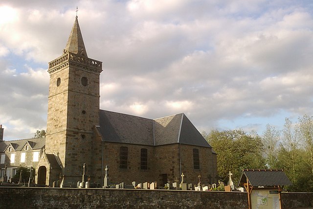

Sainte-Pience
- former commune in Manche, France
- Country:
- Postal Code: 50870
- Coordinates: 48° 45' 50" N, 1° 18' 9" E
- GPS tracks (wikiloc): [Link]
- Area: 8.68 sq km
- Population: 318
- Web site: [Link]


Saint-Malo-de-la-Lande
- commune in Manche, France
- Country:
- Postal Code: 50200
- Coordinates: 49° 4' 15" N, 1° 32' 25" E
- GPS tracks (wikiloc): [Link]
- Area: 4.01 sq km
- Population: 486

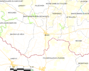
Buais
- former commune in Manche, France
- Country:
- Postal Code: 50640
- Coordinates: 48° 31' 21" N, 0° 58' 9" E
- GPS tracks (wikiloc): [Link]
- Area: 17.92 sq km
- Population: 492
- Web site: [Link]


Reigneville-Bocage
- commune in Manche, France
- Country:
- Postal Code: 50390
- Coordinates: 49° 24' 25" N, 1° 28' 30" E
- GPS tracks (wikiloc): [Link]
- Area: 2.27 sq km
- Population: 39


Fermanville
- commune in Manche, France
- Country:
- Postal Code: 50840
- Coordinates: 49° 41' 12" N, 1° 26' 25" E
- GPS tracks (wikiloc): [Link]
- Area: 11.6 sq km
- Population: 1317


Jullouville
- commune in Manche, France
- Country:
- Postal Code: 50740; 50610
- Coordinates: 48° 46' 29" N, 1° 33' 57" E
- GPS tracks (wikiloc): [Link]
- Area: 21.88 sq km
- Population: 2306
- Web site: [Link]


Sainte-Marie-du-Bois
- former commune in Manche, France
- Country:
- Postal Code: 50640
- Coordinates: 48° 33' 47" N, 0° 53' 29" E
- GPS tracks (wikiloc): [Link]
- Area: 4.77 sq km
- Population: 63


Lingreville
- commune in Manche, France
- Country:
- Postal Code: 50660
- Coordinates: 48° 57' 2" N, 1° 31' 37" E
- GPS tracks (wikiloc): [Link]
- Area: 9.04 sq km
- Population: 999


Saint-Martin-le-Bouillant
- commune in Manche, France
- Country:
- Postal Code: 50800
- Coordinates: 48° 47' 7" N, 1° 10' 38" E
- GPS tracks (wikiloc): [Link]
- Area: 12.37 sq km
- Population: 316


Roncey
- commune in Manche, France
- Country:
- Postal Code: 50210
- Coordinates: 48° 59' 22" N, 1° 20' 1" E
- GPS tracks (wikiloc): [Link]
- Area: 12.15 sq km
- Population: 817


Bréville-sur-Mer
- commune in Manche, France
- Country:
- Postal Code: 50290
- Coordinates: 48° 51' 52" N, 1° 33' 24" E
- GPS tracks (wikiloc): [Link]
- Area: 6.86 sq km
- Population: 785
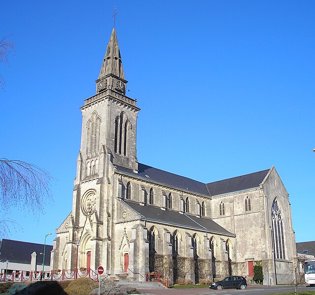
Percy
- former commune in Manche, France
- Country:
- Postal Code: 50410
- Coordinates: 48° 55' 1" N, 1° 11' 21" E
- GPS tracks (wikiloc): [Link]
- Area: 37.04 sq km
- Population: 2302
- Web site: [Link]


Le Vast
- commune in Manche, France
- Country:
- Postal Code: 50630
- Coordinates: 49° 37' 21" N, 1° 21' 27" E
- GPS tracks (wikiloc): [Link]
- Area: 13.04 sq km
- Population: 316


Sainte-Marie-du-Mont
- commune in Manche, France
- Country:
- Postal Code: 50480
- Coordinates: 49° 22' 42" N, 1° 13' 34" E
- GPS tracks (wikiloc): [Link]
- Area: 26.98 sq km
- Population: 733
- Web site: [Link]


Saint-Rémy-des-Landes
- former commune in Manche, France
- Country:
- Postal Code: 50580
- Coordinates: 49° 18' 5" N, 1° 39' 24" E
- GPS tracks (wikiloc): [Link]
- Area: 8.3 sq km
- Population: 217
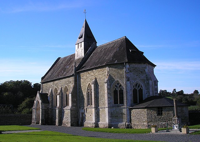

Sainte-Suzanne-sur-Vire
- commune in Manche, France
- Country:
- Postal Code: 50750
- Coordinates: 49° 3' 43" N, 1° 3' 34" E
- GPS tracks (wikiloc): [Link]
- Area: 5.05 sq km
- Population: 674
- Web site: [Link]


Nicorps
- commune in Manche, France
- Country:
- Postal Code: 50200
- Coordinates: 49° 1' 37" N, 1° 25' 15" E
- GPS tracks (wikiloc): [Link]
- Area: 5.63 sq km
- Population: 418


Montviron
- former commune in Manche, France
- Country:
- Postal Code: 50530
- Coordinates: 48° 44' 15" N, 1° 25' 14" E
- GPS tracks (wikiloc): [Link]
- Area: 5.91 sq km
- Population: 351

Biéville
- commune in Manche, France
- Country:
- Postal Code: 50160
- Coordinates: 49° 4' 53" N, 0° 53' 18" E
- GPS tracks (wikiloc): [Link]
- Area: 5.56 sq km
- Population: 189


Contrières
- commune in Manche, France
- Country:
- Postal Code: 50660
- Coordinates: 48° 59' 15" N, 1° 25' 50" E
- GPS tracks (wikiloc): [Link]
- Area: 9.12 sq km
- Population: 384
- Web site: [Link]


Saint-Germain-sur-Ay
- commune in Manche, France
- Country:
- Postal Code: 50430
- Coordinates: 49° 14' 6" N, 1° 35' 36" E
- GPS tracks (wikiloc): [Link]
- Area: 14.52 sq km
- Population: 911
- Web site: [Link]


Blainville-sur-Mer
- commune in Manche, France
- Country:
- Postal Code: 50560
- Coordinates: 49° 4' 0" N, 1° 35' 1" E
- GPS tracks (wikiloc): [Link]
- Area: 11.6 sq km
- Population: 1634
- Web site: [Link]

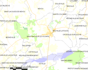
Saint-Sauveur-le-Vicomte
- commune in Manche, France
- Country:
- Postal Code: 50390
- Coordinates: 49° 23' 12" N, 1° 31' 56" E
- GPS tracks (wikiloc): [Link]
- Area: 34.27 sq km
- Population: 2199
- Web site: [Link]


Rocheville
- commune in Manche, France
- Country:
- Postal Code: 50260
- Coordinates: 49° 30' 10" N, 1° 35' 45" E
- GPS tracks (wikiloc): [Link]
- Area: 10.07 sq km
- Population: 628


Carnet
- former commune in Manche, France
- Country:
- Postal Code: 50240
- Coordinates: 48° 30' 36" N, 1° 21' 26" E
- GPS tracks (wikiloc): [Link]
- Area: 10.18 sq km
- Population: 494
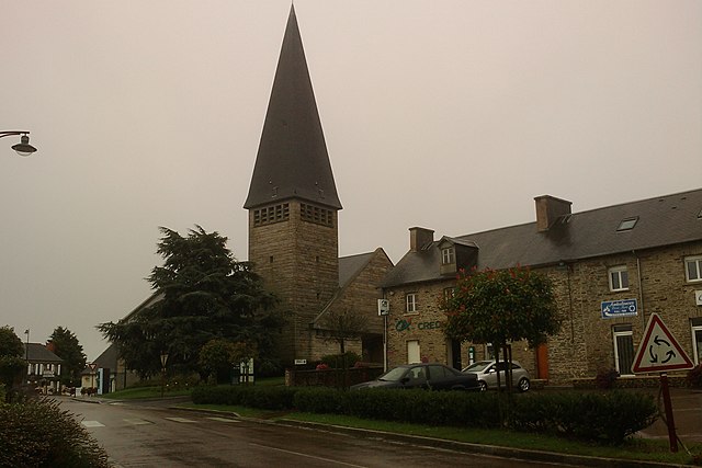
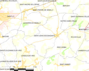
Saint-Jean-des-Baisants
- former commune in Manche, France
- Country:
- Postal Code: 50810
- Coordinates: 49° 5' 35" N, 0° 58' 27" E
- GPS tracks (wikiloc): [Link]
- Area: 13.37 sq km
- Population: 1252
- Web site: [Link]


Sacey
- commune in Manche, France
- Country:
- Postal Code: 50170
- Coordinates: 48° 30' 34" N, 1° 27' 0" E
- GPS tracks (wikiloc): [Link]
- Area: 15.27 sq km
- Population: 524


Saint-Fromond
- commune in Manche, France
- Country:
- Postal Code: 50620
- Coordinates: 49° 13' 14" N, 1° 5' 29" E
- GPS tracks (wikiloc): [Link]
- Area: 15.52 sq km
- Population: 774


Émondeville
- commune in Manche, France
- Country:
- Postal Code: 50310
- Coordinates: 49° 27' 32" N, 1° 20' 34" E
- GPS tracks (wikiloc): [Link]
- Area: 5.33 sq km
- Population: 357
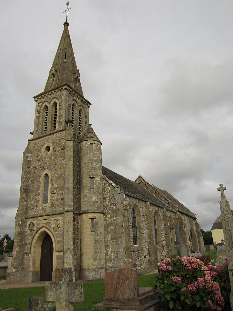
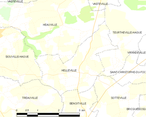
Helleville
- commune in Manche, France
- Country:
- Postal Code: 50340
- Coordinates: 49° 33' 17" N, 1° 47' 0" E
- GPS tracks (wikiloc): [Link]
- Area: 5.88 sq km
- Population: 516

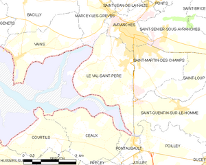
Le Val-Saint-Père
- commune in Manche, France
- Country:
- Postal Code: 50300
- Coordinates: 48° 39' 48" N, 1° 22' 30" E
- GPS tracks (wikiloc): [Link]
- Area: 11.1 sq km
- Population: 2017
- Web site: [Link]


Saint-Martin-le-Hébert
- former commune in Manche, France
- Country:
- Postal Code: 50260
- Coordinates: 49° 30' 39" N, 1° 36' 30" E
- GPS tracks (wikiloc): [Link]
- AboveSeaLevel: 111 м m
- Area: 2.13 sq km
- Population: 163


Fresville
- commune in Manche, France
- Country:
- Postal Code: 50310
- Coordinates: 49° 26' 23" N, 1° 21' 22" E
- GPS tracks (wikiloc): [Link]
- Area: 13.94 sq km
- Population: 362
- Web site: [Link]
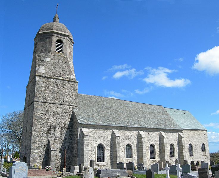

Sainte-Croix-Hague
- former commune in Manche, France
- Country:
- Postal Code: 50440
- Coordinates: 49° 38' 19" N, 1° 46' 24" E
- GPS tracks (wikiloc): [Link]
- Area: 9.84 sq km
- Population: 860
- Web site: [Link]


Saint-Joseph
- commune in Manche, France
- Country:
- Postal Code: 50700
- Coordinates: 49° 31' 58" N, 1° 31' 36" E
- GPS tracks (wikiloc): [Link]
- Area: 9.78 sq km
- Population: 792
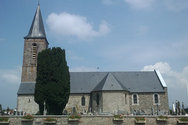

Saint-Romphaire
- former commune in Manche, France
- Country:
- Postal Code: 50750
- Coordinates: 49° 2' 20" N, 1° 6' 21" E
- GPS tracks (wikiloc): [Link]
- Area: 9.97 sq km
- Population: 738
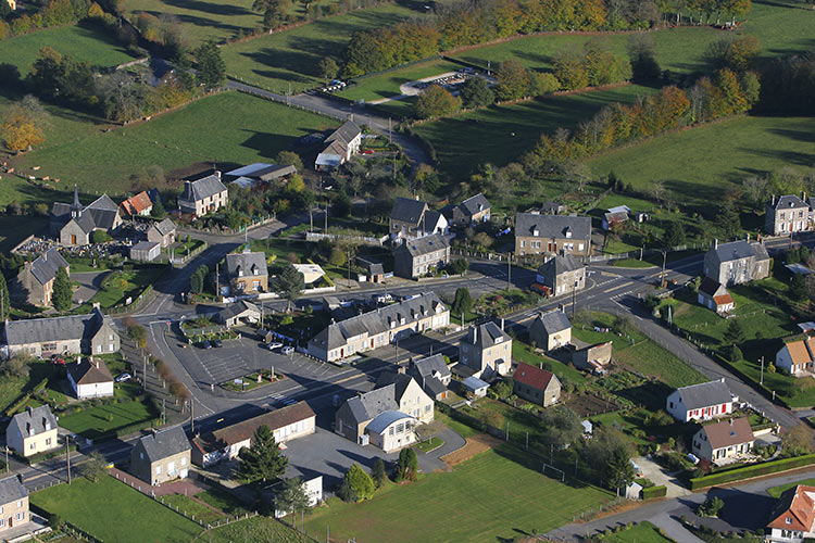

Saint-Barthélemy
- commune in Manche, France
- Country:
- Postal Code: 50140
- Coordinates: 48° 40' 53" N, 0° 57' 10" E
- GPS tracks (wikiloc): [Link]
- Area: 6.81 sq km
- Population: 328


Geffosses
- commune in Manche, France
- Country:
- Postal Code: 50560
- Coordinates: 49° 7' 52" N, 1° 33' 32" E
- GPS tracks (wikiloc): [Link]
- Area: 15.07 sq km
- Population: 429
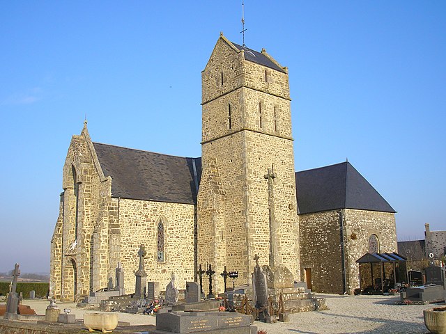

Montaigu-les-Bois
- commune in Manche, France
- Country:
- Postal Code: 50450
- Coordinates: 48° 53' 34" N, 1° 16' 46" E
- GPS tracks (wikiloc): [Link]
- Area: 6.67 sq km
- Population: 233


Brix
- commune in Manche, France
- Country:
- Postal Code: 50700
- Coordinates: 49° 32' 43" N, 1° 34' 44" E
- GPS tracks (wikiloc): [Link]
- Area: 32.16 sq km
- Population: 2114
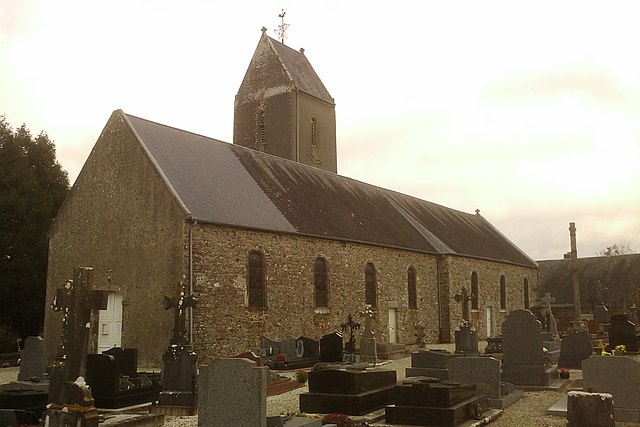

Ouville
- commune in Manche, France
- Country:
- Postal Code: 50210
- Coordinates: 49° 1' 10" N, 1° 21' 45" E
- GPS tracks (wikiloc): [Link]
- Area: 11.2 sq km
- Population: 449
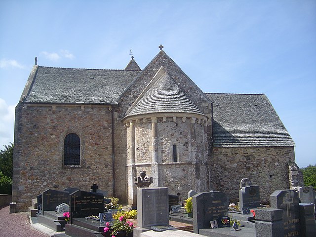
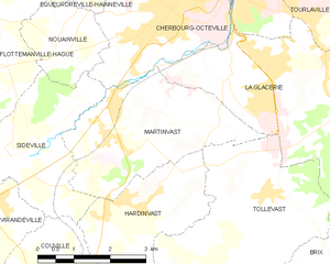
Martinvast
- commune in Manche, France
- Country:
- Postal Code: 50690
- Coordinates: 49° 35' 45" N, 1° 39' 50" E
- GPS tracks (wikiloc): [Link]
- Area: 10.31 sq km
- Population: 1248
- Web site: [Link]


Ger
- commune in Manche, France
- Country:
- Postal Code: 50850
- Coordinates: 48° 40' 54" N, 0° 47' 19" E
- GPS tracks (wikiloc): [Link]
- Area: 39.78 sq km
- Population: 821


Mobecq
- former commune in Manche, France
- Country:
- Postal Code: 50250
- Coordinates: 49° 16' 21" N, 1° 31' 4" E
- GPS tracks (wikiloc): [Link]
- Area: 7.99 sq km
- Population: 245


Lengronne
- commune in Manche, France
- Country:
- Postal Code: 50510
- Coordinates: 48° 56' 1" N, 1° 22' 57" E
- GPS tracks (wikiloc): [Link]
- Area: 12.07 sq km
- Population: 438


Périers
- commune in Manche, France
- Country:
- Postal Code: 50190
- Coordinates: 49° 11' 11" N, 1° 24' 26" E
- GPS tracks (wikiloc): [Link]
- Area: 14.62 sq km
- Population: 2342
- Web site: [Link]


Morigny
- commune in Manche, France
- Country:
- Postal Code: 50410
- Coordinates: 48° 52' 53" N, 1° 3' 34" E
- GPS tracks (wikiloc): [Link]
- Area: 4.35 sq km
- Population: 89


Plomb
- former commune in Manche, France
- Country:
- Postal Code: 50870
- Coordinates: 48° 43' 49" N, 1° 18' 9" E
- GPS tracks (wikiloc): [Link]
- Area: 8.16 sq km
- Population: 394


Hiesville
- commune in Manche, France
- Country:
- Postal Code: 50480
- Coordinates: 49° 22' 18" N, 1° 15' 48" E
- GPS tracks (wikiloc): [Link]
- Area: 4.03 sq km
- Population: 64


Montgardon
- former commune in Manche, France
- Country:
- Postal Code: 50250
- Coordinates: 49° 16' 49" N, 1° 34' 22" E
- GPS tracks (wikiloc): [Link]
- Area: 13.32 sq km
- Population: 448


Marcey-les-Grèves
- commune in Manche, France
- Country:
- Postal Code: 50300
- Coordinates: 48° 41' 48" N, 1° 23' 29" E
- GPS tracks (wikiloc): [Link]
- Area: 6.73 sq km
- Population: 1270


Benoîtville
- commune in Manche, France
- Country:
- Postal Code: 50340
- Coordinates: 49° 31' 40" N, 1° 46' 51" E
- GPS tracks (wikiloc): [Link]
- Area: 8.29 sq km
- Population: 622

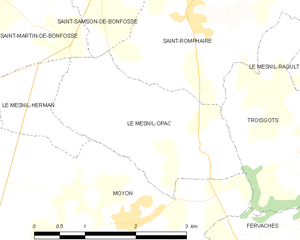
Le Mesnil-Opac
- former commune in Manche, France
- Country:
- Postal Code: 50860
- Coordinates: 49° 0' 47" N, 1° 5' 52" E
- GPS tracks (wikiloc): [Link]
- Area: 5.58 sq km
- Population: 259
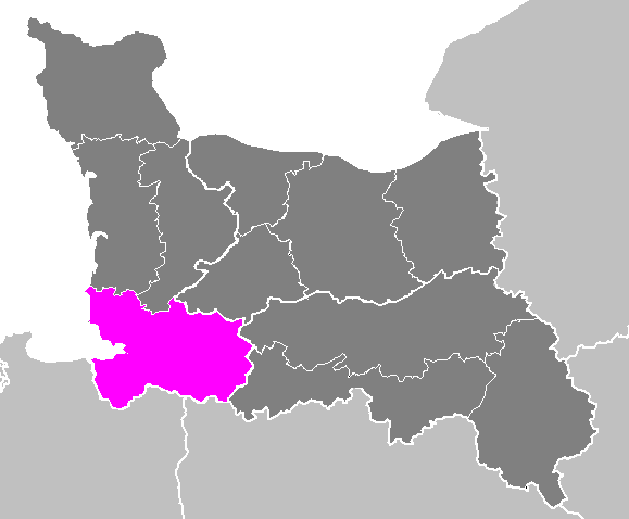
arrondissement of Avranches
- arrondissement of France
- Country:
- Capital: Avranches
- Coordinates: 48° 40' 0" N, 1° 10' 0" E
- GPS tracks (wikiloc): [Link]
- Area: 1762 sq km
- Population: 134905

arrondissement of Cherbourg
- arrondissement of France
- Country:
- Capital: Cherbourg-Octeville
- Coordinates: 49° 30' 0" N, 1° 35' 0" E
- GPS tracks (wikiloc): [Link]
- Area: 1639 sq km
- Population: 190547

arrondissement of Saint-Lô
- arrondissement of France in the Manche department
- Country:
- Capital: Saint-Lô
- Coordinates: 49° 6' 30" N, 1° 5' 4" E
- GPS tracks (wikiloc): [Link]
- Area: 1235 sq km
- Population: 102780


Moulines
- commune in Manche, France
- Country:
- Postal Code: 50600
- Coordinates: 48° 32' 43" N, 1° 1' 57" E
- GPS tracks (wikiloc): [Link]
- Area: 7.41 sq km
- Population: 296


Gorges
- commune in Manche, France
- Country:
- Postal Code: 50190
- Coordinates: 49° 15' 23" N, 1° 24' 24" E
- GPS tracks (wikiloc): [Link]
- Area: 22.67 sq km
- Population: 347


Picauville
- former commune in Manche, France
- Country:
- Postal Code: 50360
- Coordinates: 49° 22' 47" N, 1° 25' 3" E
- GPS tracks (wikiloc): [Link]
- Area: 19.1 sq km
- Population: 1928
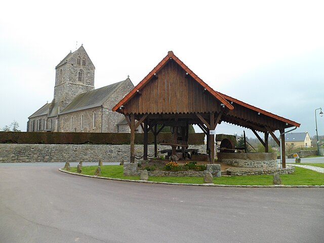

Feugères
- commune in Manche, France
- Country:
- Postal Code: 50190
- Coordinates: 49° 9' 4" N, 1° 19' 13" E
- GPS tracks (wikiloc): [Link]
- Area: 8.31 sq km
- Population: 344
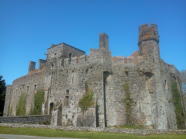

Pirou
- commune in Manche, France
- Country:
- Postal Code: 50770
- Coordinates: 49° 9' 57" N, 1° 34' 8" E
- GPS tracks (wikiloc): [Link]
- Area: 29.11 sq km
- Population: 1484
- Web site: [Link]


Denneville
- commune in Manche, France
- Country:
- Postal Code: 50580
- Coordinates: 49° 18' 48" N, 1° 39' 37" E
- GPS tracks (wikiloc): [Link]
- Area: 8.24 sq km
- Population: 586
- Web site: [Link]

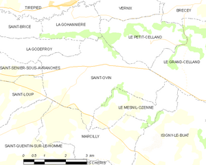
Saint-Ovin
- commune in Manche, France
- Country:
- Postal Code: 50300
- Coordinates: 48° 40' 53" N, 1° 15' 41" E
- GPS tracks (wikiloc): [Link]
- Area: 12.93 sq km
- Population: 768


Saint-Hilaire-du-Harcouët
- commune in Manche, France
- Country:
- Postal Code: 50730; 50600
- Coordinates: 48° 34' 40" N, 1° 5' 31" E
- GPS tracks (wikiloc): [Link]
- Area: 10.12 sq km
- Population: 3900
- Web site: [Link]


Saint-Laurent-de-Terregatte
- commune in Manche, France
- Country:
- Postal Code: 50111
- Coordinates: 48° 34' 20" N, 1° 15' 33" E
- GPS tracks (wikiloc): [Link]
- Area: 16.35 sq km
- Population: 644


Neufmesnil
- commune in Manche, France
- Country:
- Postal Code: 50250
- Coordinates: 49° 18' 42" N, 1° 32' 22" E
- GPS tracks (wikiloc): [Link]
- Area: 5.33 sq km
- Population: 201


Gouberville
- former commune in Manche, France
- Country:
- Postal Code: 50330
- Coordinates: 49° 41' 0" N, 1° 19' 43" E
- GPS tracks (wikiloc): [Link]
- Area: 2.79 sq km
- Population: 118


Saint-Pierre-de-Semilly
- commune in Manche, France
- Country:
- Postal Code: 50810
- Coordinates: 49° 7' 13" N, 1° 0' 21" E
- GPS tracks (wikiloc): [Link]
- Area: 4.59 sq km
- Population: 444


Saint-Laurent-de-Cuves
- commune in Manche, France
- Country:
- Postal Code: 50670
- Coordinates: 48° 45' 6" N, 1° 7' 22" E
- GPS tracks (wikiloc): [Link]
- Area: 14.8 sq km
- Population: 485


Saint-Aubin-de-Terregatte
- commune in Manche, France
- Country:
- Postal Code: 50111
- Coordinates: 48° 34' 33" N, 1° 17' 58" E
- GPS tracks (wikiloc): [Link]
- Area: 20.96 sq km
- Population: 685
- Web site: [Link]


Appeville
- commune in Manche, France
- Country:
- Postal Code: 50500
- Coordinates: 49° 19' 18" N, 1° 20' 35" E
- GPS tracks (wikiloc): [Link]
- Area: 13.2 sq km
- Population: 177
- Web site: [Link]

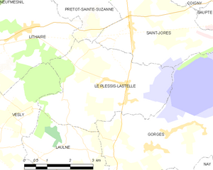
Le Plessis-Lastelle
- commune in Manche, France
- Country:
- Postal Code: 50250
- Coordinates: 49° 16' 52" N, 1° 25' 35" E
- GPS tracks (wikiloc): [Link]
- AboveSeaLevel: 36 м m
- Area: 14.99 sq km
- Population: 242


Saint-Germain-le-Gaillard
- commune in Manche, France
- Country:
- Postal Code: 50340
- Coordinates: 49° 29' 11" N, 1° 46' 56" E
- GPS tracks (wikiloc): [Link]
- Area: 13.83 sq km
- Population: 747

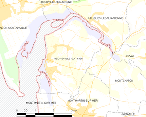
Regnéville-sur-Mer
- commune in Manche, France
- Country:
- Postal Code: 50590
- Coordinates: 49° 1' 17" N, 1° 32' 31" E
- GPS tracks (wikiloc): [Link]
- Area: 8.5 sq km
- Population: 750
- Web site: [Link]


Brécey
- commune in Manche, France
- Country:
- Postal Code: 50670
- Coordinates: 48° 43' 29" N, 1° 9' 59" E
- GPS tracks (wikiloc): [Link]
- Area: 20.96 sq km
- Population: 2083
- Web site: [Link]


Gourfaleur
- former commune in Manche, France
- Country:
- Postal Code: 50750
- Coordinates: 49° 4' 59" N, 1° 6' 44" E
- GPS tracks (wikiloc): [Link]
- Area: 8.45 sq km
- Population: 468


Isigny-le-Buat
- commune in Manche, France
- Country:
- Postal Code: 50540
- Coordinates: 48° 37' 8" N, 1° 10' 17" E
- GPS tracks (wikiloc): [Link]
- Area: 73.31 sq km
- Population: 3299
- Web site: [Link]


Quettetot
- former commune in Manche, France
- Country:
- Postal Code: 50260
- Coordinates: 49° 29' 15" N, 1° 40' 0" E
- GPS tracks (wikiloc): [Link]
- Area: 12.43 sq km
- Population: 711

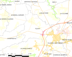
Fleury
- commune in Manche, France
- Country:
- Postal Code: 50800
- Coordinates: 48° 50' 52" N, 1° 16' 33" E
- GPS tracks (wikiloc): [Link]
- Area: 12.6 sq km
- Population: 1052

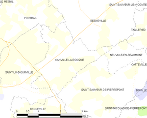
Canville-la-Rocque
- commune in Manche, France
- Country:
- Postal Code: 50580
- Coordinates: 49° 20' 30" N, 1° 38' 14" E
- GPS tracks (wikiloc): [Link]
- Area: 5.35 sq km
- Population: 134


Courcy
- commune in Manche, France
- Country:
- Postal Code: 50200
- Coordinates: 49° 2' 29" N, 1° 23' 35" E
- GPS tracks (wikiloc): [Link]
- Area: 11.45 sq km
- Population: 618


Perriers-en-Beauficel
- commune in Manche, France
- Country:
- Postal Code: 50150
- Coordinates: 48° 44' 13" N, 0° 59' 48" E
- GPS tracks (wikiloc): [Link]
- Area: 9.3 sq km
- Population: 216


Gréville-Hague
- former commune in Manche, France
- Country:
- Postal Code: 50440
- Coordinates: 49° 40' 29" N, 1° 48' 3" E
- GPS tracks (wikiloc): [Link]
- Area: 10.03 sq km
- Population: 719
- Web site: [Link]

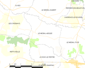
Le Mesnil-Adelée
- commune in Manche, France
- Country:
- Postal Code: 50520
- Coordinates: 48° 42' 2" N, 1° 4' 33" E
- GPS tracks (wikiloc): [Link]
- Area: 6.82 sq km
- Population: 170

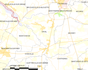
Orval
- former commune in Manche, France
- Country:
- Postal Code: 50660
- Coordinates: 49° 0' 52" N, 1° 28' 17" E
- GPS tracks (wikiloc): [Link]
- Area: 12.54 sq km
- Population: 853

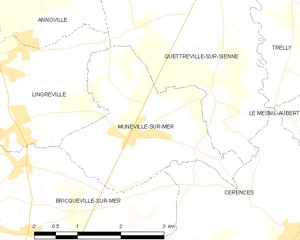
Muneville-sur-Mer
- commune in Manche, France
- Country:
- Postal Code: 50290
- Coordinates: 48° 56' 1" N, 1° 29' 27" E
- GPS tracks (wikiloc): [Link]
- Area: 7.42 sq km
- Population: 462
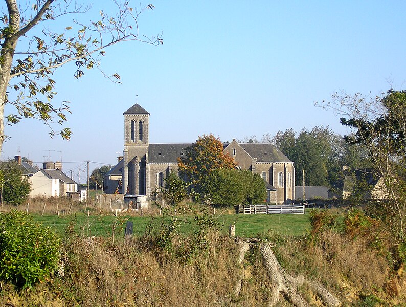
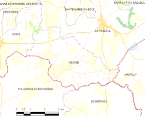
Heussé
- former commune in Manche, France
- Country:
- Postal Code: 50640
- Coordinates: 48° 30' 25" N, 0° 54' 2" E
- GPS tracks (wikiloc): [Link]
- Area: 14.57 sq km
- Population: 228


Romagny
- former commune in Manche, France
- Country:
- Postal Code: 50140
- Coordinates: 48° 38' 24" N, 0° 57' 58" E
- GPS tracks (wikiloc): [Link]
- Area: 29.46 sq km
- Population: 1027

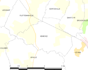
Hémevez
- commune in Manche, France
- Country:
- Postal Code: 50700
- Coordinates: 49° 27' 30" N, 1° 26' 28" E
- GPS tracks (wikiloc): [Link]
- Area: 4.3 sq km
- Population: 182
- Web site: [Link]


Rampan
- commune in Manche, France
- Country:
- Postal Code: 50000
- Coordinates: 49° 8' 44" N, 1° 7' 48" E
- GPS tracks (wikiloc): [Link]
- AboveSeaLevel: 14 м m
- Area: 4.09 sq km
- Population: 210


Le Mesnil-Ozenne
- commune in Manche, France
- Country:
- Postal Code: 50220
- Coordinates: 48° 40' 1" N, 1° 13' 51" E
- GPS tracks (wikiloc): [Link]
- Area: 4.59 sq km
- Population: 259


Biniville
- commune in Manche, France
- Country:
- Postal Code: 50390
- Coordinates: 49° 25' 39" N, 1° 28' 38" E
- GPS tracks (wikiloc): [Link]
- Area: 2.98 sq km
- Population: 116
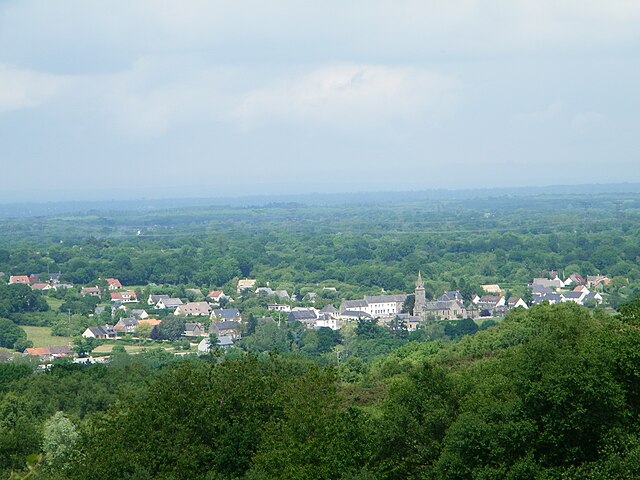

Lithaire
- former commune in Manche, France
- Country:
- Postal Code: 50250
- Coordinates: 49° 18' 0" N, 1° 29' 1" E
- GPS tracks (wikiloc): [Link]
- Area: 14.21 sq km
- Population: 568

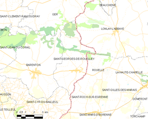
Saint-Georges-de-Rouelley
- commune in Manche, France
- Country:
- Postal Code: 50720
- Coordinates: 48° 36' 13" N, 0° 46' 6" E
- GPS tracks (wikiloc): [Link]
- Area: 20.52 sq km
- Population: 562
- Web site: [Link]

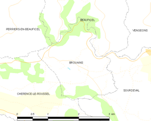
Brouains
- commune in Manche, France
- Country:
- Postal Code: 50150
- Coordinates: 48° 43' 17" N, 0° 58' 4" E
- GPS tracks (wikiloc): [Link]
- AboveSeaLevel: 145 м m
- Area: 3.79 sq km
- Population: 146


Saint-Amand
- former commune in Manche, France
- Country:
- Postal Code: 50160
- Coordinates: 49° 2' 34" N, 0° 57' 50" E
- GPS tracks (wikiloc): [Link]
- Area: 29.2 sq km
- Population: 2351
- Web site: [Link]

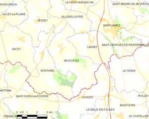
Argouges
- former commune in Manche, France
- Country:
- Postal Code: 50240
- Coordinates: 48° 30' 9" N, 1° 23' 46" E
- GPS tracks (wikiloc): [Link]
- Area: 16.41 sq km
- Population: 529

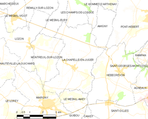
La Chapelle-en-Juger
- former commune in Manche, France
- Country:
- Postal Code: 50570
- Coordinates: 49° 7' 40" N, 1° 12' 53" E
- GPS tracks (wikiloc): [Link]
- Area: 15 sq km
- Population: 656


Saint-Martin-de-Landelles
- former commune in Manche, France
- Country:
- Postal Code: 50730
- Coordinates: 48° 32' 45" N, 1° 10' 19" E
- GPS tracks (wikiloc): [Link]
- Area: 19.91 sq km
- Population: 1124
- Web site: [Link]
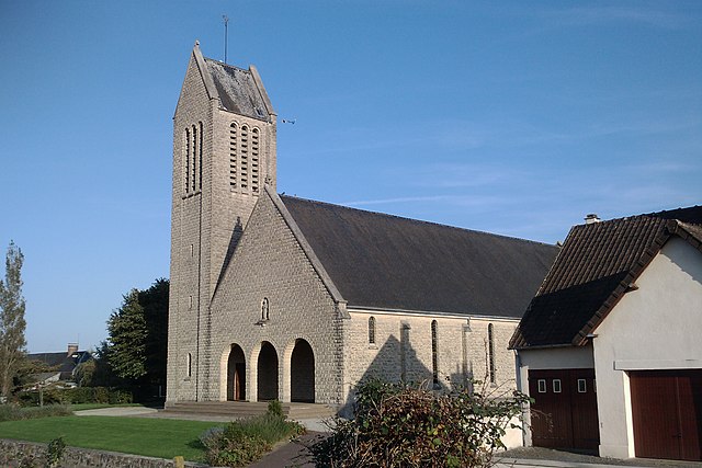

Auxais
- commune in Manche, France
- Country:
- Postal Code: 50500
- Coordinates: 49° 12' 47" N, 1° 17' 55" E
- GPS tracks (wikiloc): [Link]
- Area: 7.76 sq km
- Population: 173


Querqueville
- former commune in Manche, France
- Country:
- Postal Code: 50460
- Coordinates: 49° 39' 48" N, 1° 41' 43" E
- GPS tracks (wikiloc): [Link]
- Area: 5.56 sq km
- Population: 5095
- Web site: [Link]


Digulleville
- former commune in Manche, France
- Country:
- Postal Code: 50440
- Coordinates: 49° 41' 56" N, 1° 51' 33" E
- GPS tracks (wikiloc): [Link]
- Area: 7.89 sq km
- Population: 285
- Web site: [Link]


Pontaubault
- commune in Manche, France
- Country:
- Postal Code: 50220
- Coordinates: 48° 37' 45" N, 1° 21' 3" E
- GPS tracks (wikiloc): [Link]
- Area: 1.94 sq km
- Population: 533
- Web site: [Link]


Saint-Pierre-de-Coutances
- commune in Manche, France
- Country:
- Postal Code: 50200
- Coordinates: 49° 2' 9" N, 1° 26' 57" E
- GPS tracks (wikiloc): [Link]
- AboveSeaLevel: 47 м m
- Area: 4.04 sq km
- Population: 422


Le Luot
- commune in Manche, France
- Country:
- Postal Code: 50870
- Coordinates: 48° 45' 24" N, 1° 19' 10" E
- GPS tracks (wikiloc): [Link]
- Area: 8.5 sq km
- Population: 257


Champrepus
- commune in Manche, France
- Country:
- Postal Code: 50800
- Coordinates: 48° 50' 2" N, 1° 19' 16" E
- GPS tracks (wikiloc): [Link]
- Area: 9.12 sq km
- Population: 335

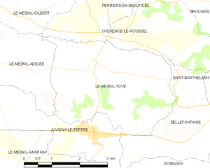
Le Mesnil-Tôve
- former commune in Manche, France
- Country:
- Postal Code: 50520
- Coordinates: 48° 42' 3" N, 1° 1' 21" E
- GPS tracks (wikiloc): [Link]
- Area: 11.74 sq km
- Population: 237


Le Mesnil-Herman
- commune in Manche, France
- Country:
- Postal Code: 50750
- Coordinates: 49° 1' 31" N, 1° 8' 44" E
- GPS tracks (wikiloc): [Link]
- Area: 1.91 sq km
- Population: 139


Éculleville
- former commune in Manche, France
- Country:
- Postal Code: 50440
- Coordinates: 49° 40' 56" N, 1° 49' 18" E
- GPS tracks (wikiloc): [Link]
- Area: 2.33 sq km
- Population: 31
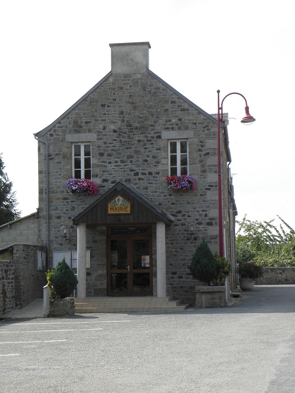

Poilley
- commune in Manche, France
- Country:
- Postal Code: 50220
- Coordinates: 48° 37' 6" N, 1° 18' 36" E
- GPS tracks (wikiloc): [Link]
- Area: 12.65 sq km
- Population: 891

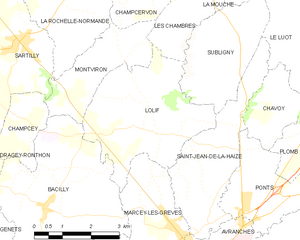
Lolif
- commune in Manche, France
- Country:
- Postal Code: 50530
- Coordinates: 48° 44' 2" N, 1° 23' 35" E
- GPS tracks (wikiloc): [Link]
- Area: 12.5 sq km
- Population: 559
- Web site: [Link]

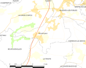
Rouffigny
- former commune in Manche, France
- Country:
- Postal Code: 50800
- Coordinates: 48° 48' 13" N, 1° 15' 14" E
- GPS tracks (wikiloc): [Link]
- Area: 6.72 sq km
- Population: 308


Chasseguey
- former commune in Manche, France
- Country:
- Postal Code: 50520
- Coordinates: 48° 38' 29" N, 1° 3' 53" E
- GPS tracks (wikiloc): [Link]
- Area: 3.06 sq km
- Population: 94


Annoville
- commune in Manche, France
- Country:
- Postal Code: 50660
- Coordinates: 48° 58' 2" N, 1° 32' 12" E
- GPS tracks (wikiloc): [Link]
- Area: 8.47 sq km
- Population: 666


Cerisy-la-Salle
- commune in Manche, France
- Country:
- Postal Code: 50210
- Coordinates: 49° 1' 34" N, 1° 16' 56" E
- GPS tracks (wikiloc): [Link]
- Area: 16.86 sq km
- Population: 1060


Saint-Aubin-du-Perron
- commune in Manche, France
- Country:
- Postal Code: 50490
- Coordinates: 49° 9' 6" N, 1° 22' 30" E
- GPS tracks (wikiloc): [Link]
- Area: 7.62 sq km
- Population: 242
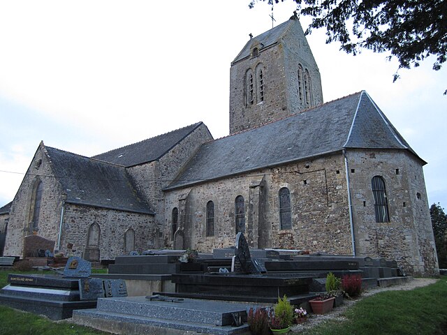

Lestre
- commune in Manche, France
- Country:
- Postal Code: 50310
- Coordinates: 49° 31' 34" N, 1° 20' 6" E
- GPS tracks (wikiloc): [Link]
- Area: 7.57 sq km
- Population: 256


Baupte
- commune in Manche, France
- Country:
- Postal Code: 50500
- Coordinates: 49° 18' 29" N, 1° 21' 41" E
- GPS tracks (wikiloc): [Link]
- Area: 2.29 sq km
- Population: 432


Omonville-la-Rogue
- former commune in Manche, France
- Country:
- Postal Code: 50440
- Coordinates: 49° 42' 9" N, 1° 50' 36" E
- GPS tracks (wikiloc): [Link]
- Area: 4.29 sq km
- Population: 490
- Web site: [Link]


Acqueville
- former commune in Manche, France
- Country:
- Postal Code: 50440
- Coordinates: 49° 36' 35" N, 1° 44' 57" E
- GPS tracks (wikiloc): [Link]
- Area: 5.79 sq km
- Population: 666

La Glacerie
- former commune in Manche, France
- Country:
- Postal Code: 50470
- Coordinates: 49° 36' 51" N, 1° 36' 15" E
- GPS tracks (wikiloc): [Link]
- Area: 18.7 sq km
- Population: 5875
- Web site: [Link]


La Chapelle-Urée
- commune in Manche, France
- Country:
- Postal Code: 50370
- Coordinates: 48° 40' 12" N, 1° 8' 33" E
- GPS tracks (wikiloc): [Link]
- Area: 4.6 sq km
- Population: 146


La Haye-du-Puits
- former commune in Manche, France
- Country:
- Postal Code: 50250
- Coordinates: 49° 17' 24" N, 1° 32' 32" E
- GPS tracks (wikiloc): [Link]
- Area: 5.25 sq km
- Population: 1478
- Web site: [Link]
Shares border with regions:
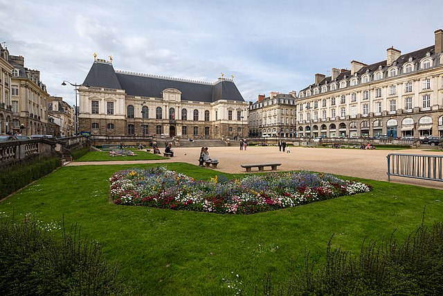

Ille-et-Vilaine
- French department
- Country:
- Capital: Rennes
- Coordinates: 48° 10' 0" N, 1° 40' 0" E
- GPS tracks (wikiloc): [Link]
- Area: 6775 sq km
- Population: 1042884
- Web site: [Link]

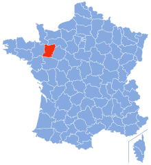
Mayenne
- department in northwest France
- Country:
- Capital: Laval
- Coordinates: 48° 10' 0" N, 0° 40' 0" E
- GPS tracks (wikiloc): [Link]
- Area: 5175 sq km
- Population: 307940
- Web site: [Link]


Orne
- French department
- Country:
- Capital: Alençon
- Coordinates: 48° 42' 0" N, 0° 0' 0" E
- GPS tracks (wikiloc): [Link]
- Area: 6103 sq km
- Population: 286618
- Web site: [Link]


Calvados
- French department
- Country:
- Capital: Caen
- Coordinates: 49° 2' 0" N, 0° 15' 0" E
- GPS tracks (wikiloc): [Link]
- Area: 5548 sq km
- Population: 693579
- Web site: [Link]