Bellevue-la-Montagne (Bellevue-la-Montagne)

- commune in Haute-Loire, France
- Country:

- Postal Code: 43350
- Coordinates: 45° 13' 14" N, 3° 49' 12" E


- GPS tracks (wikiloc): [Link]
- Area: 32.74 sq km
- Population: 413
- Web site: http://www.bellevue-la-montagne.com/
- Wikipedia en: wiki(en)
- Wikipedia: wiki(fr)
- Wikidata storage: Wikidata: Q270566
- Wikipedia Commons Category: [Link]
- Freebase ID: [/m/03ntj1f]
- GeoNames ID: Alt: [6449018]
- SIREN number: [214300261]
- BnF ID: [152599315]
- VIAF ID: Alt: [145425174]
- Library of Congress authority ID: Alt: [n81059406]
- INSEE municipality code: 43026
Shares border with regions:

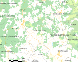
Céaux-d'Allègre
- commune in Haute-Loire, France
- Country:
- Postal Code: 43270
- Coordinates: 45° 10' 52" N, 3° 44' 50" E
- GPS tracks (wikiloc): [Link]
- Area: 32.41 sq km
- Population: 471
Monlet
- commune in Haute-Loire, France
- Country:
- Postal Code: 43270
- Coordinates: 45° 13' 10" N, 3° 42' 52" E
- GPS tracks (wikiloc): [Link]
- Area: 35.7 sq km
- Population: 399


Félines
- commune in Haute-Loire, France
- Country:
- Postal Code: 43160
- Coordinates: 45° 16' 20" N, 3° 44' 36" E
- GPS tracks (wikiloc): [Link]
- Area: 20.5 sq km
- Population: 301


Saint-Pierre-du-Champ
- commune in Haute-Loire, France
- Country:
- Postal Code: 43130
- Coordinates: 45° 14' 52" N, 3° 53' 58" E
- GPS tracks (wikiloc): [Link]
- AboveSeaLevel: 950 м m
- Area: 31.09 sq km
- Population: 506


Chomelix
- commune in Haute-Loire, France
- Country:
- Postal Code: 43500
- Coordinates: 45° 15' 44" N, 3° 49' 40" E
- GPS tracks (wikiloc): [Link]
- Area: 26.47 sq km
- Population: 479
- Web site: [Link]


Vorey
- commune in Haute-Loire, France
- Country:
- Postal Code: 43800
- Coordinates: 45° 11' 11" N, 3° 54' 36" E
- GPS tracks (wikiloc): [Link]
- Area: 39.23 sq km
- Population: 1419
- Web site: [Link]


Saint-Geneys-près-Saint-Paulien
- commune in Haute-Loire, France
- Country:
- Postal Code: 43350
- Coordinates: 45° 9' 42" N, 3° 49' 26" E
- GPS tracks (wikiloc): [Link]
- Area: 16.49 sq km
- Population: 310