Bellino (Bellino)
- Italian comune
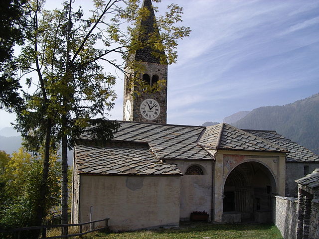
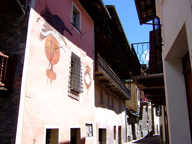
Bellino is a picturesque village located in the Susa Valley of the Piedmont region in northern Italy. It’s known for its stunning landscapes, rich culture, and outdoor activities, making it a fantastic destination for hiking enthusiasts.
Hiking Trails in Bellino
-
Sentiero dei Franchi: This trail provides an opportunity to explore the beautiful valleys and alpine meadows. It is marked well and offers breathtaking views.
-
Colle di Bellino: A hike to this pass allows you to traverse through diverse terrains with panoramic vistas. It’s accessible for both beginners and more experienced hikers.
-
Gorges of the Bellino River: These stunning gorges present a unique hiking experience with the chance to explore the local flora and fauna.
-
Lago di Pontechianale: A scenic hike leads to this beautiful lake, perfect for a picnic and enjoying the serene surroundings.
Preparation and Tips
- Weather: The weather can change rapidly in the mountains, so be prepared for all conditions. Check local forecasts before heading out.
- Gear: Wear sturdy hiking shoes, and consider layering your clothing for comfort.
- Hydration and Nutrition: Carry enough water and snacks to keep your energy levels up during your hike.
- Maps and Signage: Make sure to have a physical map or a GPS device, as some trails might not always be well-marked.
Best Time to Hike
- Summer Months (June to September): These months offer the best weather, though trails may be busier.
- Early Autumn (late September to October): The fall colors provide a stunning backdrop, and the crowds have typically thinned out.
Local Culture and Sightseeing
After a rewarding day of hiking, you can explore Bellino's charming village life, including local cuisine, historical sites, and traditional festivals.
Remember to respect nature and fellow hikers by sticking to trails, keeping noise to a minimum, and carrying out any trash. Enjoy your hiking adventure in Bellino!
- Country:

- Postal Code: 12020
- Local Dialing Code: 0175
- Licence Plate Code: CN
- Coordinates: 44° 35' 0" N, 7° 2' 0" E


- GPS tracks (wikiloc): [Link]
- AboveSeaLevel: 1576 м m
- Area: 62.07 sq km
- Population: 103
- Web site: http://www.comune.bellino.cn.it/
- Wikipedia en: wiki(en)
- Wikipedia: wiki(it)
- Wikidata storage: Wikidata: Q18205
- Wikipedia Commons Category: [Link]
- Freebase ID: [/m/0gb7yx]
- GeoNames ID: Alt: [6542420]
- VIAF ID: Alt: [244265272]
- OSM relation ID: [43294]
- ISTAT ID: 004017
- Italian cadastre code: A750
Shares border with regions:

Elva
- Italian comune
Elva, a picturesque village situated in the Piedmont region of Italy, is an excellent destination for hiking enthusiasts. Nestled in the Valle Maira, Elva offers stunning landscapes, diverse trails, and a rich cultural heritage. Here are some key points about hiking in and around Elva:...
- Country:

- Postal Code: 12020
- Local Dialing Code: 0171
- Licence Plate Code: CN
- Coordinates: 44° 32' 0" N, 7° 5' 0" E


- GPS tracks (wikiloc): [Link]
- AboveSeaLevel: 1637 м m
- Area: 26.22 sq km
- Population: 94
- Web site: [Link]

Pontechianale
- Italian comune
Pontechianale, located in the Susa Valley in the Piedmont region of Italy, is a stunning area for hiking enthusiasts. Nestled at the base of the impressive Alps, it offers breathtaking views, diverse trails, and a variety of landscapes ranging from lush valleys to rocky peaks. Here are some highlights of hiking in Pontechianale:...
- Country:

- Postal Code: 12020
- Local Dialing Code: 0175
- Licence Plate Code: CN
- Coordinates: 44° 37' 0" N, 7° 2' 0" E


- GPS tracks (wikiloc): [Link]
- AboveSeaLevel: 1614 м m
- Area: 94.92 sq km
- Population: 163
- Web site: [Link]
Acceglio
- Italian comune
Acceglio is a beautiful village located in the Piedmont region of Italy, nestled in the stunning Susa Valley of the Cottian Alps. Known for its picturesque landscape, rich flora and fauna, and traditional alpine architecture, it serves as an excellent base for hiking enthusiasts....
- Country:

- Postal Code: 12021
- Local Dialing Code: 0171
- Licence Plate Code: CN
- Coordinates: 44° 29' 0" N, 6° 59' 0" E


- GPS tracks (wikiloc): [Link]
- AboveSeaLevel: 1200 м m
- Area: 151.53 sq km
- Population: 155
- Web site: [Link]

Casteldelfino
- Italian comune
Casteldelfino is a charming village located in the Piedmont region of Italy, specifically in the Susa Valley near the borders of France. This picturesque area offers various hiking opportunities for outdoor enthusiasts looking to explore the stunning natural landscapes of the Italian Alps....
- Country:

- Postal Code: 12020
- Local Dialing Code: 0175
- Licence Plate Code: CN
- Coordinates: 44° 35' 26" N, 7° 4' 15" E


- GPS tracks (wikiloc): [Link]
- AboveSeaLevel: 1296 м m
- Area: 33.95 sq km
- Population: 152
- Web site: [Link]
Prazzo
- Italian comune
Prazzo is a charming alpine village located in the Piedmont region of Italy, near the French border. It is nestled within the beautiful natural landscape of the Valle Maira, which is known for its stunning scenery, rich biodiversity, and traditional culture....
- Country:

- Postal Code: 12028
- Local Dialing Code: 0171
- Licence Plate Code: CN
- Coordinates: 44° 29' 0" N, 7° 3' 0" E


- GPS tracks (wikiloc): [Link]
- AboveSeaLevel: 1030 м m
- Area: 52.39 sq km
- Population: 167
- Web site: [Link]

Saint-Paul-sur-Ubaye
- commune in Alpes-de-Haute-Provence, France
 Hiking in Saint-Paul-sur-Ubaye
Saint-Paul-sur-Ubaye is a charming commune in the Alpes-de-Haute-Provence region of France, nestled in the Ubaye Valley. It's an excellent destination for hiking enthusiasts due to its stunning natural landscapes, alpine scenery, and rich biodiversity. Here’s what you can expect when hiking in this area:...
- Country:

- Postal Code: 04530
- Coordinates: 44° 31' 0" N, 6° 45' 0" E


- GPS tracks (wikiloc): [Link]
- Area: 205.55 sq km
- Population: 200
- Web site: [Link]