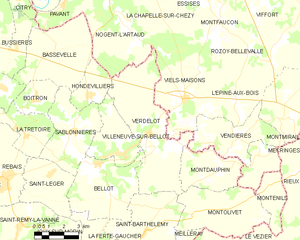
Bellot (Bellot)

- commune in Seine-et-Marne, France
- Country:

- Postal Code: 77510
- Coordinates: 48° 51' 24" N, 3° 19' 6" E


- GPS tracks (wikiloc): [Link]
- Area: 16.36 sq km
- Population: 785
- Web site: http://www.mairie-bellot.fr/
- Wikipedia en: wiki(en)
- Wikipedia: wiki(fr)
- Wikidata storage: Wikidata: Q251141
- Wikipedia Commons Category: [Link]
- Freebase ID: [/m/02pkq10]
- Freebase ID: [/m/02pkq10]
- GeoNames ID: Alt: [6455264]
- GeoNames ID: Alt: [6455264]
- SIREN number: [217700301]
- SIREN number: [217700301]
- BnF ID: [152753716]
- BnF ID: [152753716]
- VIAF ID: Alt: [132864721]
- VIAF ID: Alt: [132864721]
- INSEE municipality code: 77030
- INSEE municipality code: 77030
Shares border with regions:

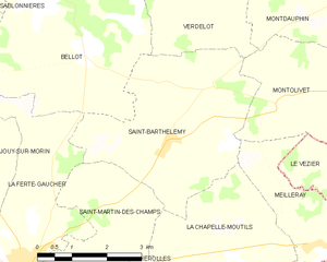
Saint-Barthélemy
- commune in Seine-et-Marne, France
- Country:
- Postal Code: 77320
- Coordinates: 48° 48' 59" N, 3° 21' 36" E
- GPS tracks (wikiloc): [Link]
- Area: 14.99 sq km
- Population: 334


Sablonnières
- commune in Seine-et-Marne, France
- Country:
- Postal Code: 77510
- Coordinates: 48° 52' 31" N, 3° 17' 47" E
- GPS tracks (wikiloc): [Link]
- Area: 13.98 sq km
- Population: 710

Verdelot
- commune in Seine-et-Marne, France
- Country:
- Postal Code: 77510
- Coordinates: 48° 52' 30" N, 3° 21' 57" E
- GPS tracks (wikiloc): [Link]
- Area: 25.6 sq km
- Population: 692


Villeneuve-sur-Bellot
- commune in Seine-et-Marne, France
- Country:
- Postal Code: 77510
- Coordinates: 48° 51' 47" N, 3° 20' 31" E
- GPS tracks (wikiloc): [Link]
- Area: 9.52 sq km
- Population: 1145


Saint-Léger
- commune in Seine-et-Marne, France
- Country:
- Postal Code: 77510
- Coordinates: 48° 50' 20" N, 3° 15' 18" E
- GPS tracks (wikiloc): [Link]
- Area: 9.63 sq km
- Population: 252

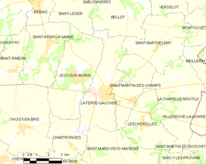
La Ferté-Gaucher
- commune in Seine-et-Marne, France
- Country:
- Postal Code: 77320
- Coordinates: 48° 46' 57" N, 3° 18' 19" E
- GPS tracks (wikiloc): [Link]
- Area: 17.32 sq km
- Population: 4802
- Web site: [Link]