Belmont (Belmont)

- commune in Isère, France
 Hiking in Belmont
Belmont is a picturesque village located in the Isère department of the Auvergne-Rhône-Alpes region in southeastern France. It offers a variety of hiking opportunities that cater to different skill levels and preferences. Here are some highlights and tips for hiking in and around Belmont:
Hiking Trails
-
Local Trails: The area around Belmont features several marked hiking trails that take you through beautiful landscapes, including forests, meadows, and mountainous terrain. Check local trail maps or resources to find those that suit your interests and fitness levels.
-
GR (Grande Randonnée) Trails: Look for sections of the GR trails that pass near or through Belmont. These long-distance trails can provide a more extensive hiking experience, often leading to stunning vistas and diverse ecosystems.
-
Nearby Mountains: The region is nestled within proximity to the Chartreuse Mountains and the Vercors Massif, which offer numerous trails with varying levels of difficulty. Popular hikes include the trails leading to peaks, panoramic viewpoints, and serene lakes.
Natural Attractions
- Flora and Fauna: The Isère region is known for its rich biodiversity. Hiking through Belmont can provide opportunities to spot a variety of wildlife and enjoy the local flora, especially in the spring and summer months.
- Scenic Views: Many trails offer breathtaking views over the Alps and the surrounding valleys. Try to hike to higher elevations for the best vistas.
Tips for Hikers
- Prepare Properly: Wear sturdy hiking boots, carry plenty of water, and bring snacks. A map or GPS device can help navigate the trails.
- Check Weather Conditions: The weather can change rapidly in the mountains, so always check forecasts before heading out and be prepared for different conditions.
- Respect Nature: Follow the Leave No Trace principles to help preserve the natural beauty of the area.
- Local Guidance: Consider reaching out to local hiking groups or guides who can provide insights on the best trails and current conditions.
Additional Resources
You might find useful resources or local guides at tourism offices or hiking shops in nearby towns. They can offer updated maps, trail conditions, and recommendations for your hiking adventure.
Belmont is a wonderful place to explore the beauty of the French Alps, offering both relaxation and adventure for hikers of all levels. Enjoy your time outdoors!
- Country:

- Postal Code: 38690
- Coordinates: 45° 28' 25" N, 5° 21' 49" E


- GPS tracks (wikiloc): [Link]
- AboveSeaLevel: 550 м m
- Area: 6.51 sq km
- Population: 582
- Wikipedia en: wiki(en)
- Wikipedia: wiki(fr)
- Wikidata storage: Wikidata: Q683026
- Wikipedia Commons Category: [Link]
- Freebase ID: [/m/03g_727]
- GeoNames ID: Alt: [6616649]
- SIREN number: [213800386]
- BnF ID: [15257867d]
- INSEE municipality code: 38038
Shares border with regions:


Bizonnes
- commune in Isère, France
Hiking in Bizonnes
Bizonnes is a small commune located in the Auvergne-Rhône-Alpes region of southeastern France, near the city of Grenoble. While it might not be the most prominent destination for hiking, it offers access to picturesque landscapes typical of the region, which is characterized by rolling hills, forests, and stunning views of the surrounding Alps....
- Country:
- Postal Code: 38690
- Coordinates: 45° 27' 18" N, 5° 22' 49" E
- GPS tracks (wikiloc): [Link]
- Area: 11.04 sq km
- Population: 926
- Web site: [Link]

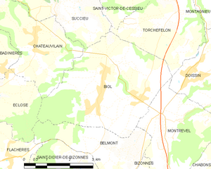
Biol
- commune in Isère, France
Hiking in Biol
Biol is a charming village located in the Isère department of the Auvergne-Rhône-Alpes region in southeastern France. It's a great destination for hikers due to its proximity to the beautiful Vercors massif and the Chartreuse mountain range. Here are some highlights and tips for hiking in and around Biol:...
- Country:
- Postal Code: 38690
- Coordinates: 45° 29' 30" N, 5° 23' 7" E
- GPS tracks (wikiloc): [Link]
- Area: 15.51 sq km
- Population: 1398
- Web site: [Link]


Saint-Didier-de-Bizonnes
- commune in Isère, France
Hiking in Saint-Didier-de-Bizonnes
Saint-Didier-de-Bizonnes is a charming village located in the Auvergne-Rhône-Alpes region of France, surrounded by beautiful natural landscapes that are ideal for hiking. Here are some highlights for hiking enthusiasts in the area:...
- Country:
- Postal Code: 38690
- Coordinates: 45° 28' 2" N, 5° 21' 4" E
- GPS tracks (wikiloc): [Link]
- Area: 7.2 sq km
- Population: 294
- Web site: [Link]


Flachères
- commune in Isère, France
Hiking in Flachères
Flachères is a small village in the Auvergne-Rhône-Alpes region of France, which offers access to beautiful natural landscapes that are ideal for hiking. While Flachères itself might not be a hiking hotspot, its proximity to the surrounding areas, such as the Vercors and the Chartreuse Mountains, presents excellent opportunities for outdoor activities....
- Country:
- Postal Code: 38690
- Coordinates: 45° 28' 12" N, 5° 18' 49" E
- GPS tracks (wikiloc): [Link]
- Area: 4.94 sq km
- Population: 516
- Web site: [Link]


Montrevel
- commune in Isère, France
Hiking in Montrevel
Montrevel is located in the Isère department of the Auvergne-Rhône-Alpes region in southeastern France. It is a beautiful area for hiking, known for its diverse landscapes that combine mountains, valleys, forests, and rivers. Here are some highlights and tips for hiking in the Montrevel area:...
- Country:
- Postal Code: 38690
- Coordinates: 45° 28' 44" N, 5° 24' 8" E
- GPS tracks (wikiloc): [Link]
- Area: 9.37 sq km
- Population: 461
- Web site: [Link]