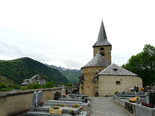
Billière (Billière)

- commune in Haute-Garonne, France
- Country:

- Postal Code: 31110
- Coordinates: 42° 48' 41" N, 0° 31' 37" E


- GPS tracks (wikiloc): [Link]
- Area: 2.18 sq km
- Population: 22
- Wikipedia en: wiki(en)
- Wikipedia: wiki(fr)
- Wikidata storage: Wikidata: Q1345882
- Wikipedia Commons Category: [Link]
- Freebase ID: [/m/03nsyf1]
- Freebase ID: [/m/03nsyf1]
- GeoNames ID: Alt: [6448284]
- GeoNames ID: Alt: [6448284]
- SIREN number: [213100688]
- SIREN number: [213100688]
- OSM relation ID: [1431880]
- OSM relation ID: [1431880]
- INSEE municipality code: 31068
- INSEE municipality code: 31068
Shares border with regions:


Benque-Dessous-et-Dessus
- commune in Haute-Garonne, France
- Country:
- Postal Code: 31110
- Coordinates: 42° 48' 55" N, 0° 33' 17" E
- GPS tracks (wikiloc): [Link]
- AboveSeaLevel: 1084 м m
- Area: 3.72 sq km
- Population: 25

Cazeaux-de-Larboust
- commune in Haute-Garonne, France
- Country:
- Postal Code: 31110
- Coordinates: 42° 48' 23" N, 0° 31' 50" E
- GPS tracks (wikiloc): [Link]
- Area: 19.14 sq km
- Population: 91


Castillon-de-Larboust
- commune in Haute-Garonne, France
- Country:
- Postal Code: 31110
- Coordinates: 42° 48' 21" N, 0° 32' 2" E
- GPS tracks (wikiloc): [Link]
- Area: 20.67 sq km
- Population: 45

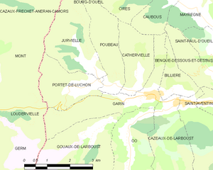
Garin
- commune in Haute-Garonne, France
- Country:
- Postal Code: 31110
- Coordinates: 42° 48' 33" N, 0° 30' 59" E
- GPS tracks (wikiloc): [Link]
- Area: 5.62 sq km
- Population: 139