Biras (Biras)

- commune in Dordogne, France
- Country:

- Postal Code: 24310
- Coordinates: 45° 17' 16" N, 0° 38' 20" E


- GPS tracks (wikiloc): [Link]
- Area: 19.43 sq km
- Population: 664
- Wikipedia en: wiki(en)
- Wikipedia: wiki(fr)
- Wikidata storage: Wikidata: Q177546
- Wikipedia Commons Category: [Link]
- Freebase ID: [/m/0264b39]
- Freebase ID: [/m/0264b39]
- GeoNames ID: Alt: [3032568]
- GeoNames ID: Alt: [3032568]
- SIREN number: [212400428]
- SIREN number: [212400428]
- BnF ID: [15251693z]
- BnF ID: [15251693z]
- INSEE municipality code: 24042
- INSEE municipality code: 24042
Shares border with regions:


Château-l'Évêque
- commune in Dordogne, France
- Country:
- Postal Code: 24460
- Coordinates: 45° 14' 43" N, 0° 41' 8" E
- GPS tracks (wikiloc): [Link]
- Area: 35.68 sq km
- Population: 2128
- Web site: [Link]

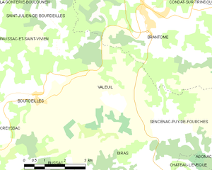
Valeuil
- commune in Dordogne, France
- Country:
- Postal Code: 24310
- Coordinates: 45° 19' 59" N, 0° 37' 4" E
- GPS tracks (wikiloc): [Link]
- Area: 18.5 sq km
- Population: 364
- Web site: [Link]


Bussac
- commune in Dordogne, France
- Country:
- Postal Code: 24350
- Coordinates: 45° 16' 20" N, 0° 36' 23" E
- GPS tracks (wikiloc): [Link]
- Area: 16.84 sq km
- Population: 385


Bourdeilles
- commune in Dordogne, France
- Country:
- Postal Code: 24310
- Coordinates: 45° 19' 19" N, 0° 35' 13" E
- GPS tracks (wikiloc): [Link]
- Area: 21.85 sq km
- Population: 739
- Web site: [Link]