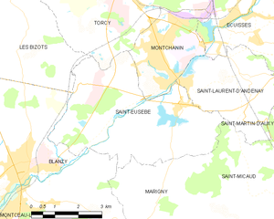
Blanzy (Blanzy)
- commune in Saône-et-Loire, France
- Country:

- Postal Code: 71450
- Coordinates: 46° 42' 14" N, 4° 23' 25" E


- GPS tracks (wikiloc): [Link]
- Area: 39.95 sq km
- Population: 6347
- Web site: http://www.blanzy71.fr
- Wikipedia en: wiki(en)
- Wikipedia: wiki(fr)
- Wikidata storage: Wikidata: Q1365776
- Wikipedia Commons Category: [Link]
- Wikipedia Commons Maps Category: [Link]
- Freebase ID: [/m/03qfy5b]
- Freebase ID: [/m/03qfy5b]
- GeoNames ID: Alt: [3032326]
- GeoNames ID: Alt: [3032326]
- SIREN number: [217100403]
- SIREN number: [217100403]
- BnF ID: [152730142]
- BnF ID: [152730142]
- Library of Congress authority ID: Alt: [n83208971]
- Library of Congress authority ID: Alt: [n83208971]
- PACTOLS thesaurus ID: [pcrt5KS3yaTQ42]
- PACTOLS thesaurus ID: [pcrt5KS3yaTQ42]
- MusicBrainz area ID: [3a057454-5e09-4346-8bfb-f3f187190eea]
- MusicBrainz area ID: [3a057454-5e09-4346-8bfb-f3f187190eea]
- INSEE municipality code: 71040
- INSEE municipality code: 71040
Shares border with regions:


Les Bizots
- commune in Saône-et-Loire, France
- Country:

- Postal Code: 71710
- Coordinates: 46° 45' 5" N, 4° 23' 25" E


- GPS tracks (wikiloc): [Link]
- Area: 21.69 sq km
- Population: 465
- Web site: [Link]


Marigny
- commune in Saône-et-Loire, France
- Country:

- Postal Code: 71300
- Coordinates: 46° 40' 44" N, 4° 27' 34" E


- GPS tracks (wikiloc): [Link]
- Area: 22.3 sq km
- Population: 151


Saint-Berain-sous-Sanvignes
- commune in Saône-et-Loire, France
- Country:

- Postal Code: 71300
- Coordinates: 46° 42' 24" N, 4° 17' 43" E


- GPS tracks (wikiloc): [Link]
- Area: 45.07 sq km
- Population: 1094
- Web site: [Link]


Saint-Vallier
- commune in Saône-et-Loire, France
- Country:

- Postal Code: 71230
- Coordinates: 46° 38' 31" N, 4° 22' 16" E


- GPS tracks (wikiloc): [Link]
- Area: 24.21 sq km
- Population: 8734
- Web site: [Link]


Gourdon
- commune in Saône-et-Loire, France
- Country:

- Postal Code: 71690
- Coordinates: 46° 38' 26" N, 4° 26' 50" E


- GPS tracks (wikiloc): [Link]
- Area: 25.41 sq km
- Population: 921


Montceau-les-Mines
- commune in Saône-et-Loire, France
- Country:

- Postal Code: 71300
- Coordinates: 46° 40' 1" N, 4° 22' 8" E


- GPS tracks (wikiloc): [Link]
- AboveSeaLevel: 287 м m
- Area: 16.62 sq km
- Population: 18772
- Web site: [Link]


Charmoy, Saône-et-Loire
- commune in Saône-et-Loire, France
- Country:

- Postal Code: 71710
- Coordinates: 46° 45' 22" N, 4° 19' 59" E


- GPS tracks (wikiloc): [Link]
- AboveSeaLevel: 310 м m
- Area: 39.54 sq km
- Population: 253


Saint-Eusèbe, Saône-et-Loire
- commune in Saône-et-Loire, France
- Country:

- Postal Code: 71210
- Coordinates: 46° 43' 32" N, 4° 28' 53" E


- GPS tracks (wikiloc): [Link]
- Area: 21.21 sq km
- Population: 1180
