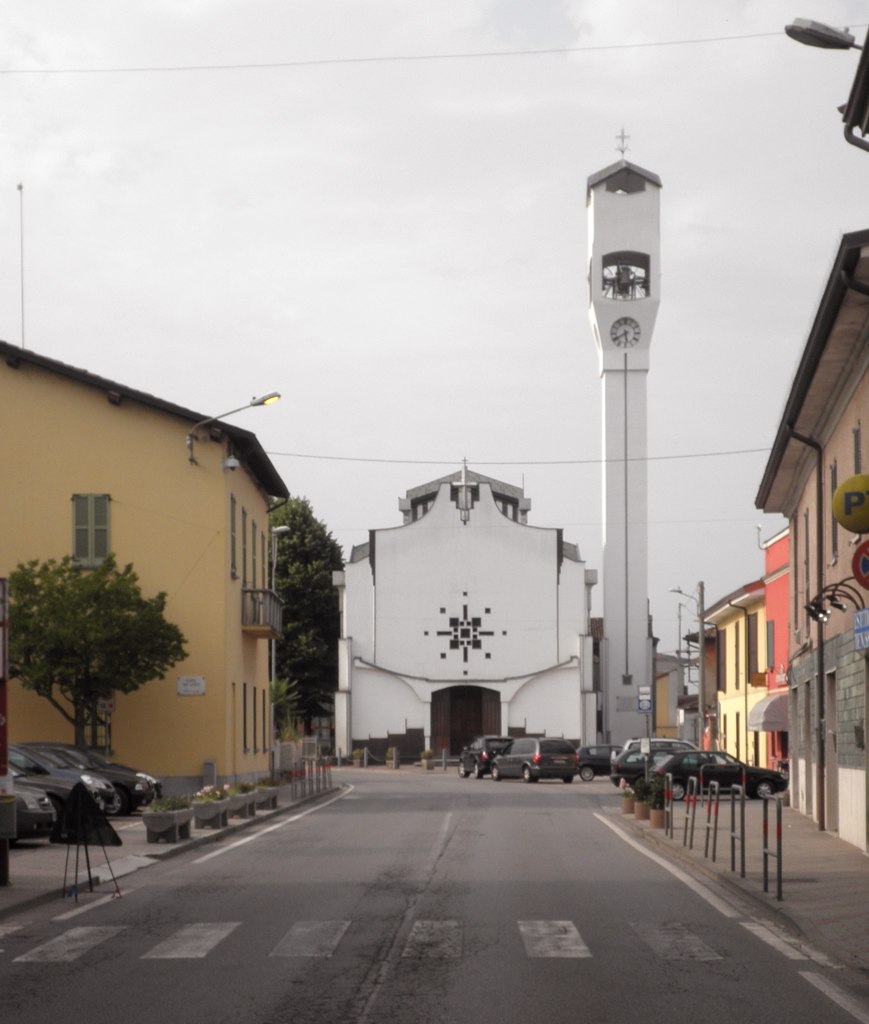
Boffalora d'Adda (Boffalora d'Adda)
.svg)
- Italian comune
 Hiking in Boffalora d'Adda
Boffalora d'Adda, a charming village located in the Lombardy region of Italy, is nestled along the banks of the Adda River. The area offers a variety of hiking opportunities, especially for those who enjoy exploring scenic landscapes, historical sites, and the natural beauty of the Lombardy countryside.
Hiking Trails
-
Adda River Trails: The banks of the Adda River provide several trails that vary in difficulty. These paths are mostly flat and suitable for all levels of hikers, making them ideal for families and casual walkers. While walking along, you'll enjoy views of the river, lush greenery, and local wildlife.
-
Countryside Paths: Beyond the river, the surrounding countryside features a network of trails that can lead you through fields, vineyards, and small forests. This is a great way to experience the rural charm of the area, with opportunities for birdwatching and encountering local farm animals.
-
Historical Stops: Along many hiking paths, you may come across historical landmarks such as the ancient churches and villas that dot the landscape. Make sure to take breaks to enjoy these culturally rich spots.
Recommended Hiking Tips
- Footwear: Wear sturdy hiking shoes or boots, as some trails may be uneven or have loose gravel.
- Weather Prep: Check the weather before you go. The climate in this region can vary, and it’s best to be prepared for fluctuations.
- Hydration: Bring plenty of water, especially during warmer months.
- Respect Nature: Stay on marked trails and leave no trace—carry out everything you bring in.
- Local Maps: Having a map of the local trails can enhance your experience and help you navigate. Local tourism offices often have resources and recommendations.
Nearby Attractions
Consider combining your hikes with visits to nearby attractions:
- Parco Adda Nord: A natural park that offers additional trails and outdoor activities like biking and kayaking.
- Historical Towns: Explore the nearby towns such as Trezzo sull'Adda, which has a rich history and beautiful sights, including the Crespi d'Adda, a UNESCO World Heritage site.
Hiking in Boffalora d'Adda is not only about enjoying the outdoors but also about immersing yourself in the local culture and history. Whether you’re looking for a leisurely stroll or a more challenging trek, you’ll find the perfect path to suit your desires. Happy hiking!
- Country:

- Postal Code: 26811
- Local Dialing Code: 0371
- Licence Plate Code: LO
- Coordinates: 45° 21' 39" N, 9° 29' 43" E


- GPS tracks (wikiloc): [Link]
- AboveSeaLevel: 78 м m
- Area: 8.13 sq km
- Population: 1770
- Web site: http://www.comune.boffaloradadda.lo.it
- Wikipedia en: wiki(en)
- Wikipedia: wiki(it)
- Wikidata storage: Wikidata: Q42310
- Wikipedia Commons Category: [Link]
- Freebase ID: [/m/0gr50t]
- GeoNames ID: Alt: [6540894]
- OSM relation ID: [44776]
- UN/LOCODE: [ITBFA]
- ISTAT ID: 098003
- Italian cadastre code: A919
Shares border with regions:

Dovera
- Italian comune
Hiking in Dovera
Dovera, a small town in Italy's Lombardy region, offers a unique opportunity for hikers, particularly those interested in exploring the natural beauty of the surrounding areas. While Dovera itself is not a major hiking destination, it's conveniently situated near several natural parks and hiking trails. Here are some points to consider if you're looking to hike in and around Dovera:...
- Country:
- Postal Code: 26010
- Local Dialing Code: 0373
- Licence Plate Code: CR
- Coordinates: 45° 22' 0" N, 9° 32' 0" E
- GPS tracks (wikiloc): [Link]
- AboveSeaLevel: 73 м m
- Area: 20.65 sq km
- Population: 3853
- Web site: [Link]

Montanaso Lombardo
- Italian comune
Hiking in Montanaso Lombardo
Montanaso Lombardo, a small municipality in Italy located in the Lombardy region, is not typically known as a prime hiking destination compared to the more famous nearby areas like the Italian Alps or the Apennines. However, it can serve as a good base for exploring the surrounding countryside....
- Country:
- Postal Code: 26836
- Local Dialing Code: 0371
- Licence Plate Code: LO
- Coordinates: 45° 20' 12" N, 9° 28' 11" E
- GPS tracks (wikiloc): [Link]
- AboveSeaLevel: 83 м m
- Area: 9.52 sq km
- Population: 2271
- Web site: [Link]

Spino d’Adda
- Italian comune
Hiking in Spino d’Adda
Spino d'Adda is a picturesque town in Lombardy, Italy, located along the Adda River. It offers a variety of hiking opportunities that allow you to explore the natural beauty of the area and its surrounding landscapes. Here are some highlights and tips for hiking in Spino d'Adda:...
- Country:
- Postal Code: 26016
- Local Dialing Code: 0373
- Licence Plate Code: CR
- Coordinates: 45° 24' 0" N, 9° 30' 0" E
- GPS tracks (wikiloc): [Link]
- AboveSeaLevel: 84 м m
- Area: 20.02 sq km
- Population: 6843
- Web site: [Link]
Galgagnano
- Italian comune
Hiking in Galgagnano
Galgagnano is a small village located in the northern Italian region of Lombardy, known for its tranquil countryside and beautiful landscapes. While it may not be a highly popular hiking destination compared to some mountainous regions in Italy, it offers opportunities for nature walks and hikes through the surrounding countryside....
- Country:
- Postal Code: 26832
- Local Dialing Code: 0371
- Licence Plate Code: LO
- Coordinates: 45° 21' 32" N, 9° 26' 47" E
- GPS tracks (wikiloc): [Link]
- AboveSeaLevel: 86 м m
- Area: 6.01 sq km
- Population: 1263
- Web site: [Link]


Zelo Buon Persico
- Italian comune
Hiking in Zelo Buon Persico
Zelo Buon Persico, a small town in the Lombardy region of Italy, is situated near the larger city of Lodi and is known for its natural surroundings, which offer opportunities for outdoor activities, including hiking. Although Zelo Buon Persico itself may not have an extensive network of hiking trails, the surrounding area features beautiful landscapes that are suitable for leisurely hikes....
- Country:
- Postal Code: 26839
- Local Dialing Code: 02
- Licence Plate Code: LO
- Coordinates: 45° 24' 48" N, 9° 26' 1" E
- GPS tracks (wikiloc): [Link]
- AboveSeaLevel: 90 м m
- Area: 18.88 sq km
- Population: 7373
- Web site: [Link]

Lodi
- Italian comune
Hiking in Lodi
Lodi, a charming town in the Lombardy region of Italy, is not only rich in history and culture but also offers some great opportunities for hiking enthusiasts. Here’s an overview of hiking in and around Lodi:...
- Country:
- Postal Code: 26900
- Local Dialing Code: 0371
- Licence Plate Code: LO
- Coordinates: 45° 19' 0" N, 9° 30' 0" E
- GPS tracks (wikiloc): [Link]
- AboveSeaLevel: 87 м m
- Area: 41.38 sq km
- Population: 45212
- Web site: [Link]