Bourcefranc-le-Chapus (Bourcefranc-le-Chapus)

- commune in Charente-Maritime, France
- Country:

- Postal Code: 17560
- Coordinates: 45° 50' 50" N, 1° 8' 51" E


- GPS tracks (wikiloc): [Link]
- Area: 12.4 sq km
- Population: 3447
- Web site: http://www.bourcefranc-le-chapus.fr
- Wikipedia en: wiki(en)
- Wikipedia: wiki(fr)
- Wikidata storage: Wikidata: Q1016328
- Wikipedia Commons Category: [Link]
- Freebase ID: [/m/03mcg50]
- GeoNames ID: Alt: [3031080]
- SIREN number: [211700588]
- BnF ID: [152489202]
- VIAF ID: Alt: [152318611]
- INSEE municipality code: 17058
Shares border with regions:

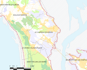
Le Château-d'Oléron
- commune in Charente-Maritime, France
- Country:
- Postal Code: 17480
- Coordinates: 45° 53' 9" N, 1° 11' 41" E
- GPS tracks (wikiloc): [Link]
- Area: 15.67 sq km
- Population: 4121
- Web site: [Link]

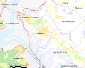
Marennes
- commune in Charente-Maritime, France
- Country:
- Postal Code: 17320
- Coordinates: 45° 49' 21" N, 1° 6' 19" E
- GPS tracks (wikiloc): [Link]
- Area: 20.09 sq km
- Population: 5662
- Web site: [Link]


Hiers-Brouage
- commune in Charente-Maritime, France
- Country:
- Postal Code: 17320
- Coordinates: 45° 50' 59" N, 1° 4' 32" E
- GPS tracks (wikiloc): [Link]
- Area: 31.35 sq km
- Population: 630
- Web site: [Link]