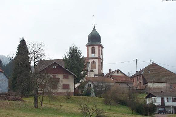
Bourg-Bruche (Bourg-Bruche)

- commune in Bas-Rhin, France
- Country:

- Postal Code: 67420
- Coordinates: 48° 21' 21" N, 7° 8' 17" E


- GPS tracks (wikiloc): [Link]
- Area: 15.02 sq km
- Population: 471
- Web site: http://bourg-bruche.valleedelabruche.fr
- Wikipedia en: wiki(en)
- Wikipedia: wiki(fr)
- Wikidata storage: Wikidata: Q21253
- Wikipedia Commons Category: [Link]
- Freebase ID: [/m/03m96th]
- Freebase ID: [/m/03m96th]
- Freebase ID: [/m/03m96th]
- GeoNames ID: Alt: [6450606]
- GeoNames ID: Alt: [6450606]
- GeoNames ID: Alt: [6450606]
- SIREN number: [216700591]
- SIREN number: [216700591]
- SIREN number: [216700591]
- BnF ID: [152712024]
- BnF ID: [152712024]
- BnF ID: [152712024]
- INSEE municipality code: 67059
- INSEE municipality code: 67059
- INSEE municipality code: 67059
Shares border with regions:


Colroy-la-Roche
- commune in Bas-Rhin, France
- Country:
- Postal Code: 67420
- Coordinates: 48° 23' 25" N, 7° 10' 55" E
- GPS tracks (wikiloc): [Link]
- Area: 8.18 sq km
- Population: 494
- Web site: [Link]

Saulxures
- commune in Bas-Rhin, France
- Country:
- Postal Code: 67420
- Coordinates: 48° 23' 32" N, 7° 7' 52" E
- GPS tracks (wikiloc): [Link]
- AboveSeaLevel: 535 м m
- Area: 12.84 sq km
- Population: 520
- Web site: [Link]


Urbeis
- commune in Bas-Rhin, France
- Country:
- Postal Code: 67220
- Coordinates: 48° 19' 32" N, 7° 13' 25" E
- GPS tracks (wikiloc): [Link]
- Area: 11.6 sq km
- Population: 322

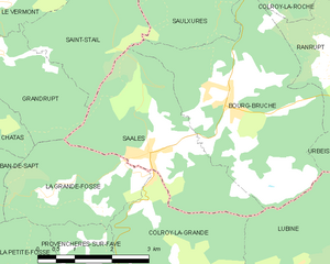
Saales
- commune in Bas-Rhin, France
- Country:
- Postal Code: 67420
- Coordinates: 48° 20' 54" N, 7° 6' 21" E
- GPS tracks (wikiloc): [Link]
- Area: 9.88 sq km
- Population: 821
- Web site: [Link]

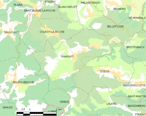
Ranrupt
- commune in Bas-Rhin, France
- Country:
- Postal Code: 67420
- Coordinates: 48° 22' 28" N, 7° 11' 54" E
- GPS tracks (wikiloc): [Link]
- Area: 14.68 sq km
- Population: 352


Saint-Stail
- commune in Vosges, France
- Country:
- Postal Code: 88210
- Coordinates: 48° 22' 28" N, 7° 4' 8" E
- GPS tracks (wikiloc): [Link]
- Area: 6.21 sq km
- Population: 71


Lubine
- commune in Vosges, France
- Country:
- Postal Code: 88490
- Coordinates: 48° 19' 0" N, 7° 9' 6" E
- GPS tracks (wikiloc): [Link]
- Area: 14.85 sq km
- Population: 213