Bouzancourt (Bouzancourt)

- commune in Haute-Marne, France
- Country:

- Postal Code: 52110
- Coordinates: 48° 18' 51" N, 4° 56' 58" E


- GPS tracks (wikiloc): [Link]
- Area: 11.75 sq km
- Population: 69
- Wikipedia en: wiki(en)
- Wikipedia: wiki(fr)
- Wikidata storage: Wikidata: Q1102179
- Wikipedia Commons Category: [Link]
- Freebase ID: [/m/03ntryk]
- Freebase ID: [/m/03ntryk]
- GeoNames ID: Alt: [6449610]
- GeoNames ID: Alt: [6449610]
- SIREN number: [215200452]
- SIREN number: [215200452]
- BnF ID: [152633151]
- BnF ID: [152633151]
- INSEE municipality code: 52065
- INSEE municipality code: 52065
Shares border with regions:


Daillancourt
- commune in Haute-Marne, France
- Country:
- Postal Code: 52110
- Coordinates: 48° 18' 9" N, 4° 57' 12" E
- GPS tracks (wikiloc): [Link]
- Area: 7.91 sq km
- Population: 76
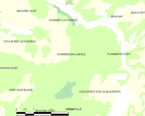
Charmes-en-l'Angle
- commune in Haute-Marne, France
- Country:
- Postal Code: 52110
- Coordinates: 48° 22' 28" N, 5° 0' 8" E
- GPS tracks (wikiloc): [Link]
- Area: 7.36 sq km
- Population: 10
Beurville
- commune in Haute-Marne, France
- Country:
- Postal Code: 52110
- Coordinates: 48° 19' 9" N, 4° 50' 0" E
- GPS tracks (wikiloc): [Link]
- Area: 22.92 sq km
- Population: 104


Ambonville
- commune in Haute-Marne, France
- Country:
- Postal Code: 52110
- Coordinates: 48° 18' 43" N, 5° 0' 56" E
- GPS tracks (wikiloc): [Link]
- Area: 14.47 sq km
- Population: 76

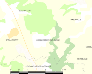
Guindrecourt-sur-Blaise
- commune in Haute-Marne, France
- Country:
- Postal Code: 52330
- Coordinates: 48° 17' 47" N, 4° 58' 27" E
- GPS tracks (wikiloc): [Link]
- Area: 5.52 sq km
- Population: 49


Leschères-sur-le-Blaiseron
- commune in Haute-Marne, France
- Country:
- Postal Code: 52110
- Coordinates: 48° 20' 14" N, 5° 2' 21" E
- GPS tracks (wikiloc): [Link]
- AboveSeaLevel: 250 м m
- Area: 14.93 sq km
- Population: 101


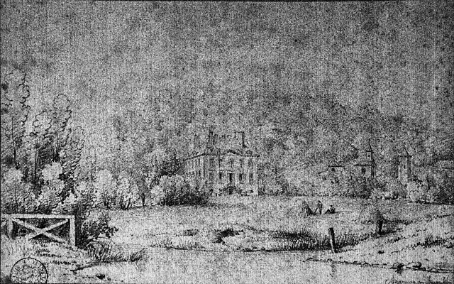
Cirey-sur-Blaise
- commune in Haute-Marne, France
- Country:
- Postal Code: 52110
- Coordinates: 48° 19' 56" N, 4° 56' 26" E
- GPS tracks (wikiloc): [Link]
- Area: 16.44 sq km
- Population: 112