Bramevaque (Bramevaque)

- commune in Hautes-Pyrénées, France
- Country:

- Postal Code: 65370
- Coordinates: 42° 58' 38" N, 0° 34' 29" E


- GPS tracks (wikiloc): [Link]
- Area: 3.77 sq km
- Population: 39
- Wikipedia en: wiki(en)
- Wikipedia: wiki(fr)
- Wikidata storage: Wikidata: Q285355
- Wikipedia Commons Category: [Link]
- Freebase ID: [/m/03nv3zs]
- Freebase ID: [/m/03nv3zs]
- GeoNames ID: Alt: [6440666]
- GeoNames ID: Alt: [6440666]
- SIREN number: [216501098]
- SIREN number: [216501098]
- BnF ID: [15270490j]
- BnF ID: [15270490j]
- PACTOLS thesaurus ID: [pcrtTIHv9X7k7X]
- PACTOLS thesaurus ID: [pcrtTIHv9X7k7X]
- INSEE municipality code: 65109
- INSEE municipality code: 65109
Shares border with regions:
Gembrie
- commune in Hautes-Pyrénées, France
- Country:
- Postal Code: 65370
- Coordinates: 42° 59' 23" N, 0° 34' 28" E
- GPS tracks (wikiloc): [Link]
- Area: 1 sq km
- Population: 76


Troubat
- commune in Hautes-Pyrénées, France
- Country:
- Postal Code: 65370
- Coordinates: 42° 58' 34" N, 0° 34' 49" E
- GPS tracks (wikiloc): [Link]
- Area: 2.79 sq km
- Population: 73

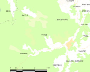
Ourde
- commune in Hautes-Pyrénées, France
- Country:
- Postal Code: 65370
- Coordinates: 42° 57' 32" N, 0° 33' 18" E
- GPS tracks (wikiloc): [Link]
- Area: 5.6 sq km
- Population: 34
Sacoué
- commune in Hautes-Pyrénées, France
- Country:
- Postal Code: 65370
- Coordinates: 42° 59' 17" N, 0° 33' 47" E
- GPS tracks (wikiloc): [Link]
- Area: 13.14 sq km
- Population: 64


Mauléon-Barousse
- commune in Hautes-Pyrénées, France
- Country:
- Postal Code: 65370
- Coordinates: 42° 57' 34" N, 0° 34' 4" E
- GPS tracks (wikiloc): [Link]
- Area: 5.49 sq km
- Population: 103