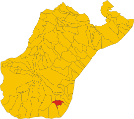
Brancaleone (Brancaleone)
.svg)
- Italian comune
 Hiking in Brancaleone
Brancaleone, located in the Calabria region of southern Italy, is a hidden gem for outdoor enthusiasts and hikers. This picturesque area offers a blend of natural beauty, historical charm, and a delightful Mediterranean climate, making it an excellent choice for hiking.
Hiking Trails
-
Aspromonte National Park: Just a short distance from Brancaleone, this national park is a hiker's paradise, featuring rugged landscapes, deep gorges, and stunning waterfalls. Trails vary in difficulty, offering something for everyone from casual walkers to seasoned trekkers.
-
Coastal Paths: The coastline near Brancaleone boasts beautiful trails that allow hikers to enjoy breathtaking views of the Tyrrhenian Sea. Walking along the beach or up the cliffs provides stunning vistas, especially during sunrise or sunset.
-
Mount Consolino: Hiking towards Mount Consolino provides not only a challenge but also panoramic views of the surrounding valleys and the coast. The ascent can be strenuous, but reaching the summit is rewarding.
Flora and Fauna
The hiking areas around Brancaleone are rich in biodiversity. As you hike, you can expect to see a variety of Mediterranean vegetation, such as olive groves, oak forests, and wildflowers. Wildlife enthusiasts may also spot different species of birds and small mammals unique to the region.
Historical Aspects
Brancaleone itself has historical significance, featuring ancient ruins and remnants of past civilizations. Exploring these sites can provide an interesting cultural element to your hiking experience.
Tips for Hiking in Brancaleone
- Stay Hydrated: Always carry water, especially during the warmer months when temperatures can rise.
- Proper Footwear: Good hiking shoes are a must for navigating rocky paths and uneven terrain.
- Weather Check: Before heading out, check the weather forecast, as conditions can change rapidly in mountainous areas.
- Local Guides: Consider hiring a local guide for a more in-depth understanding of the natural and cultural history of the region.
Best Time to Hike
The ideal time for hiking in Brancaleone is during the spring (April to June) and fall (September to October) when temperatures are mild, and the scenery is vibrant. Summer can be quite hot, while winter might bring cooler, wetter conditions.
Whether you’re looking for a scenic stroll along the coast or a challenging hike in the mountains, Brancaleone offers diverse options that cater to all levels of hikers.
- Country:

- Postal Code: 89036
- Local Dialing Code: 0964
- Licence Plate Code: RC
- Coordinates: 37° 57' 50" N, 16° 6' 4" E


- GPS tracks (wikiloc): [Link]
- AboveSeaLevel: 12 м m
- Area: 36.14 sq km
- Population: 3550
- Web site: http://www.comune.brancaleone.rc.it
- Wikipedia en: wiki(en)
- Wikipedia: wiki(it)
- Wikidata storage: Wikidata: Q54578
- Wikipedia Commons Category: [Link]
- Freebase ID: [/m/0gnxxd]
- GeoNames ID: Alt: [2525507]
- VIAF ID: Alt: [238756179]
- OSM relation ID: [39459]
- GND ID: Alt: [4428491-3]
- Library of Congress authority ID: Alt: [n89600930]
- ISTAT ID: 080014
- Italian cadastre code: B118
Shares border with regions:


Bruzzano Zeffirio
- Italian comune
Hiking in Bruzzano Zeffirio
Bruzzano Zeffirio, located in the Calabria region of southern Italy, is a charming coastal town that offers beautiful landscapes and hiking opportunities. Nestled between the Aspromonte National Park and the Ionian Sea, it provides a unique blend of mountain and sea hikes....
- Country:
- Postal Code: 89030
- Local Dialing Code: 0964
- Licence Plate Code: RC
- Coordinates: 38° 1' 0" N, 16° 5' 0" E
- GPS tracks (wikiloc): [Link]
- AboveSeaLevel: 82 м m
- Area: 20.74 sq km
- Population: 1094
- Web site: [Link]


Palizzi
- Italian comune
Hiking in Palizzi
Palizzi is a charming town located in the Calabria region of Italy, known for its stunning landscapes and proximity to the Aspromonte National Park. Hiking in this area can be an unforgettable experience due to the diverse terrain, rich flora and fauna, and breathtaking views of the surrounding mountains and coastline....
- Country:
- Postal Code: 89030
- Local Dialing Code: 0965
- Licence Plate Code: RC
- Coordinates: 37° 58' 0" N, 15° 59' 0" E
- GPS tracks (wikiloc): [Link]
- AboveSeaLevel: 272 м m
- Area: 52.62 sq km
- Population: 2436
- Web site: [Link]

Staiti
- Italian comune
Hiking in Staiti
Staiti is a charming town located in the Calabria region of southern Italy, nestled in the Aspromonte National Park. The area is known for its rugged terrain, beautiful landscapes, and rich biodiversity, making it an appealing destination for hikers and nature enthusiasts....
- Country:
- Postal Code: 89030
- Local Dialing Code: 0964
- Licence Plate Code: RC
- Coordinates: 38° 0' 0" N, 16° 2' 0" E
- GPS tracks (wikiloc): [Link]
- AboveSeaLevel: 550 м m
- Area: 16.31 sq km
- Population: 238
- Web site: [Link]