
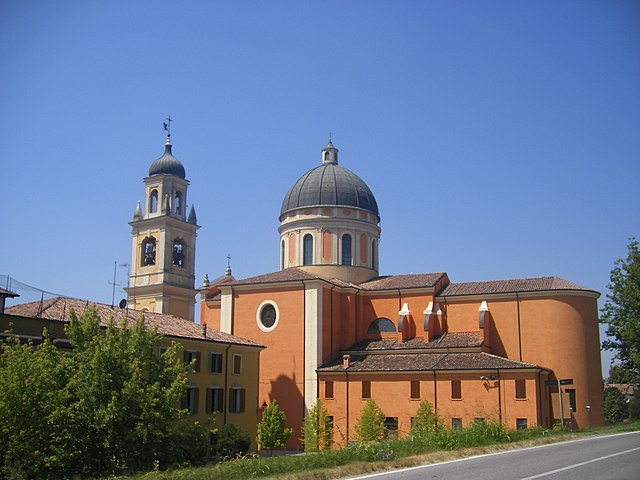
Brescello (Brescello)
.svg)
- Italian comune
 Hiking in Brescello
Brescello, a charming town in the Emilia-Romagna region of Italy, is known more for its cultural heritage and beautiful landscapes than for extensive hiking trails like some other regions in Italy. However, it still offers opportunities for nature walks and mild hikes, especially for those who enjoy scenic views and countryside exploration.
Hiking Opportunities Near Brescello
-
Scenic Countryside: The area around Brescello features flat, picturesque landscapes, with fields, rivers, and small forests. Walking or biking through the countryside can be quite rewarding, allowing you to enjoy the serene atmosphere and discover local flora and fauna.
-
Po River Park: The nearby Po River Park (Parco del Po) offers paths along the river that are great for hiking, cycling, and birdwatching. This expansive area is home to diverse ecosystems and provides a different kind of outdoor experience, with opportunities to see various wildlife species.
-
Local Trails: While there are not extensive marked hiking trails specifically in Brescello, you can find local paths that connect to nearby villages and towns. Exploring these paths can lead you to discover hidden gems in the region, such as quaint farmhouses and beautiful rural landscapes.
-
Cultural Hikes: Given Brescello's connection to Italian cinema (it served as the set for the famous "Don Camillo" movies), you might consider undertaking cultural hikes that include visits to significant historical sites and enjoying the local gastronomy along the way.
Tips for Hiking in the Area
- Best Time to Visit: Spring and fall are wonderful seasons for hiking in this region, with mild temperatures and vibrant scenery.
- Gear: Comfortable walking shoes and plenty of water are essential, especially if you're venturing off the beaten path.
- Combine with Culture: Plan your hikes to include stops at local amenities or cultural sites to enhance your experience.
- Maps and Guides: Though the area may not have elaborate signage, carrying a local map or guide can help you navigate more easily.
Conclusion
Overall, while Brescello might not be a traditional hiking destination, the surrounding areas provide plenty of opportunities to enjoy nature and explore the beautiful Emilia-Romagna countryside. Whether you're looking for a leisurely walk or a more engaging outdoor experience, you'll find that Brescello offers a unique blend of cultural richness and natural beauty.
- Country:

- Postal Code: 42041
- Local Dialing Code: 0522
- Licence Plate Code: RE
- Coordinates: 44° 54' 0" N, 10° 31' 0" E


- GPS tracks (wikiloc): [Link]
- AboveSeaLevel: 24 м m
- Area: 24.04 sq km
- Population: 5601
- Web site: http://www.comune.brescello.re.it
- Wikipedia en: wiki(en)
- Wikipedia: wiki(it)
- Wikidata storage: Wikidata: Q111113
- Wikipedia Commons Gallery: [Link]
- Wikipedia Commons Category: [Link]
- Freebase ID: [/m/0gkf8x]
- GeoNames ID: Alt: [6538435]
- VIAF ID: Alt: [134010040]
- OSM relation ID: [43694]
- GND ID: Alt: [4511776-7]
- UN/LOCODE: [ITBRE]
- ISTAT ID: 035006
- Italian cadastre code: B156
Shares border with regions:

Boretto
- Italian comune
Hiking in Boretto
Boretto, located in the Emilia-Romagna region of Italy, is more known for its scenic riverside views along the Po River and its charming historical architecture rather than extensive hiking trails. However, there are still great opportunities for walking and exploring the natural surroundings....
- Country:
- Postal Code: 42022
- Local Dialing Code: 0522
- Licence Plate Code: RE
- Coordinates: 44° 54' 0" N, 10° 33' 0" E
- GPS tracks (wikiloc): [Link]
- AboveSeaLevel: 23 м m
- Area: 18.11 sq km
- Population: 5345
- Web site: [Link]


Gattatico
- Italian comune
Hiking in Gattatico
Gattatico is a municipality located in the Emilia-Romagna region of Italy. While it may not be widely recognized as a major hiking destination, the area around Gattatico offers some picturesque landscapes and opportunities for outdoor activities, particularly for those interested in exploring the countryside and rural areas of northern Italy....
- Country:
- Postal Code: 42043
- Local Dialing Code: 0522
- Licence Plate Code: RE
- Coordinates: 44° 48' 0" N, 10° 28' 0" E
- GPS tracks (wikiloc): [Link]
- AboveSeaLevel: 40 м m
- Area: 42 sq km
- Population: 5744
- Web site: [Link]


Poviglio
- Italian comune
Hiking in Poviglio
Poviglio is a small municipality in the Emilia-Romagna region of Italy, situated near the Po River. While Poviglio itself may not be widely recognized as a hiking destination, the surrounding area offers scenic landscapes and opportunities for outdoor activities....
- Country:
- Postal Code: 42028
- Local Dialing Code: 0522
- Licence Plate Code: RE
- Coordinates: 44° 50' 0" N, 10° 33' 0" E
- GPS tracks (wikiloc): [Link]
- AboveSeaLevel: 29 м m
- Area: 43.55 sq km
- Population: 7285
- Web site: [Link]


Viadana
- Italian comune
Hiking in Viadana
Viadana is a town in the Lombardy region of Italy, located along the banks of the Po River. While it may not be as mountainous as other areas in Lombardy, it offers several opportunities for outdoor activities, including hiking, especially along the river and in the surrounding countryside....
- Country:
- Postal Code: 46019
- Local Dialing Code: 0375
- Licence Plate Code: MN
- Coordinates: 44° 55' 36" N, 10° 31' 12" E
- GPS tracks (wikiloc): [Link]
- AboveSeaLevel: 26 м m
- Area: 103.84 sq km
- Population: 20044
- Web site: [Link]